
Special Weather Statement: Significant Snowfall Possible Monday Night in Eastern Newfoundland
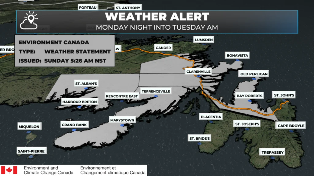
Special Weather Statement issue early in the morning on December 7, 2025.
Environment and Climate Change Canada has issued a Special Weather Statement for parts of eastern Newfoundland ahead of a system set to move in Monday evening and out early Tuesday morning.
Who’s Included
This statement is in effect for the following areas:
Avalon Peninsula North
Burin Peninsula
Connaigre
Bonavista Peninsula
Clarenville and vicinity
Terra Nova
In less specific terms, the northwestern Avalon, Clarenville, Terra Nova, Connaigre, and the Bonavista and Burin Peninsulas are all in the zone for potentially significant snow.
How Much Snow?
Potential snowfall: 10 to 20 cm
Locally higher amounts are possible, depending on the exact track of the storm.
This is enough snow to make for slippery, snow-covered roads, reduced visibility at times, and some messy travel Monday night into early Tuesday.
Wind
Wind gusts: Northeasterly to northwesterly up to 80 km/h
Those winds, combined with the snow, could lead to areas of blowing snow, especially in exposed locations and along the coast.
Timing
Start: Monday evening
End: Early Tuesday morning
The worst conditions are most likely overnight Monday into the pre-dawn hours of Tuesday, which could affect early Tuesday travel and school/commute plans.
Track Still Uncertain
Forecasters are still fine-tuning the track of this system:
A small shift in the storm’s path could mean:
More snow for some areas, or
Less snow if the heaviest band sets up elsewhere.
As guidance improves, we’ll know whether this evolves into formal snowfall or wind warnings for parts of eastern Newfoundland.
Areas on either side of this alert, including the St. John’s area and the southern shore, will also see snow during the time frame. At the moment, this area looks to remain out of the heaviest snowfall band, but 5 to 10 cm looks likely between Monday afternoon and Tuesday morning. A slight eastward or westward shift in the low’s track will have a significant impact of snowfall amounts, as the swath of heaviest snow looks quite narrow at this time.
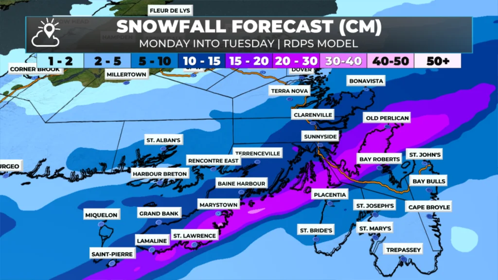
This snowfall forecast from the RDPS model is between Monday at 12 PM and Tuesday at 12 PM (December 8 – 9, 2025).
What You Should Do
Keep an eye on updated forecasts and alerts through Monday.
If you have to travel Monday night or early Tuesday, plan for:
Snow-covered and slippery roads
Periods of poor visibility in snow and blowing snow
Consider adjusting early Tuesday travel if the heavier snow looks to line up with your route.
I’ll post updated maps and details as the track becomes clearer and any alerts are upgraded.

Good morning Eddie and thanks for the update
Thanks Eddie for weather update
Good morning Eddie thanks for the update. Have a great day 😊
👍
Thank you!
Thank you
I want summer back. But thanks for keeping us in the know.
Hi Eddie, I have an appointment in Bay Roberts tomorrow (Monday) should I cancel. I live about 20 minutes from Bay Roberts
Thanks for the update….
Looks like this early unusual start to winter may be here to stay. Little rain and warmer temps later this week will compat it a little.
Thank you for the update.