
Special Weather Statement: First Snow of the Season for the High Country of Western Newfoundland
Environment Canada has issued a Special Weather Statement for western and northwestern Newfoundland. The first notable accumulating snowfall of the season is expected on the higher elevations of the Great Northern Peninsula and Green Bay–White Bay, from late this evening until Thanksgiving Monday afternoon.
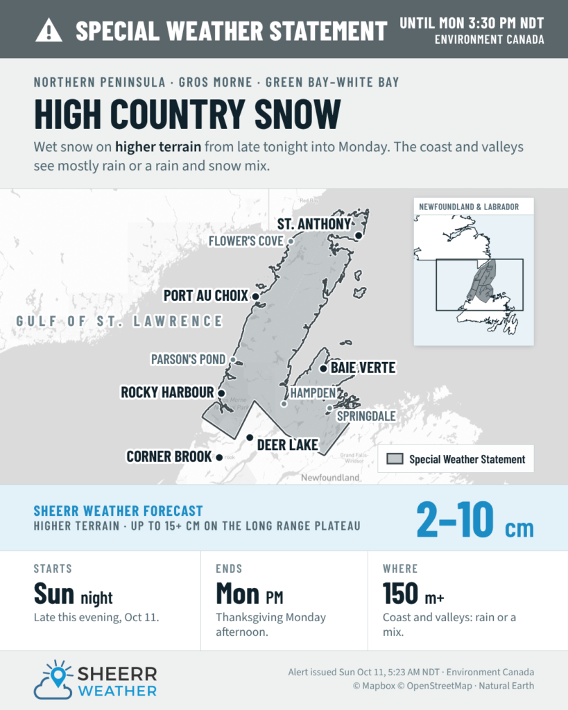
What Environment Canada says
The statement is in effect for:
- Gros Morne
- Green Bay–White Bay
- Northern Peninsula East
- Parson’s Pond–Hawke’s Bay
- Port Saunders and the Straits
My forecast
I’m running a touch higher than Environment Canada: 2 to 10 cm above roughly 150 metres, with 15 cm or more possible on the Long Range plateau, the highest ground in the region.
Elevation is everything with this one. Temperatures will be close to, or even below, freezing on the higher ground, so the chance of winter-like conditions goes up the higher you go. Closer to sea level, along the coast and in the valleys, it’s mostly rain or a rain and wet snow mix. Even a short drive uphill could take you from wet roads into snow-covered ones.
Thanksgiving travel
If you’re driving through higher ground tonight or Monday, including the Viking Trail (Route 430) through the Long Range Mountains, the Baie Verte Highway (Route 410), and the hillier stretches of the Trans-Canada between Deer Lake and Springdale:
- Expect conditions to change quickly as the road climbs. Wet roads in the valleys can turn slushy and slippery on the hills.
- Slow down, leave extra space, and give yourself extra time to reach your Thanksgiving dinner.
- Keep a snow brush and scraper in the vehicle, and if the winter tires aren’t on yet, plan for that soon.
Seeing snow where you are? Environment Canada asks that you report severe weather by email to NLstorm@ec.gc.ca or on social media using #NLwx.
I’ll keep an eye on how far down the hills the snow reaches and update you if anything changes.
Too early for that. Xmas eve is time enough for a dusting.
Thank You for the update…and so it begins….snow!! Happy Thanksgiving to you and your family.