
Snow Possible Monday on the Avalon, Special Weather Statement Issued for St. John’s Metro
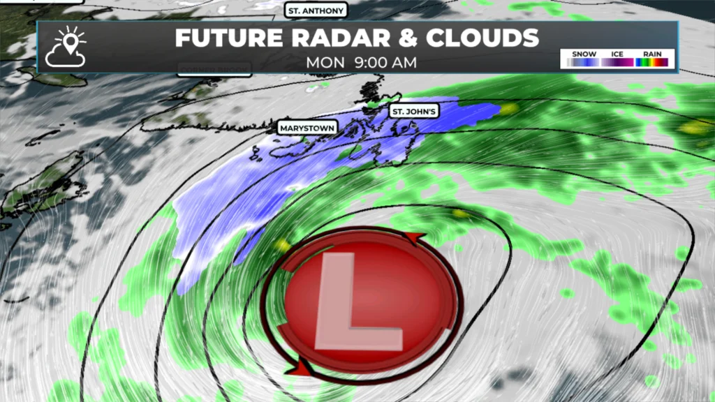
An area of low pressure will develop southwest of the Avalon Peninsula on Sunday and Sunday night and will pass to the east on Monday. The track of this system, combined with just enough cold air, will present the opportunity for snow to fall over parts of the Avalon on Monday. The best chance of accumulation will be in areas inland and over higher terrain, but there is a very real possibility that most areas will see snowflakes.
Environment Canada has issued a Special Weather Statement for the Monday morning to Monday evening time frame the following area:
St. John’s and vicinity
The alert states the following:
Precipitation is expected to spread across the metro region after midnight tonight and persist through the day on Monday. Precipitation is likely to be mainly rain along the coast, but late-season snow is expected for much of the metro region.
Snowfall accumulations could exceed 5 cm by Monday evening, with the highest expected in inland areas and over higher terrain.
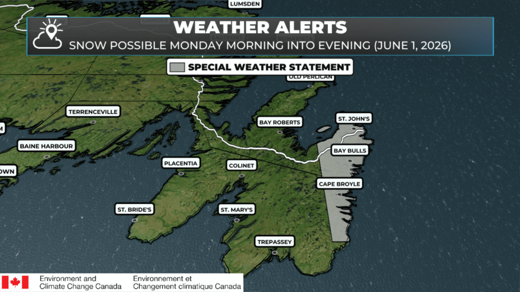
Special Weather Statements as of May 31, 2026 at 8 AM NDT.
There is the chance that this statement gets expanded. I’ll have a more detailed update on Monday’s forecast posted later today.
📱 Get the Sheerr Weather App in the Apple App Store and Google Play Store.
🗺️ Check out the Map Room to see all the latest weather observations for the Province.
🎥 Check out the Provincial Highway Cams to see 👀 what’s going on around our highways and
Make it stopppp 😭
Good morning Eddie thanks for the wonderful update 😂we definitely don’t want any snow, have a great day
Lol, yes …what Susan said. Make it stop ! I’m not thawed out from yesterday. Thanks Eddie
Thank you Eddie for such a thorough report
Eddie where is the sun and warmer temperatures find them please
We need sun and warmer temperatures help Eddie
Good morning Eddie, thanks for the update. Have a great day.
Thanks Eddie, can you try to improve the weather, Please
Good morning Eddie hopefully this will be the end of the intense cold weather after Monday
Eddie, can you tell me if we are ever get summer this year????We live in Salmon Cove CBN
Eddie wa are all grasping at straws for a bit of warm weather.