
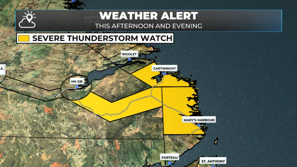
Severe Thunderstorm Watch in effect for southeast Labrador until this evening
From the Environment and Climate Change Canada Weather Office in Gander
Conditions are favourable for the development of severe thunderstorms across southeastern Labrador this afternoon. These storms may be capable of producing:
🌧 Heavy downpours with rainfall rates of 25 mm per hour or more
🌬 Strong wind gusts reaching or exceeding 90 km/h
🌩 Small hail and frequent lightning strikes
A line of thunderstorms currently developing over the Trans-Labrador Highway is expected to push toward the coast. As these storms move through, expect localized flash flooding, reduced visibility, and dangerous wind conditions that may toss around loose objects.
⚡️ Safety First:
“When thunder roars, go indoors.”
Lightning is a real threat and causes injuries and fatalities in Canada each year. If you hear thunder, take it seriously and seek shelter immediately.
What is a Severe Thunderstorm Watch?
A Severe Thunderstorm Watch is issued when atmospheric conditions are primed for the development of dangerous storms capable of producing hail, damaging winds, and heavy rainfall.
Stay tuned for updates — watches can quickly escalate to warnings as storms intensify.
📲 Follow Sheerr Weather for the latest updates throughout the day.
Thank you for the updates