
Wind Warnings, Special Weather Statements for Freezing Rain Issued For Sunday’s Storm
Environment Canada has four weather alerts out this morning ahead of Sunday’s storm: two wind warnings for western Newfoundland and two special weather statements for freezing rain, one for western and northern Newfoundland and one for the Trans-Labrador Highway. Here’s what each one means and where.
- Wreckhouse wind warning: southeast gusts near 130 km/h, tonight until Sunday evening.
- Wind warning, Bay St. George to Parson’s Pond: gusts of 80 km/h, and 110 to 120 km/h in prone spots, Sunday afternoon and evening.
- Freezing rain over high terrain, western and northern Newfoundland: Sunday, with local ice over 10 mm in the mountains.
- Labrador: freezing rain inland along the Trans-Labrador Highway from Kenamu River to Red Bay, late Sunday afternoon and evening.
Wreckhouse wind warning
This was upgraded overnight. Environment Canada now expects southeast gusts to reach 100 km/h overnight tonight, then climb to near 130 km/h during much of the day on Sunday in the Wreckhouse area, easing Sunday evening.
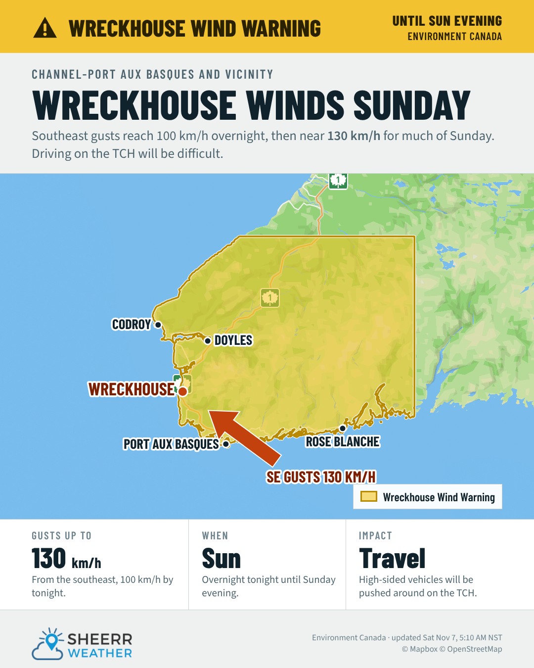
High-sided vehicles will be pushed around by the wind, and disruptions to services and travel are possible. If you’re hauling a trailer or driving a truck through the Codroy Valley on Sunday, plan around it. Keep an eye on the Wreckhouse Wind Gauge for live gusts.
Wind warning: Bay St. George to Parson’s Pond
Strong southeasterly winds arrive along the west coast Sunday afternoon and evening, with gusts of 80 km/h, except 110 to 120 km/h in areas prone to enhanced southeasterlies.
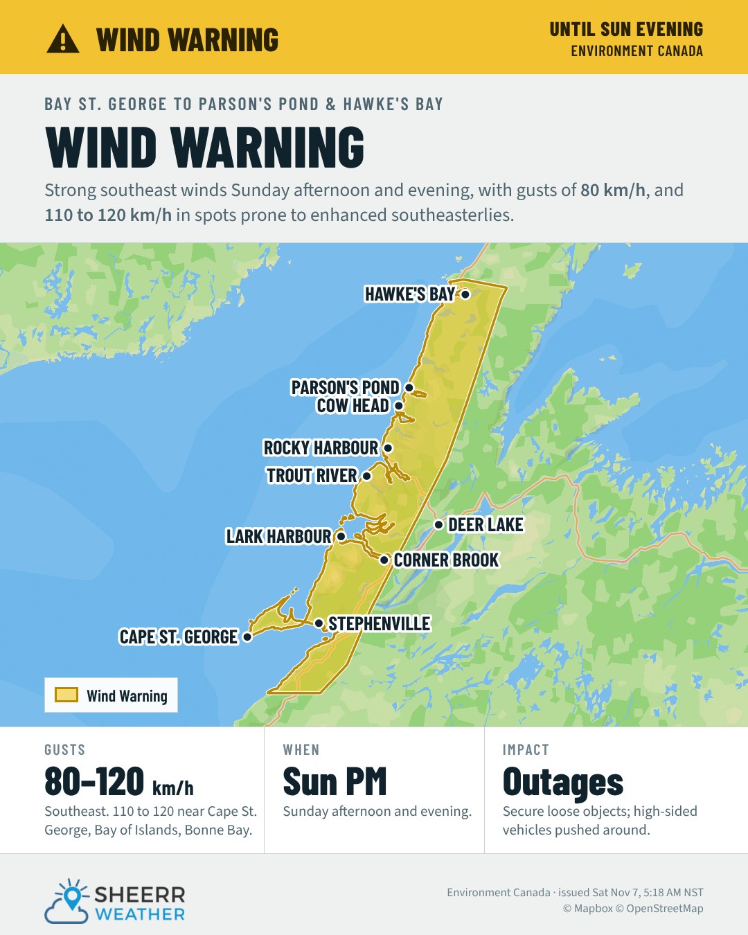
Environment Canada says the strongest gusts typically happen around Cape St. George, Port au Port Bay, the outer Bay of Islands, Trout River Bay, Bonne Bay, Western Brook Pond, St. Paul’s Bay and Parson’s Pond River. Secure loose objects around your property today. Local power outages are possible, and high-sided vehicles will be pushed around.
Freezing rain over high terrain: western and northern Newfoundland
For most communities and roads, Sunday’s precipitation falls as rain. But over higher terrain, especially the upper elevations of the Long Range Mountains and the Gaff Topsails, it will be cold enough for freezing rain. It could last several hours, with local ice buildup of more than 10 mm.
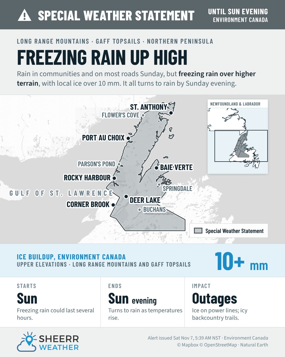
Ice on transmission lines in the mountains can cause power outages that reach communities below, so it’s worth charging devices Saturday night. If you’re heading into the backcountry on a snowmobile or ATV, expect icy trails. Everything changes to rain later Sunday into Sunday evening as temperatures rise above the freezing mark.
Labrador: freezing rain on the Trans-Labrador Highway
In southeastern Labrador, it’s rain on the coast, but colder air inland and over higher terrain means a period of freezing rain along the Trans-Labrador Highway from Kenamu River to Red Bay, late Sunday afternoon through Sunday evening. Around Eagle River, ice pellets may come first.
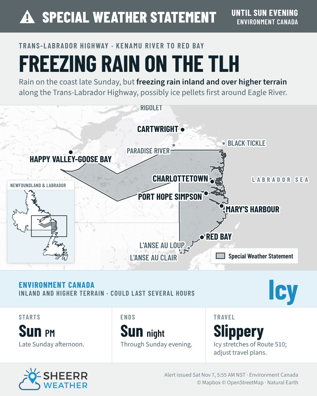
The freezing rain could last several hours in some spots, leaving icy, slippery surfaces. If you can, avoid driving that stretch of highway Sunday evening, or give yourself a lot of extra time.
I’ll keep a close eye on these and post updates through the weekend. You’ll find them first in the app.
Don’t forget to…
📱 Get the Sheerr Weather App in the Apple App Store and Google Play Store for my latest updates.
📺 Tune into Sheerr Weather 24, my 24-hour weather channel on YouTube.
🗺️ Check out the Map Room to see all the latest weather observations for the Province.
🎥 Check out the Provincial Highway Cams to see 👀 what’s going on around our highways.