
Wind Warning, Special Weather Statement for Snow, Issued for Friday
As Subtropical Storm Josephine passes well south of Newfoundland and colder air works in from the north, Environment Canada has issued a wind warning and a special weather statement for Friday. The wind warning covers the south coast, including the Burin, Connaigre and southern Avalon peninsulas, and the special weather statement is for the first notable accumulating snowfall of the season over higher terrain. Here’s what you need to know.
Wind warning: Friday afternoon and evening
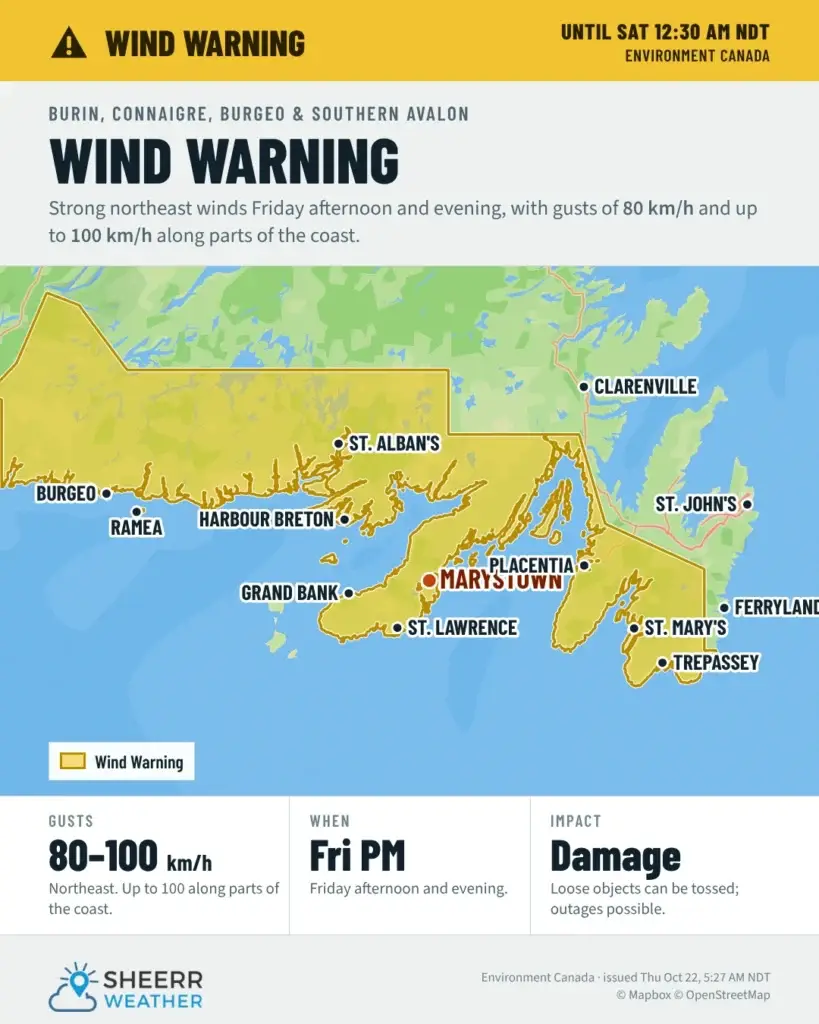
A wind warning is in effect for:
- Avalon Peninsula Southeast
- Avalon Peninsula Southwest
- Burgeo – Ramea
- Burin Peninsula
- Connaigre
Strong winds are expected along the south coast of Newfoundland, including the Burin, Connaigre and southern Avalon peninsulas, with maximum wind gusts of northeasterly 80 km/h, except 100 along parts of the coast, on Friday afternoon and evening.
Environment Canada says local utility outages are possible, and disruptions to services and travel are possible. Now’s a good time to secure anything that could blow around, like garbage bins, patio furniture and Halloween decorations, and to charge your phone and devices in case the power goes out.
Special weather statement: first accumulating snow of the season
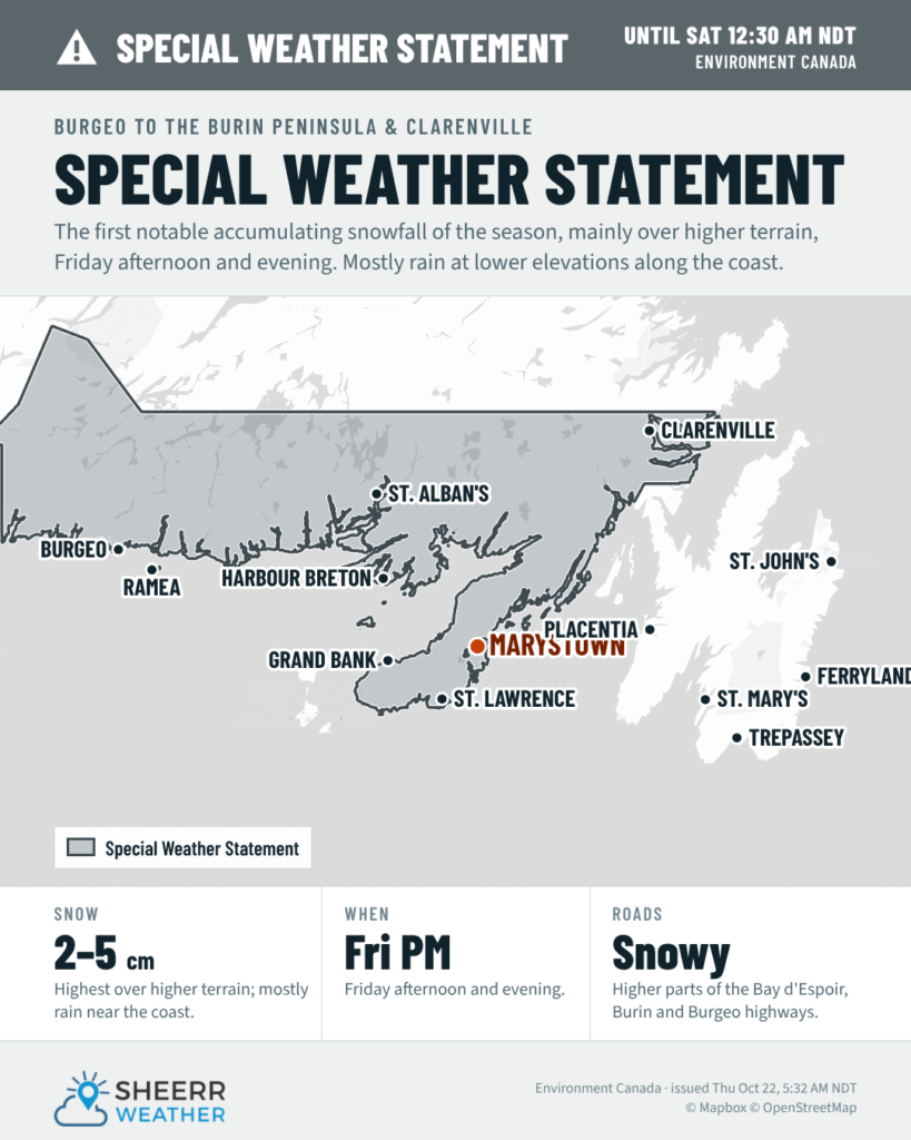
A special weather statement is in effect for:
- Burgeo – Ramea
- Burin Peninsula
- Clarenville and vicinity
- Connaigre
The first notable accumulating snowfall of the season is expected, primarily over higher terrain, along the south coast of Newfoundland from Burgeo to the Burin Peninsula, as well as Clarenville and vicinity. Potential snowfall is 2 to 5 cm, highest over higher terrain, on Friday afternoon and evening.
With temperatures hovering near the freezing mark, snowfall amounts may vary over short distances. Precipitation should stay mostly as rain at lower elevations along the coast.
If you’re on the road Friday, be prepared for winter driving conditions, especially over the higher sections of:
- the Bay d’Espoir Highway
- the Burin Peninsula Highway
- the Burgeo Highway
- the Trans-Canada Highway between Goobies and Port Blandford
If you haven’t put your winter tires on yet, you may want to hold off on any unnecessary trips over those highways Friday afternoon and evening, or give yourself plenty of extra time.
What’s causing it
Subtropical Storm Josephine is passing well south of Newfoundland, about 280 km south of Cape Race early Saturday, before heading out to sea. It isn’t a direct hit, but along with another system dropping in from the west, it’s bringing rain, a raw northeast wind and big swells to the south coast. As colder air works in from the north on Friday, some of that rain will change to wet snow over higher terrain. Swells from Josephine are also building along the South Coast, the Burin and the southern Avalon, with heavy surf and dangerous rip currents into the weekend, so keep well back from the water’s edge.
For the latest conditions and forecast where you live, check out the Burin Peninsula, South Coast, Avalon and Eastern regional forecast pages, and the Provincial Highway Cams before you head out. I’ll have updates as these alerts change.
📱 Get the Sheerr Weather App in the Apple App Store and Google Play Store for alerts as they’re issued.
⚠️ See all active alerts on the Weather Warnings page.
One Response