Josephine Update: Less Rain and Snow Likely, but Still Windy
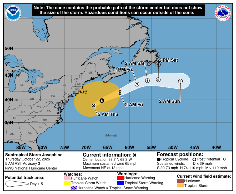
Subtropical Storm Josephine will pass east of the Maritime Provinces and south of Newfoundland between today and Saturday night.
October 22, 2026 – 12 PM
Summary
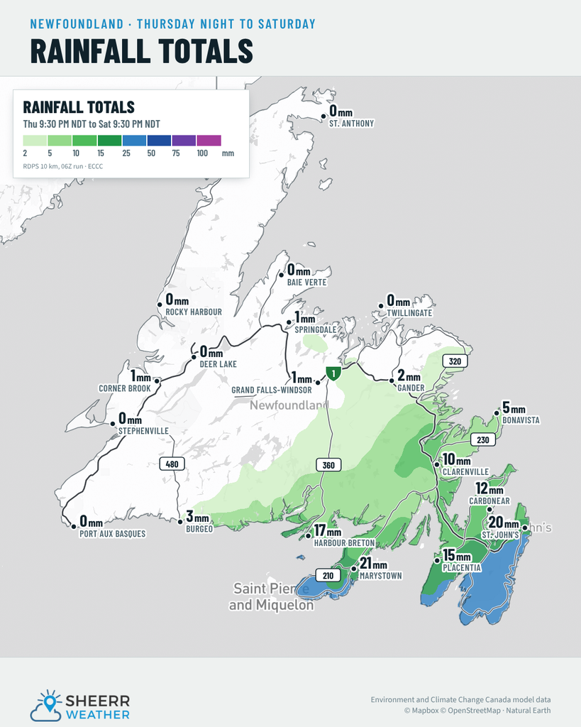
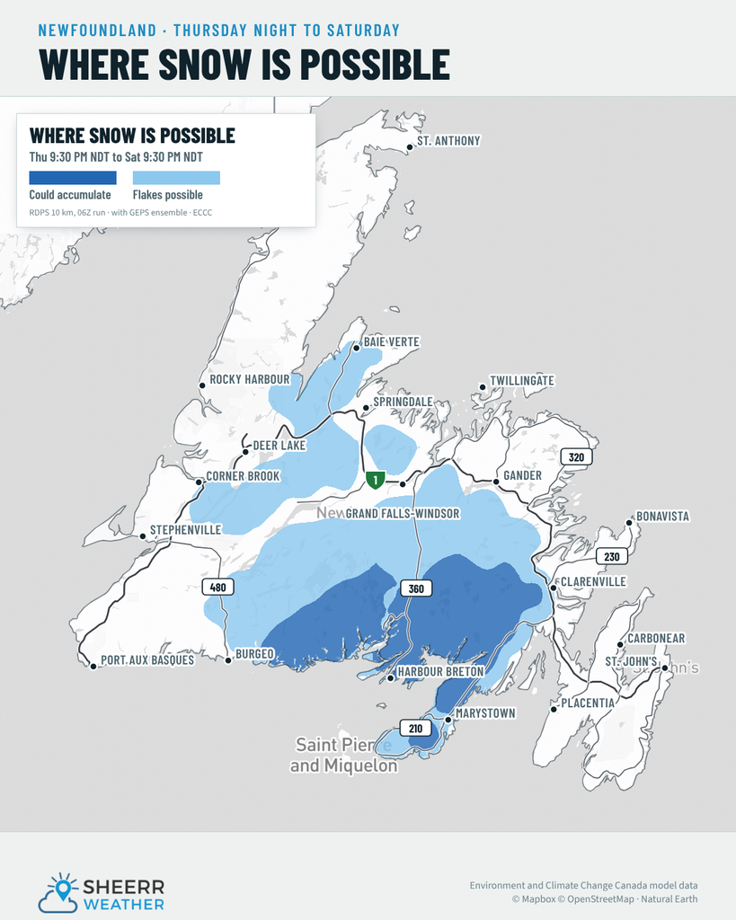
Current forecasts indicate that Josephine’s northward progress may be more limited than it looked yesterday. If so, we are looking at less rain over southern and eastern Newfoundland, and less snow.
Wind 💨
Wind will still be an issue for southern and eastern Newfoundland, with northerly gusts in the 80 to 110 km/h range. The highest wind speeds will be over southern coastlines in those areas.
Waves 🌊
Large waves and high surf will affect much of Newfoundland’s south- and east-facing shores over the next couple of days. Be sure to use common sense and stay back from the water, as it can come up without warning, even in strong offshore flow.
I’m combing through the latest data now and will have another update for you this afternoon. In the meantime, you can keep an eye on the Wind Warning and Special Weather Statement for Friday.
A look at Josephine 🛰️
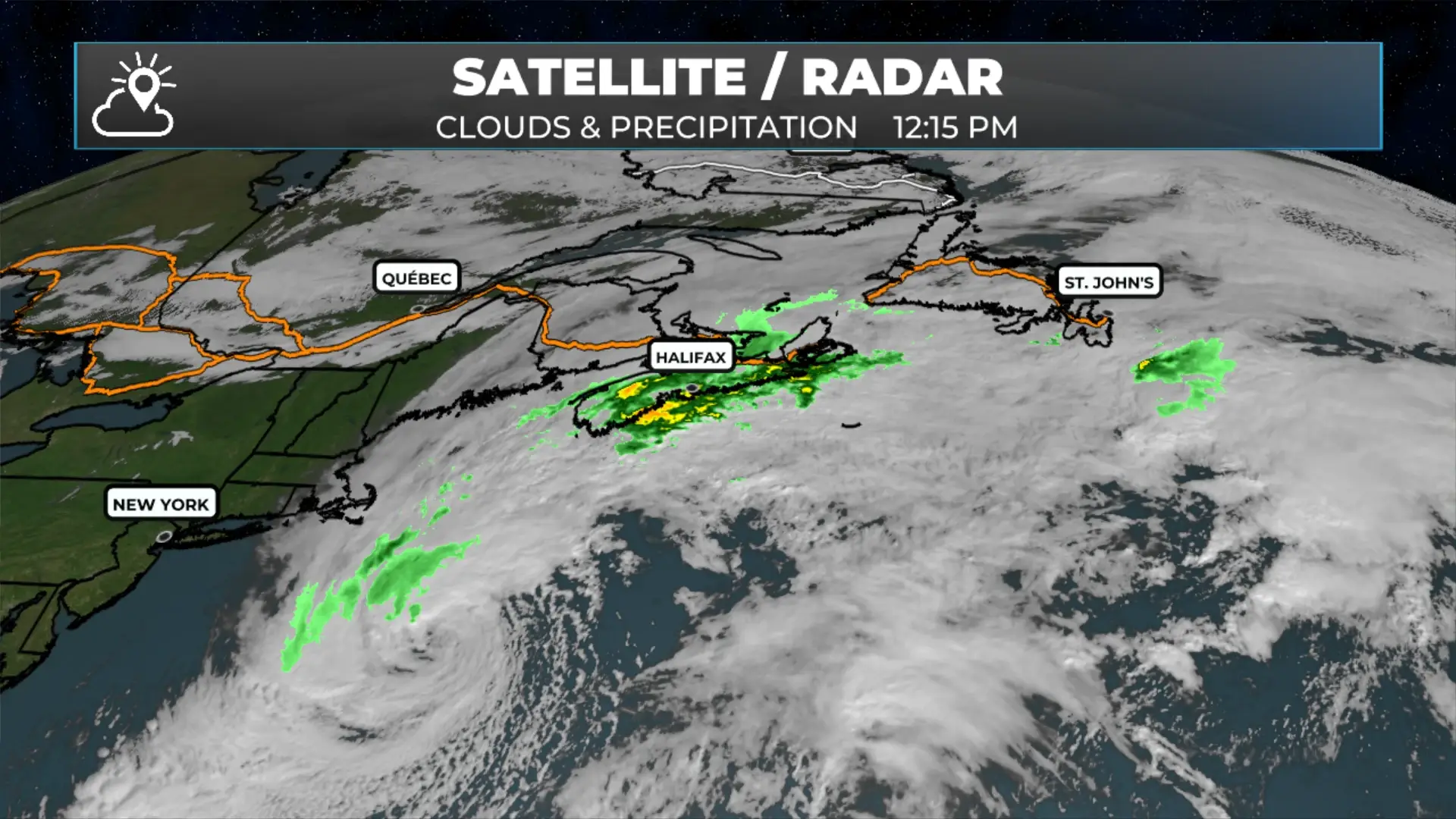
Here is a look at Subtropical Storm Josephine, which is currently producing sustained winds near 100 km/h and is located 675 km south-southwest of Halifax, Nova Scotia. The storm is moving northeast at 19 km/h.
October 22, 2026 – 12:11 PM
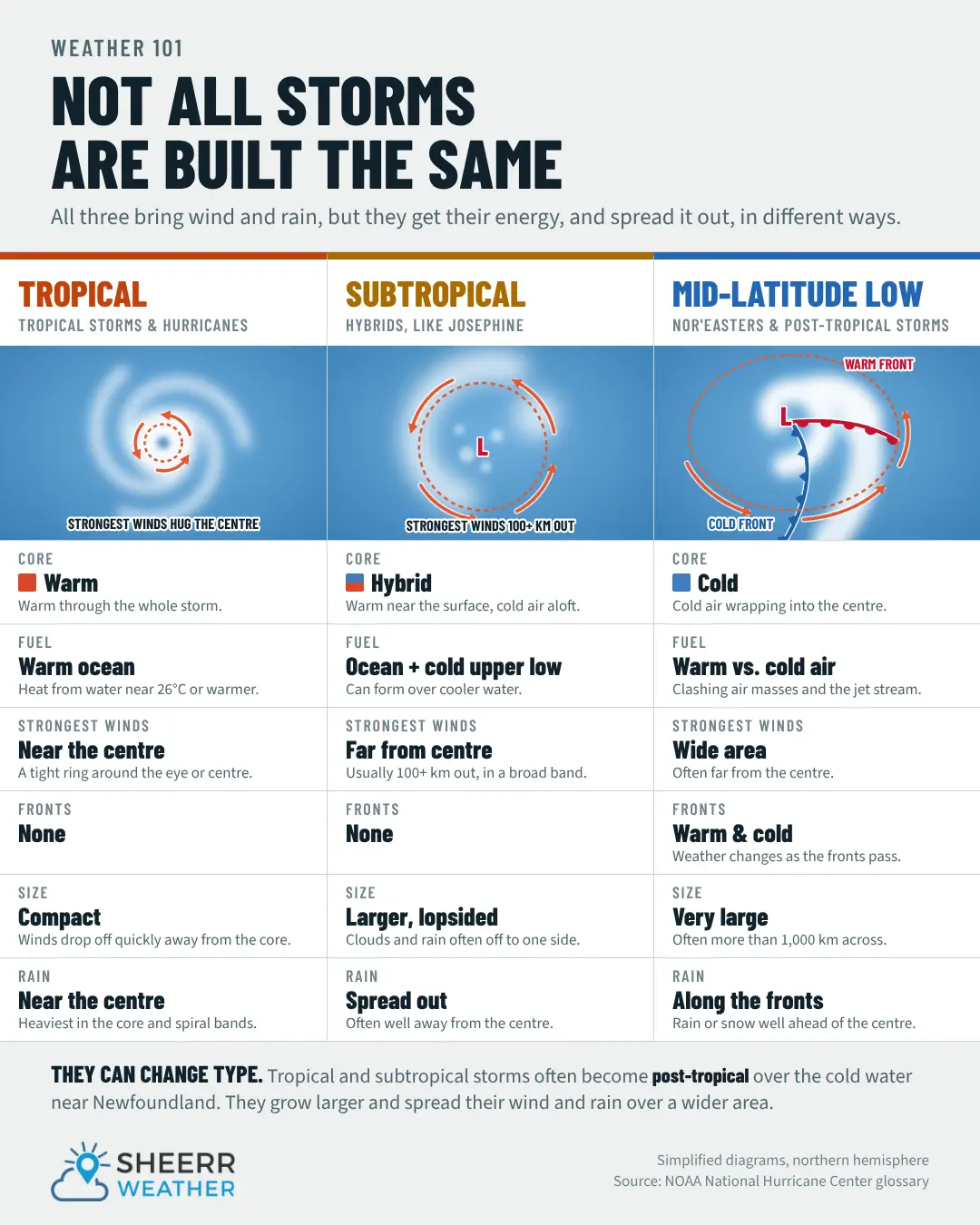
What is a subtropical storm, you ask?
A tropical storm is a warm-core weather system that gets its energy primarily from warm ocean waters and thunderstorms near its centre. It typically has a well-organized circulation, with the strongest winds and heaviest rain concentrated closer to the centre.
A subtropical storm has characteristics of both tropical and non-tropical weather systems. It often gets some of its energy from temperature differences in the atmosphere, rather than relying entirely on warm ocean waters. Subtropical storms generally have a broader wind field, with the strongest winds often occurring farther from the centre.
Both can produce strong winds, heavy rain and dangerous coastal conditions, and a subtropical storm can transition into a fully tropical storm if its structure changes.