
Wednesday Morning’s Weather Update — December 3, 2025
Good Wednesday morning!
Many schools are closed today, including the ones in the St. John’s Metro. Visit NLSchools.ca for the status report.
The first flakes of this winter storm have arrived across much of southern and parts of western Newfoundland. The snow will continue to advance north through the morning. The radar loop below shows how the inbound precipitation has evolved over the last few hours.
The snow is moving from south to north and will continue to do so over the next several hours, reaching the northeast coast and northern shores in the next couple of hours. The snow will also intensify from south to north throughout the morning.

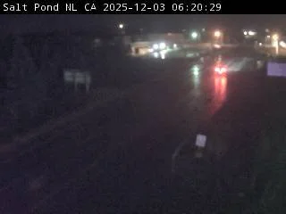
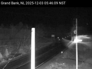
I’ve looked at some of the overnight guidance, and there’s not much change. This is a fairly complex forecast, so today we will wait and see how things unfold compared to how the guidance suggested they would. For instance, webcams show that Marystown and Grand Bank are both currently seeing the rain, while the forecast suggests it should be snow.
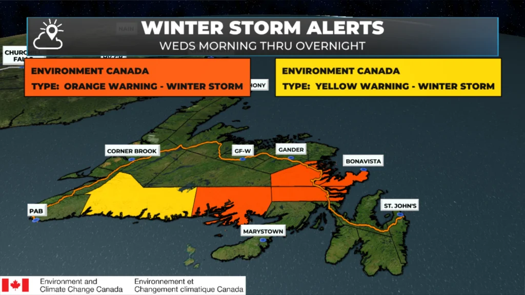
Winter weather alerts and wind alerts remain in effect this morning for a large chunk of the Island from the south coast to the Avalon and many areas between. We’ve got yellow warnings for wind and snowfall and both yellow and orange warnings for winter storm conditions.
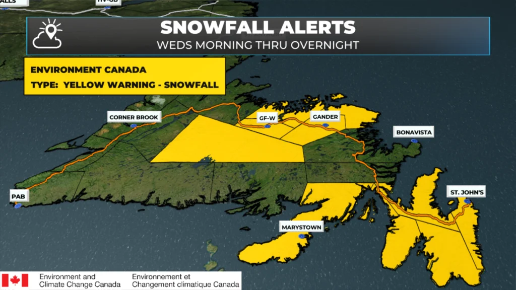
The most intense snowfall for many areas will be later this morning into the early to mid-afternoon. In the Avalon and Metro area, you will notice an increase in snow intensity beginning around 9 or 10 AM, when snowfall rates will ratchet up and may reach 5 cm/h for a few hours. The snow in the southeast should change to ice pellets and rain for most areas between 12 PM and 3 PM. Farther west, the snow will continue through the day.
This update is sponsored by Roebothan, McKay, Marshall.

Visit MakeTheCall.ca TODAY to learn more about what the law firm can do for you.
The animation below shows how snow, ice, and rain will unfold across Newfoundland throughout the day. The blue is snow (the darker, the heavier); the green is rain; pink/purple is ice pellets and/or freezing rain. Remember, this is a forecast, but it should give you a good idea of what to expect.
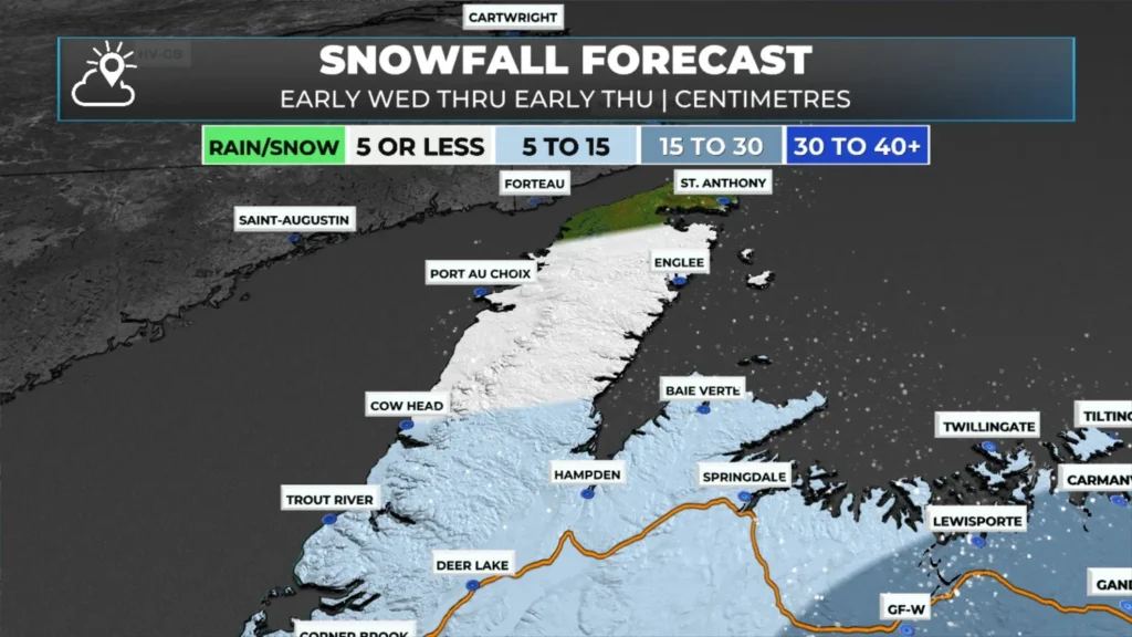
The snow will ease off later this evening and tonight. Below are a series of snowfall maps that I hand-drew yesterday. These maps may not align exactly with what my app says. In the future, I will do my best to ensure the values are similar. Snowfall forecasting is one of the hardest things I do as there are so many variables to getting it right… or close to right.. on our little rock in the Atlantic. Tap on the thumbnail at the bottom to see the one closest to your area.
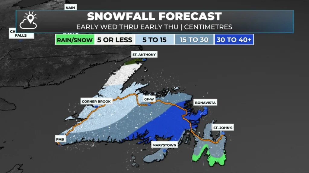
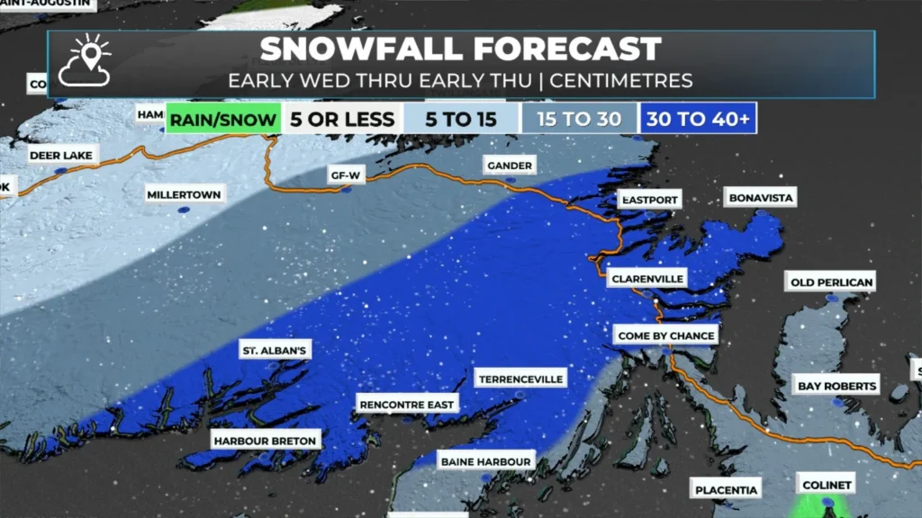
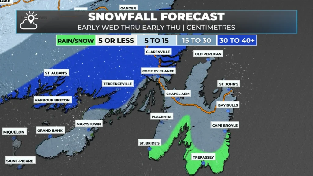
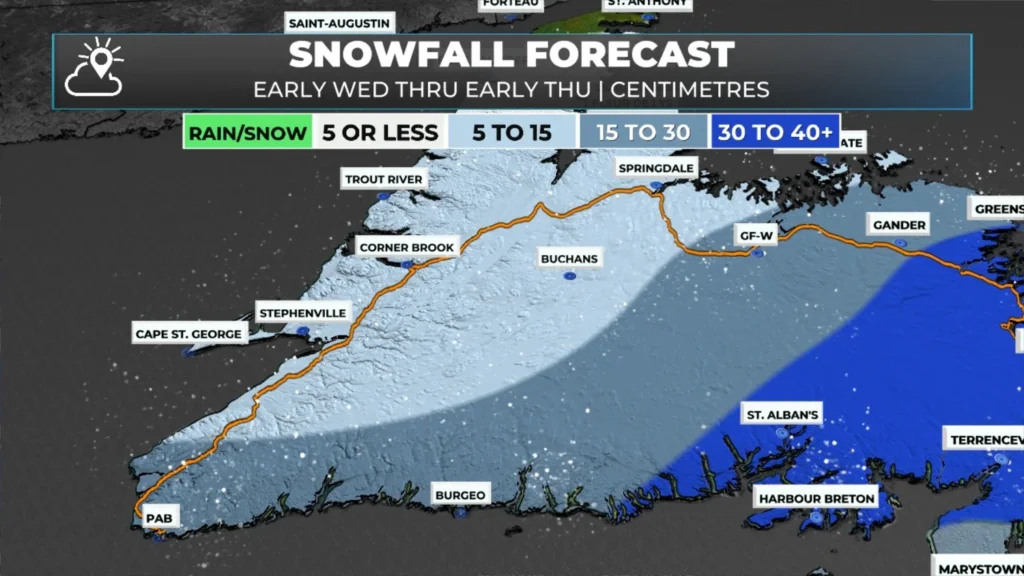
The other issue today will be the wind. Yellow Warnings for Wind are currently in effect for the Burin Peninsula and the Avalon Peninsula. On the Burin Peninsula, expect winds to gust from the north as high as 100 km/h this afternoon. On the Avalon, expect the wind gusts to ramp up this evening and gusts as high as 100 km/h from the north or northeast between then and early Thursday. The wind speeds will come down on Thursday morning. The Bonavista Peninsula is not under a Wind Alert at this time, but some areas will see winds as high, or higher, than the Avalon. One may be issued for the area.
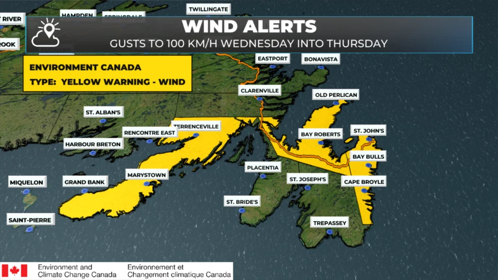
Yellow Warning for High Winds as of 5 AM NST on December 3, 2025.
Something of note that areas under the Orange Warnings for Winter Storm Conditions will also see high wind gusts today, close to 80 km/h from the northeast. The animation below times out the wind speeds quite well as we move through today and tonight.
I will have updates throughout the day and will also have some live streams. Be sure to get the app and follow me on socials to see the latest weather information from Sheerr Weather!
I’ll have my next update posted later today!
📱 Get the Sheerr Weather App in the Apple App Store and Google Play Store.
🗺️ Check out the Map Room to see all the latest weather observations for the Province.
🎥 Check out the Provincial Highway Cams to see 👀 what’s going on around our highways and
Thanks, husband.
welcome wife!
Thanks!
Thanks for keeping us up to date!! Great job Eddie as always 👏
Good morning Eddie and thank you for all the updates.
Thanks Eddie stay safe
Tanks Eddie!!
Thanks, Eddie! You’re going to have a busy day!
Thanks Eddie!
Good morning Eddie, thanks for weather update.
Thanks Eddie. Not a good day to travel! Hopefully tomorrow will be better.
Out here on LITTLE BAY ISLANDS EDDY, settling in for the first winters big snow fall,,and a great winter of solitude,,love your app,,keep up the great work and have a great day
Thank you! Say hi to Mike and Georgina for me!
Good morning Eddie☕️…Thank you for the weather update!
Have a great day & stay safe!
Thank you Eddy. Just saw you on tv on your morning. Great job! You make Newfoundland proud!
Thank you!
Good morning. Thanks for the detailed forecast. Have a great one.