
Wednesday Morning’s Weather Briefing — September 16, 2026

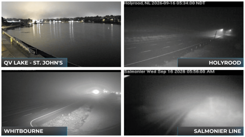
Webcam images from across the Avalon Peninsula earlier this morning (September 16, 2026).
Good Wednesday Morning! Here are today’s highlights
This morning, there are areas of drizzle and fog on the Avalon; areas just to the west do not seem to be dealing with it, per webcams.
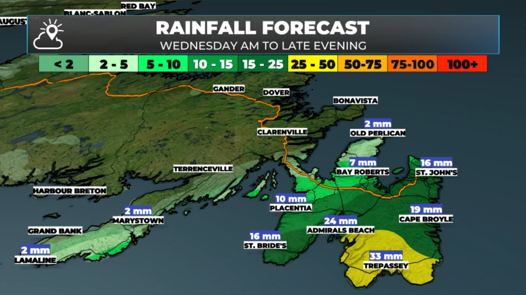
Rain will develop and fall over the Avalon today and some adjacent areas of eastern Newfoundland.
Sunshine will be the rule rather than the exception for most areas of NL west of the Avalon today. There will be a few showers this afternoon in Labrador West.
Highs reach the upper teens to lower 20s for most today — it’ll be breezy in the Big Land as a cold front approaches from the west.
This morning’s update is sponsored by Roebothan, McKay, Marshall.

Visit MakeTheCall.ca today to learn more about how the law firm can help you!
The Avalon Today
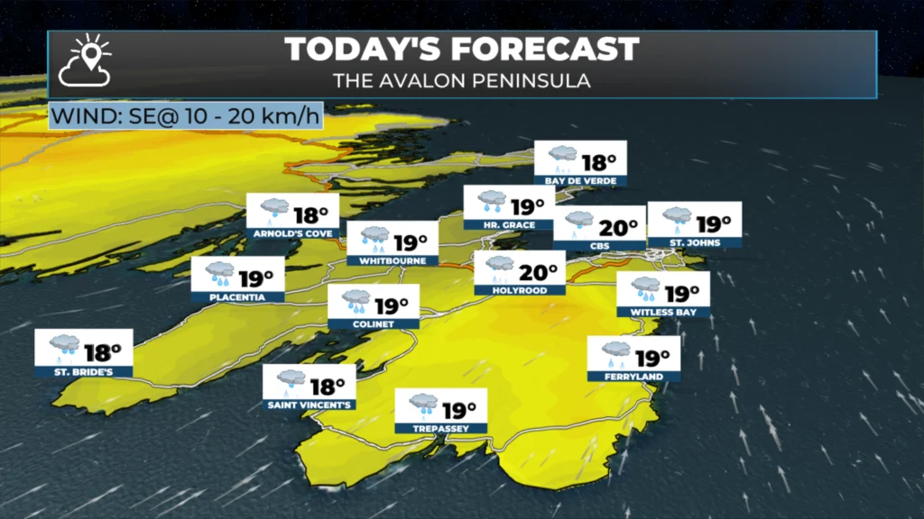
Of all the places in the province, the Avalon Peninsula is going to have the wettest weather today. A trough is lifting up from the south in association with a fairly weak area of low pressure. That trough is narrow, but it’s enough to drive some rain. In plain terms, a trough is a place where air comes together — that convergence forces air upward, and that lift is what produces the rain.
Because this is a small feature, really only the Avalon sees the rain today. It develops over the next several hours this morning and generally continues into this evening, ending overnight into Thursday morning.
Rainfall amounts look to be 15 to 25 millimetres for the southwest Avalon, southeast Avalon, the Southern Shore and the northeast Avalon, with lower amounts on the north Avalon.
Temperatures still peak in the upper teens to low twenties despite the rain. We may see a few breaks of sun here and there, but this won’t be the sunniest of days on the easternmost peninsula.
The Rest of Newfoundland
Away from the Avalon, the rest of Newfoundland is in for a much better day. Skies will generally be sunny, or turn more sunny as the day progresses. There may be a bit of cloud cover this morning on the West Coast and the Great Northern Peninsula, but that clears out. Highs this afternoon reach the upper teens to low twenties.
I should note that there’s no real chance of rain today — the exception being the Burin and Bonavista Peninsulas, where a few showers are possible late this morning into the early afternoon.
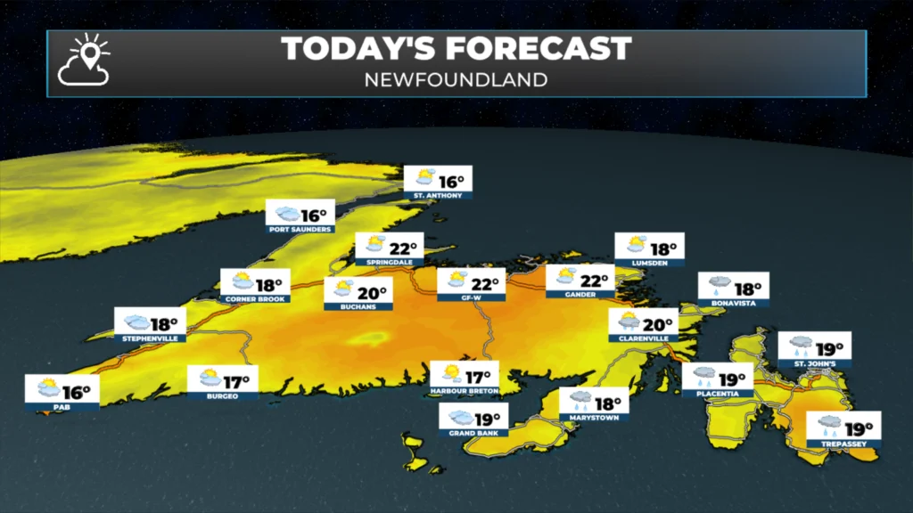
Newfoundland’s forecast for today (September 16, 2026).
Labrador’s Outlook
Labrador starts sunny today and generally stays that way, but there’s a cold front on the way. Winds are the first thing to notice. It’s breezy across the Big Land today, starting in the west and spreading to most areas, with gusts generally between 60 and 80 kilometers per hour from this afternoon into tonight — both ahead of the front and just behind it as it moves through.
A few showers roll in along that front this afternoon across the north and west. They arrive in Lab West around the one o’clock hour, Churchill Falls shortly after, and reach Happy Valley-Goose Bay and the North Coast by this evening. Outside of that, most of the day stays dry.
Highs today land in the middle to upper teens, but the front ushers in much cooler air behind it. Tonight turns much cooler across the Big Land, with temperatures by tomorrow morning down into the low single digits everywhere but the extreme south. Highs tomorrow only reach about five or six degrees across most areas.
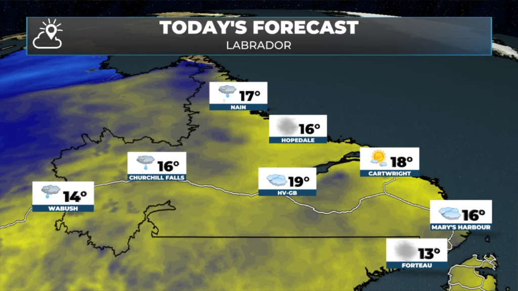
Labrador’s forecast for today (September 16, 2026).
Late Week Storm
My confidence is growing that a strong storm will affect Newfoundland between Friday afternoon and Saturday evening. This system will bring heavy rain and high winds to the Island. My concern leans more toward the high wind speeds right now, as forecasts indicate a large swath of gusts as high as 100 km/h for central and eastern areas, with a smaller area along the northeast coast and possibly the Avalon seeing gusts nearing hurricane-force (120 km/h) from the north or north-northwest. More details on this to come later today.

My next update will be posted later today right here. Don’t forget to…
📱 Get the Sheerr Weather App in the Apple App Store and Google Play Store.
🗺️ Check out the Map Room to see all the latest weather observations for the Province.
🎥 Check out the Provincial Highway Cams to see 👀 what’s going on around our highways and
Good morning Eddie thanks for the update , have a wonderful day
Thanks for the update Eddie, have a great day 😊
Thanks Eddie for weather update
Good morning Eddie, thanks for the update. Have a great day.