
Wednesday Morning’s Weather Briefing — October 7, 2026
Good Wednesday Morning! Here are today’s TL;DR notes:
It’s breezy this morning, with winds across the Province gusting between 40 and 60+ km/h.
Temperatures range from just above freezing to about 10º at this hour (5 AM).
We are still seeing areas of onshore showers over parts of western Newfoundland, with scattered showers in the east, and rain and high-elevation snow continue along and near the coast of Labrador this morning.
As the low departs this morning, precipitation across the Province ends, winds drop, and skies become partly cloudy to mostly sunny.
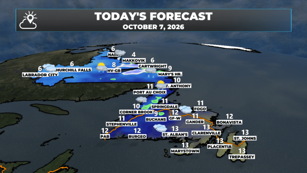
Temperatures peak in the single digits to lower teens today.
This morning’s update is sponsored by Roebothan, McKay, Marshall.
Visit MakeTheCall.ca today to learn more about how the law firm can help you!
Breezy Start
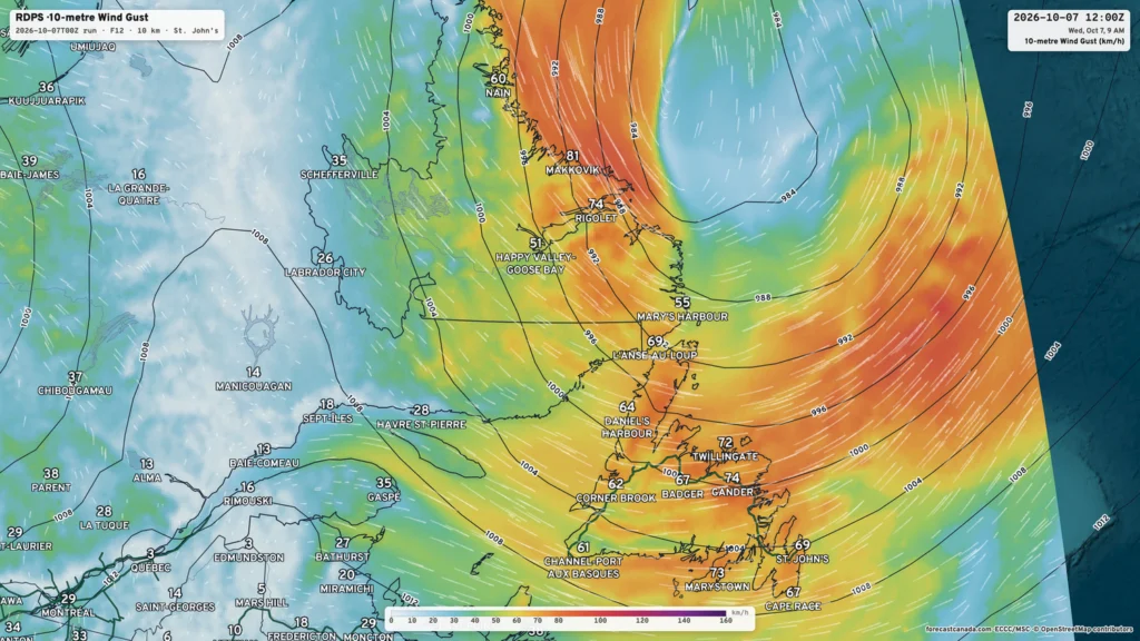
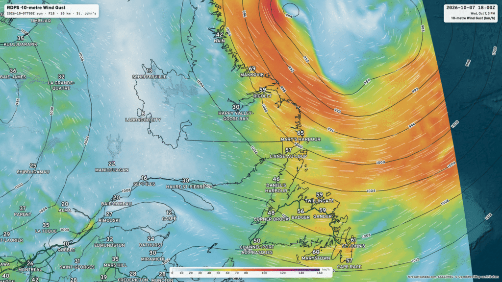
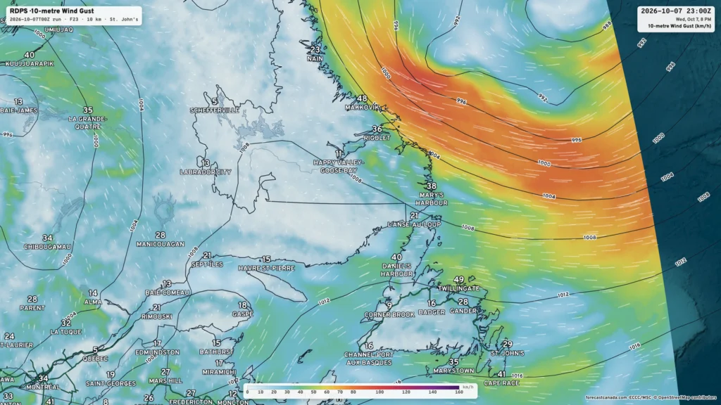
An intense low-pressure system is spinning in the Labrador Sea this morning, driving gusty winds across the Province. Many areas are currently seeing westerly wind gusts of 40 to 60+ km/h. As the day progresses, those wind speeds will drop as the low moves away from the Province and the pressure gradient that drives the wind eases. That’s a fancy term for the fact that the pressure difference between the inside and outside of the low will not be as significant. It’s those pressure differentials that drive the wind. The images below show how wind will drop through the day. The first image is the forecast wind gusts at 9:30 AM, the second is the forecast for 3:30 PM, and the last is for 9:30 PM.
Today’s Forecast
The low-pressure area driving the winds is currently spinning in the Labrador Sea but is moving away from the Province. That being said, it is still bringing rain and showers across the Province. The animation below is simulated satellite and radar imagery and should give us a better understanding of where the rain and high elevation are located.
As we move through the day, and the morning really, that will all end, the weather will improve across the board. In fact, most of the Province will see sunshine before the end of the day if you wake up in the cloud cover. Some areas will be in the sunshine for most of the day. The next animation, futurecast, also shows how this plays out through the day.
Temperatures peak in the single digits to teens across the Province today, with the coolest readings being found in Labrador and the warmest over eastern Newfoundland.
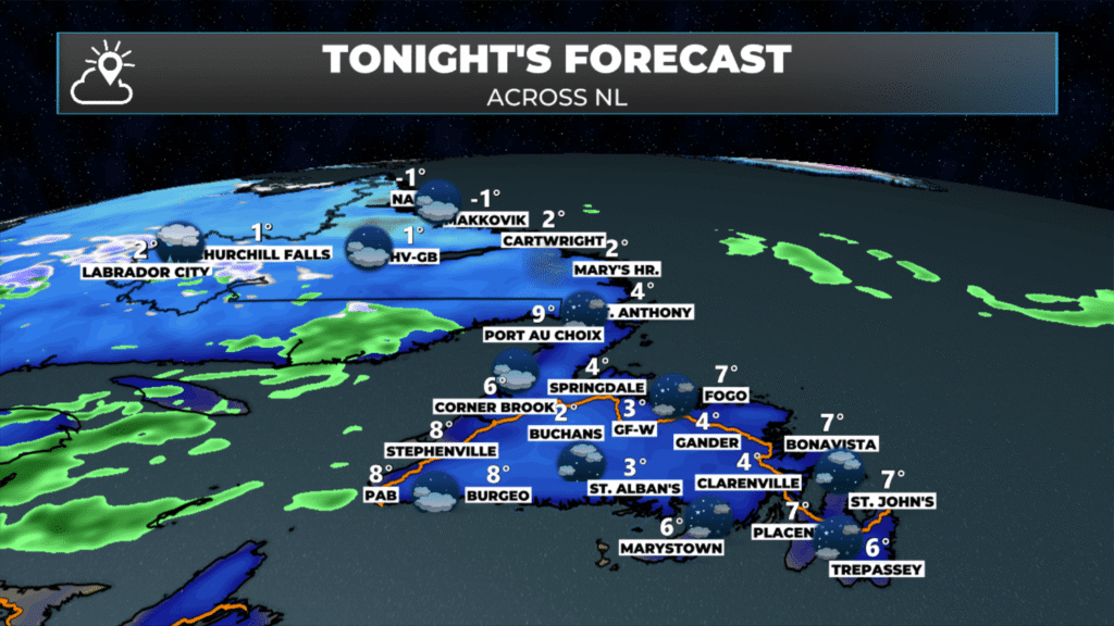
The next weather-maker arrives later tonight and Thursday, bringing another period of unsettled weather to the Province as we close out the week. That said, it will not be as significant a system as the one we just dealt with. I’ll have an update on this later today.
📱 Get the Sheerr Weather App in the Apple App Store and Google Play Store.
🗺️ Check out the Map Room to see all the latest weather observations for the Province.
🎥 Check out the Provincial Highway Cams to see 👀 what’s going on around our highways and
Good Morning Eddie
Thanks for update. Have a good day!
Good morning Eddie have a great day