
Wednesday Morning’s Weather Briefing — February 25, 2026
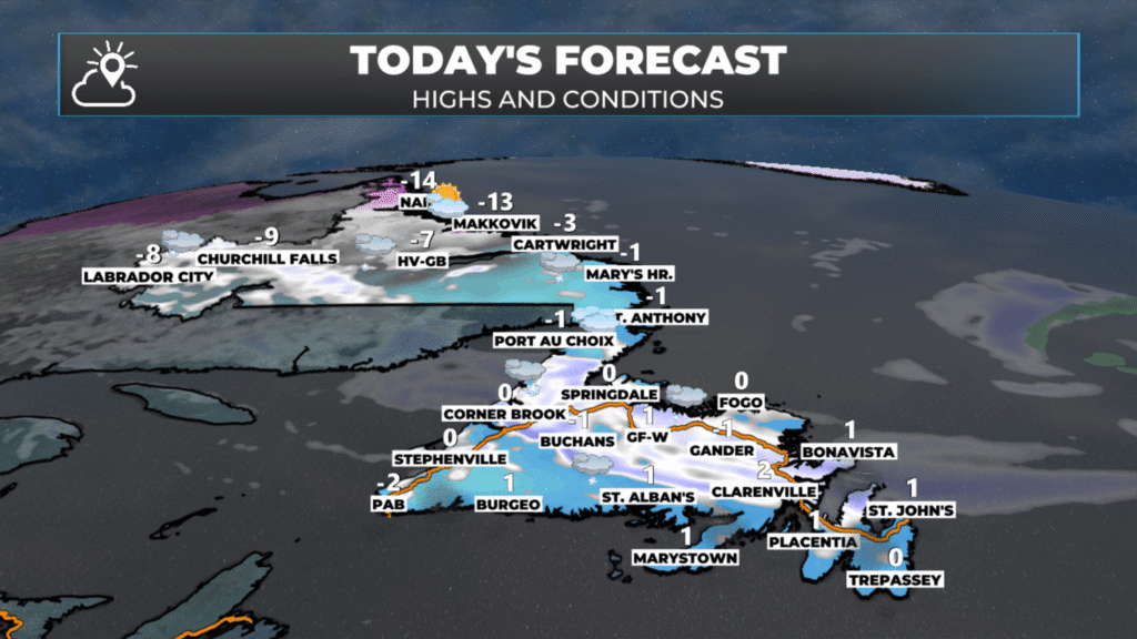
The forecast for NL for today, February 25, 2026
Good Wednesday Morning
Here are today’s weather highlights:
A Blowing Snow Advisory (Yellow Level) remains in effect for Cartwright to Black Tickle until midday.
Yesterday’s low has departed into the North Atlantic, a little trough is hanging down to its south, and that is acting as a focusing mechanism for some light snow across the Island this morning. That will continue in some areas, like central and northeastern areas, through much of the day.
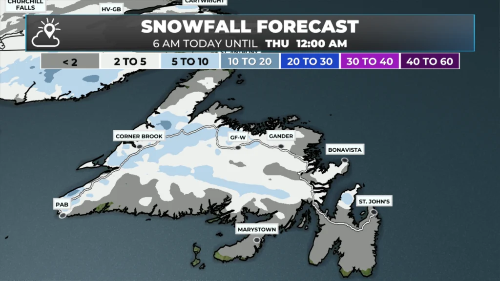
These setups are often hard to track and can lead to locally significant snowfall, especially along and near the coast. However, most areas will see 1 to 3 cm of snow today.
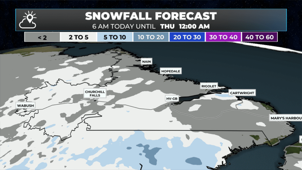
Flurries will fly in much of Labrador today, especially this afternoon
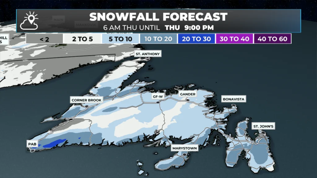
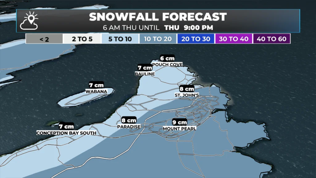
The next weather-maker arrives on the Island Thursday morning and will bring another shot of snow with it for most areas, including the east. Snowfall looks to be in the 5 to 10 cm range for most. Snow eases late morning or early afternoon as the low quickly departs.
Friday looks quiet… for now
As our latest low departs into the North Atlantic, a little trough is hanging down to its south. This little feature will drive light snow across a large portion of the Island today. Flurries will be possible everywhere, but the light snowfall should focus mostly on central and northeastern areas, as well as the interior. Radar imagery this morning from Marble and Holyrood shows areas of light snow over western Newfoundland, but it is NOT picking up the ongoing snow in the middle of the Island. However, future radar will show that, and also show you how that plays out throughout the day.
The total snowfall, as stated in the highlights section, should be mostly insignificant. However, some areas will see fairly sporadic snowfall today, which could lead to locally significant amounts that are difficult to quantify from my vantage point this morning. The most likely area for this will be near the coast in central and northeastern Newfoundland, possibly around Gander, as Gander tends to overachieve in situations like this. The maps below show the snowfall expected from this morning through midnight tonight. Tap the map to expand, then swipe to see both.
The weather tonight will turn calmer, but the next weather maker rolls in Thursday morning, bringing another shot of snow to much of the Island between 7 or 8 AM and early to mid-afternoon. While amounts will not be overly significant, a widespread 5 to 15 is expected and snowfall rates will be briefly intense, reaching 3 to 5 cm per hour for an hour or two. Future radar shows how this plays out, and below that is the expected snowfall from 6 AM to 9 PM Thursday.
I’ll have updates for you throughout the day!
📱 Get the Sheerr Weather App in the Apple App Store and Google Play Store.
🗺️ Check out the Map Room to see all the latest weather observations for the Province.
🎥 Check out the Provincial Highway Cams to see 👀 what’s going on around our highways and
Good Wednesday morning ☕️Eddie…Thank you for the weather update!….Enjoy your day!
Could you tell me how much Carbonear will get have appointment in Bay Roberts
Happy Hump Day Eddie. Have a great day. Thanks for the weather updates ☺️
Thanks Eddie! You’re the best!
Thanks for the update Eddie. Have a great day
Good morning Eddie thanks for the update, have a great day
Good Morning Eddie. Thanks for the update. Hopefully Friday will bring us a better day. If not, I have a reservation to cancel. Enjoy your day!!
Thanks Eddie for the update…Have a great day and weekend ahead …
Good morning Eddie, thanks for the update, have a great Wednesday
Env Canada and The Weather Network both saying the West Coast is headed for a big cool down next week. You seeing that too, Eddie?
Thanks Eddie for weather update