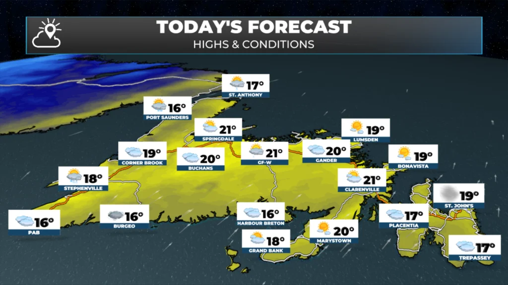
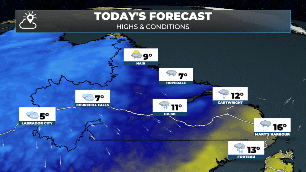
Temperatures are already into the teens for much of the Island, while Labrador is seeing more seasonable temperatures in the north and west. In the southeast, it’s still quite mild and the weather is more akin to the Island at this hour (6:20 AM NDT).
The weather on the Island today will be very similar to yesterday, although it may not be as warm. Speaking of yesterday, multiple locations hit highs over 20º, including in St. Johns, which marked the 82nd time this year such a thing happened, and a few locations hit the warmest temperatures EVER recorded in October. Check out this post on Blue Sky from Rodney Barney!
=NEW MONTHLY RECORDS=
Tuesday brought the warmth to the island. A number of locations seeing their warmest October day on record. 📈
Badger 26.4°C just 0.8°C short of highest reliable official October temperature rec for all of NL (27.2°C, Grand Falls, Oct 14, 1938). 🌡️
#nlwx
Readings today will be a few degrees cooler, in general, than yesterday, but I’m still expecting lots of sunshine across the Island. However, like yesterday, today will be a little breezy with westerly gusts reaching as high as 50+ km/h in some areas. There will also be some showers arriving on and near the West Coast, Southwest Coast, and GNP late this afternoon or early this evening.
This morning’s update is sponsored by Roebothan, McKay, and Marshall.
Sponsored
Visit MakeTheCall.ca to learn more about what the law firm can do for you.
Labrador will see areas of rain and showers in the southeast this morning, becoming a bit less widespread as the day goes along. Temperatures will reach the single digits in the north and west. Areas ahead of the cold front will creep into the lower teens, but once the front passes, temperatures will drop into the single digits.
The cold air that we are seeing over Labrador will make its way onto the Island between later tonight and late Thursday. Enjoy the last bit of summer weather, because there is a very high chance it could be the last for a while. Additionally, we can expect some much-needed rainfall over the Island tomorrow. The rain will be heavy at times during the day, especially in areas from the South Coast northward into central and northeastern regions.
Have a great Wednesday! I’ll have a comprehensive forecast update for you later today!
⚠ Storm ModeGet warnings pushed to your phone the moment they’re issued.Get the app
By using this website, you agree to our use of cookies. We use cookies to provide you with a great experience and to help our website run effectively. Privacy Policy


Thanks for keeping us up informed.
Good morning Eddie,thanks for the weather update.
Tks for the daily update Eddy 🤗. Another beauty of a day to enjoy
Good morning!Thanks for the update Eddie !
Good morning Eddie!…Thank you for the update!
Happy Wednesday!..Enjoy your day!😊
Love your forecast Eddie. Thanks so much. Can always count on you.
Foggy here again today at 11:30am on the south coast.We did see the sun for a short period yesterday .