
Wednesday Morning Update — January 21, 2026
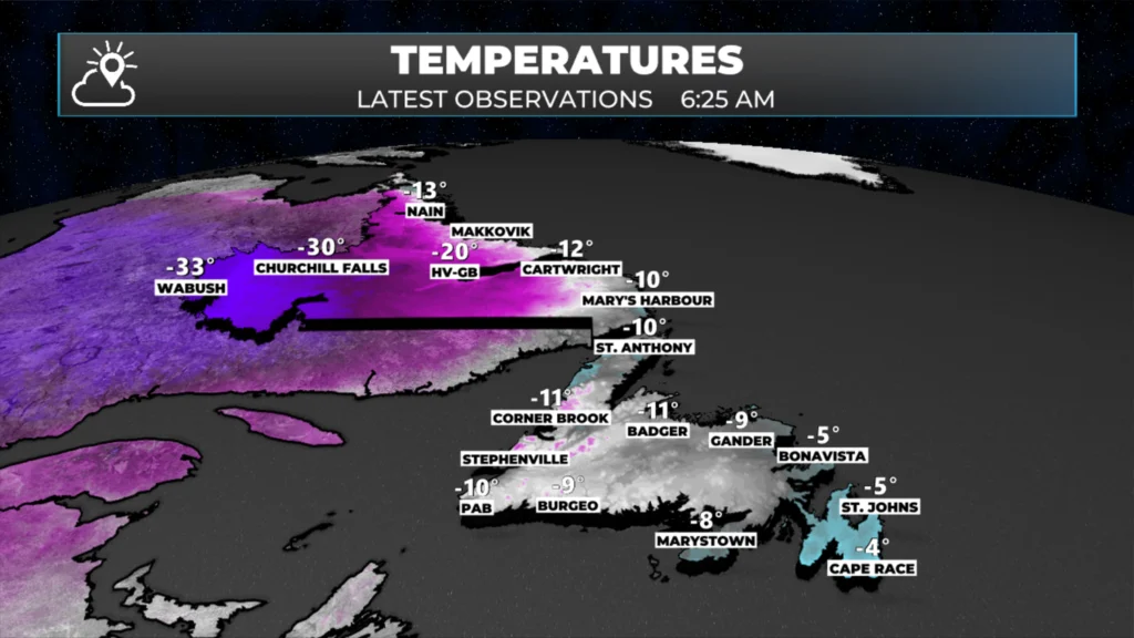
Observed temperatures as of 6:25 AM NST on January 21, 2026
Good Wednesday Morning!
Here are today’s weather highlights:
The Northern Lights were stunning last night (I’ll have a gallery posted later today— for real this time)!
Arctic air is spilling into the Province as I type this up, and the coldest air of the season has arrived or is arriving.
Temperatures are about as warm now as they’re going to be, as readings will fall throughout the day in most areas.
Snow squalls will be common today for much of the Island — outside of that, it will be partly cloudy and breezy across the Province.

This update is sponsored by Roebothan, McKay, Marshall.
Visit MakeTheCall.ca TODAY to learn more about what the law firm can do for you.
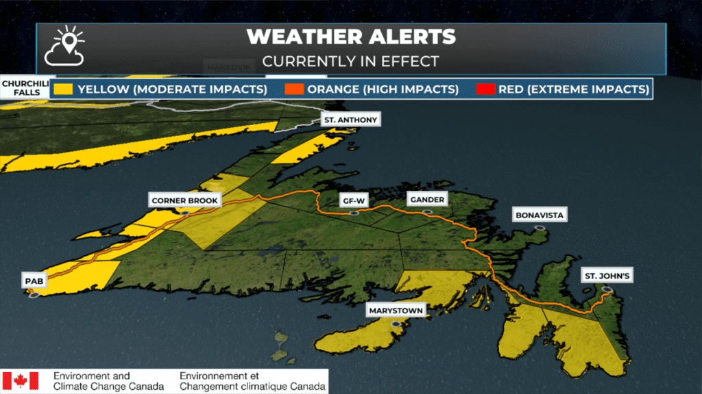
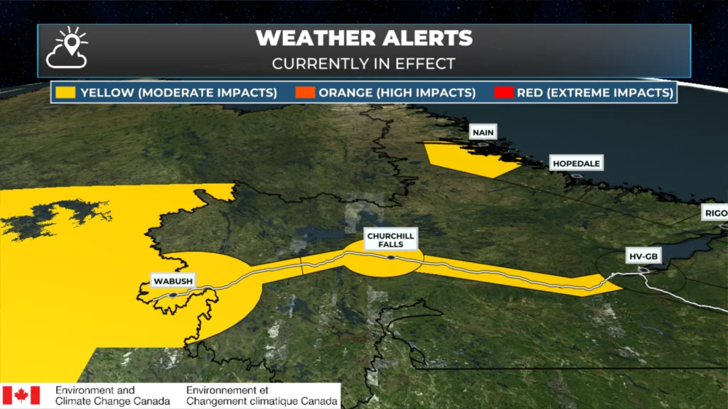
Current Weather Alerts
A Yellow Level Extreme Cold Warning remains in effect from the Churchill Valley to Labrador City and Wabush for wind chills as low as -50ºC this morning!
A Yellow Level Snow Squall Warning is in effect for Corner Brook and vicinity, and Bay St. George as of 6 AM, while a Yellow Level Snow Squall Watch remains in effect for Deer Lake – Humber Valley, Gros Morne, The Burin Peninsula and the Southwest and Southeast Avalon Peninsula.
A Warning means that a particular weather element is occurring or imminent, and a watch means that a weather element is possible.
Yellow Level Wind and Extreme Cold Warnings are in effect for the Northern Peninsula East from later today through tomorrow morning, for wind chills as low as -35ºC and wind gusts as high as 100 km/h.
A Yellow Level Blowing Snow Advisory and a Wind Warning are in effect for Nain and vicinity today for wind gusts as high as 100 km/h and ~5 cm of snow.
More on the latest alerts can be found here.
Today’s Weather
As of 6:08 this morning, we are seeing areas of flurries across much of Newfoundland, with intense snow squalls occurring along and near the West Coast. The radar loop over the last 3 hours shows this nicely. The snow squalls will continue to be a thorn in our side throughout the day for much of western, southern, and parts of eastern and southeastern Newfoundland. Snowfall under these squalls will be significant for areas that end up under persistent snowfall. On top of that, blizzard conditions are likely in the squalls as well due to the combo of falling snow, blowing snow and wind gusts of 60 to 80 km/h.
Snowfall in the higher terrain of western Newfoundland will be significant, and blizzard conditions are likely to exist until Thursday morning in some areas.
The other element of today’s weather will be the cold air. Most places will see temperatures fall this morning and then hold at fairly cold levels through the day. This includes the Metro area, where the temperature will fall to about -9º this morning, and hold there, with wind chills into the -20s. The animation below gives you the wind chill, or feels like, temperature for the remainder of today across the Province.
Conditions will calm down tonight; however, another weather-maker moves in on Thursday. This will spread snow into southwestern areas during the afternoon, before that snow spreads across much of the Island during the second half of the day and overnight. The snow will end by Friday morning, and on the Avalon, it will end as rain or drizzle in some areas. Amounts will be on the order of 5 to 10 cm for most areas.
Updates to come throughout the day.
📱 Get the Sheerr Weather App in the Apple App Store and Google Play Store.
🗺️ Check out the Map Room to see all the latest weather observations for the Province.
🎥 Check out the Provincial Highway Cams to see 👀 what’s going on around our highways and
Thanks Eddie for weather update. MO
Thank-you for update Eddie. Another messy day it seems with those snow squalls. We can’t catch a break!
Thanks Eddie.
Good morning Eddie it’s a chilly one have a great day and thanks for the update
Good morning Eddie, thanks for the update. Have a great day.
Good morning Eddie,thanks for the update and it’s a chilly 🥶 morning
Good morning Eddie. What a mess of a day here in Irishtown-Summerside on the West Coast. Thanks for the update!
Thanks Eddie for the update. And have a nice day.