
Tuesday Morning’s Weather Briefing — February 24, 2026
Good Tuesday Morning
Here are today’s weather highlights:
Another weather maker moves through today, bringing snow to much of Newfoundland and Labrador. Areas south and east will see the snow change to rain, through freezing rain, this morning before ending. This includes the Metro area.
Yellow Level Winter Storm Warnings are in effect for southern areas of Newfoundland, Green Bay-White Bay, the Northern Peninsjua and southeast Labrador. Details on the alerts here.
Wreckhouse Winds peaked around 130 km/h overnight and are still gusting to 111 at this hour. The winds there will slow through the morning.
Travel will remain difficult across much of western, northwestern Newfoundland and southeast Labrador today as today’s low moves quickly across the region. Weather conditions improve across the board tonight.
The next round of snow arrives Thursday morning and will bring another shot of snow to eastern areas, including the Metro. Forecasts indicate another 5 to 15 cm before a change to drizzle or rain.
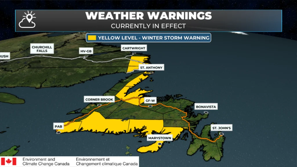
Winter Weather Alerts as of 6:27 AM on Feb. 24, 2026
Today’s Outlook
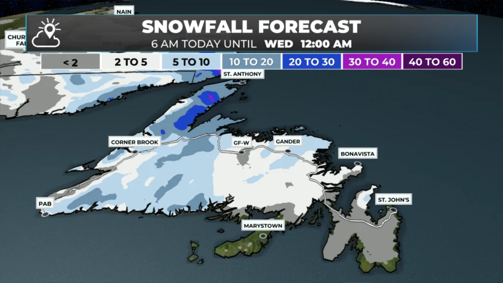
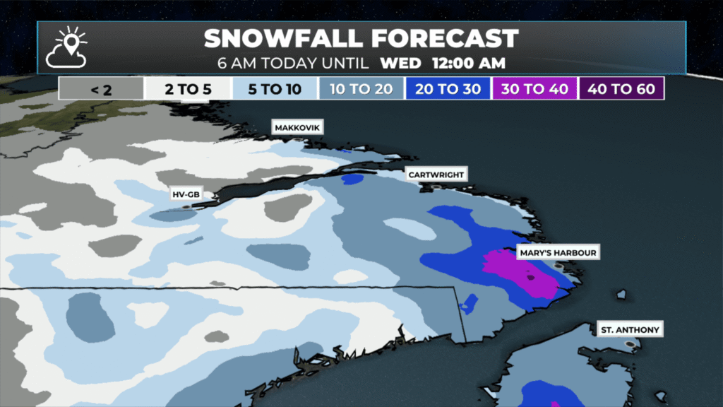
A low-pressure area will move across the Island today. This will bring messy weather to eastern areas, with snow west and north of its track and less mess under the low. Travel will remain difficult today across western Newfoundland, Green Bay-White Bay, the Northern Peninsula, and much of southeast Labrador due to snow and wind. Snowfall amounts in these areas today will generally be 15 to 25 cm, with locally higher amounts. East and south, and in Labrador West, lesser amounts are expected today. In fact, in southeastern Newfoundland, temperatures will reach about 6ºC for a high this afternoon before cooling back down. The animation below shows how precipitation and temperatures will unfold today.
Today will also be on the windy side across many areas of the Province, with gusts of 60 to 90 km/h. Wind alerts are not in effect; however, that doesn’t mean it will not be breezy. It just means that the wind isn’t forecast to reach advisory criteria in most areas. This animation shows today’s wind forecast.
The weather improves for Wednesday… ahead of our next weather maker which arrives early Thursday. That will bring another shot of snow to eastern and southeastern Newfoundland. Amounts look to be in the 5 to 15 cm range as of this morning. As always… stay tuned.
I’ll have updates for you throughout the day!
📱 Get the Sheerr Weather App in the Apple App Store and Google Play Store.
🗺️ Check out the Map Room to see all the latest weather observations for the Province.
🎥 Check out the Provincial Highway Cams to see 👀 what’s going on around our highways and
Thank-you!
I’m sick of the wind more than the snow,especially when I have to travel on ferry regularly 😒
Tks Eddie snowing and blowing snow in gander right now
Thanks Eddie
Raining here in newbridge st Mary’s bay
Good morning Eddie, thank you for all the work you’ve put into bringing us weather enthusiasts such a detailed look at what’s going on with the weather! You certainly deserve a medal, and a GOLD one at that! It’s obvious that you’ve put a lot of time and energy into this report! It is, ‘ what it is’ , but it will be nice when all this snow and wind is behind us! God love your interest, patience, reporting and love! Sending big hugs, keep safe and warm!
Thanks for weather update
Thanks for the weather update!
Good morning Eddie thanks for keeping us updated, have a wonderful day
Thanks Eddie for all the weather reporting. Have wonderful day