
Tuesday Morning’s Weather Brief | October 14, 2025
Good Tuesday morning!
Today is election day — go vote!
If you don’t know where to go to vote, start here: https://www.elections.gov.nl.ca/

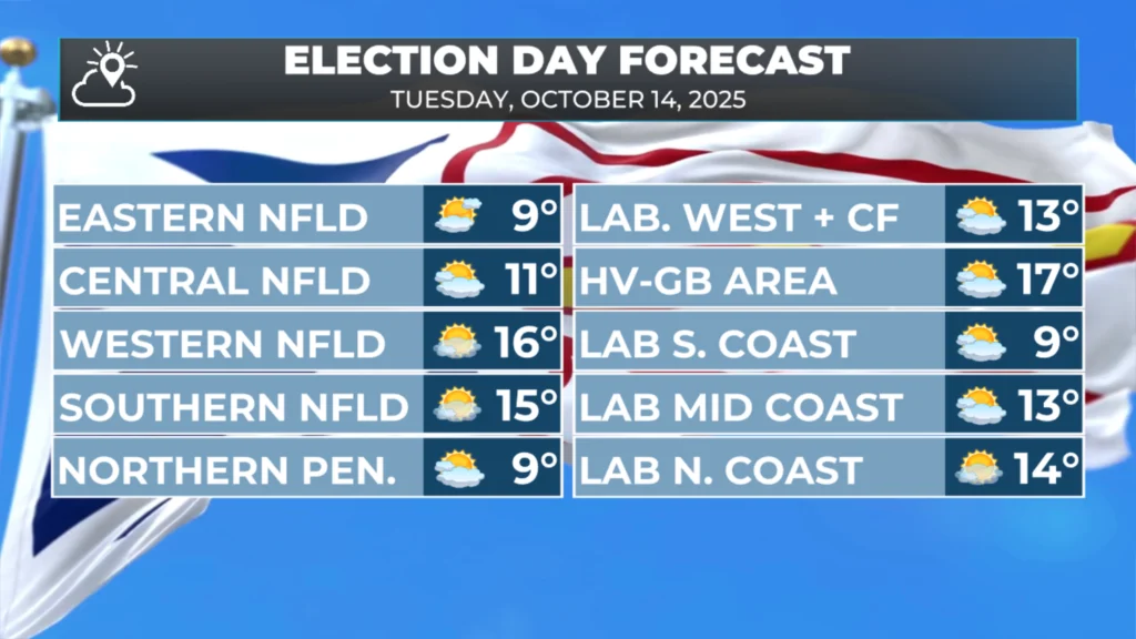
The weather today looks great across the Province! We are going to see lots of sunshine to start, comfortable high temperatures, and a little bit of a breeze in some areas this afternoon. Clouds will begin to increase this afternoon along an imaginary line that runs from near Black Tickle, Labrador, to Newfoundland’s Avalon Peninsula. That means if you are between those two areas in the Province, you’ll see the clouds arrive this afternoon.
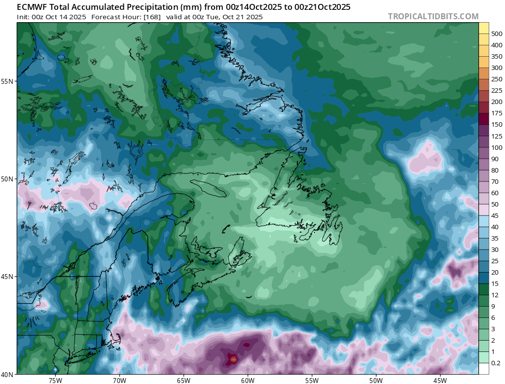
After today, the weather pattern will change significantly for the remainder of the week. Our region will see the first stint of rain, drizzle, and fog we’ve seen in a very long time. I’d reckon since June… this is due to a large area of high pressure over Greenland.
This morning’s update is sponsored by Roebothan, McKay, Marshall.

Visit MakeTheCall.ca today to find out what the law firm can do for you!
The high will essentially cause a traffic back-up of lows in the North Atlantic. Most of which will be to the east of Atlantic Canada. This places the region on the backside of the counter-clockwise rotating lows, which means lots of northerly flow, and subsequent low cloud, drizzle, and bouts of fog along and near the north and east-facing shores of the Province.

Thanks for the update
Thanks for the update
👍
Good morning Eddie, thanks for the update. Have a great day.
Good morning Eddie, thanks for weather update.
Good morning Eddie ! Thanks for the update…
Good morning Eddie. A very beautiful day here in Irishtown-Summerside on the West Coast. I really enjoy your app. Have a great day.