
Tuesday Morning Weather Update — December 23, 2025
Good Tuesday morning!
We are seeing flurries and light snow across the East Coast and the West Coast this morning. Some locations are seeing moderate rates, which will be enough to make the roads slick and snow-covered. This is especially true on the Avalon, where snow appears widespread at this hour. The radar images below clearly illustrate the point.
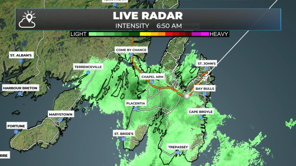
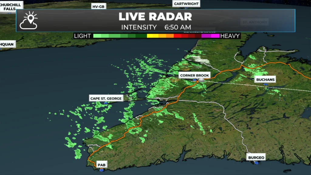
On top of that, there are likely areas of snow not being picked up by radar, as the 511NL.ca site is reporting most roads across the Island as covered or partly covered this morning. The reason for this isn’t the radar; it’s where the snow is in the atmosphere. As the radar beams leave Hoyrood and Marble, they do so at an angle. If the snow is below the radar beam, which most of this is, it will not get picked up.

This update is sponsored by Roebothan, McKay, Marshall.
Visit MakeTheCall.ca TODAY to learn more about what the law firm can do for you.
Computer guidance indicates that parts of northeastern Newfoundland and the Avalon will experience intermittent flurries and areas of light snow throughout the day. Locally, some areas could see 5 to 10 cm of snow. However, these forecasted features are small-scale, and pinpointing their exact locations is often challenging. I’ll watch the radar closely and will provide updates on my socials and in the app throughout the day. You can also use the radar page in the app to track the snow yourself.
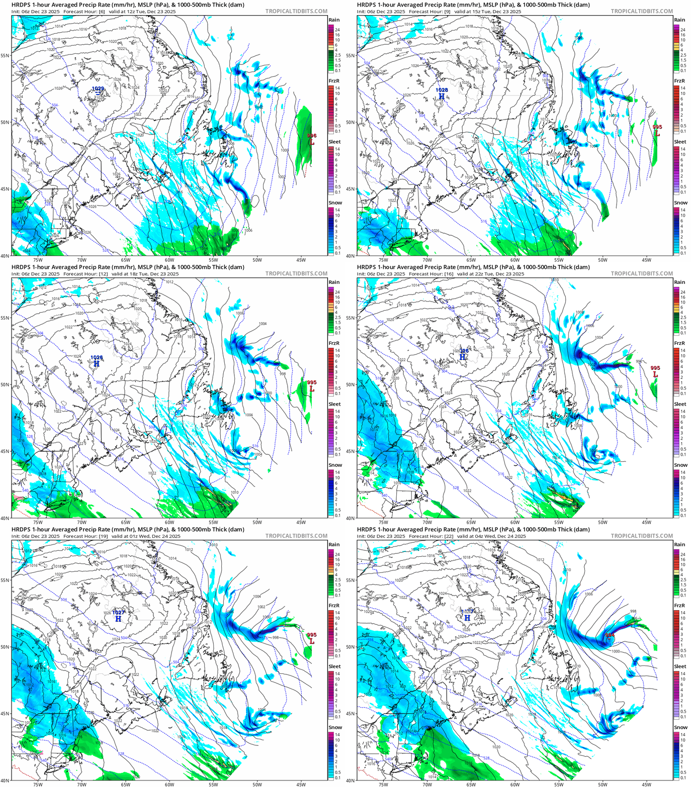
GIF of HRDPS model depiction of today’s weather from 8:30 AM to 2:30 AM Wednesday.
Projected snowfall amounts reflect the semi-stratiform but also lollipop nature of today’s snowfall. This will undoubtedly lead to locally challenging travel conditions at times and in spots.
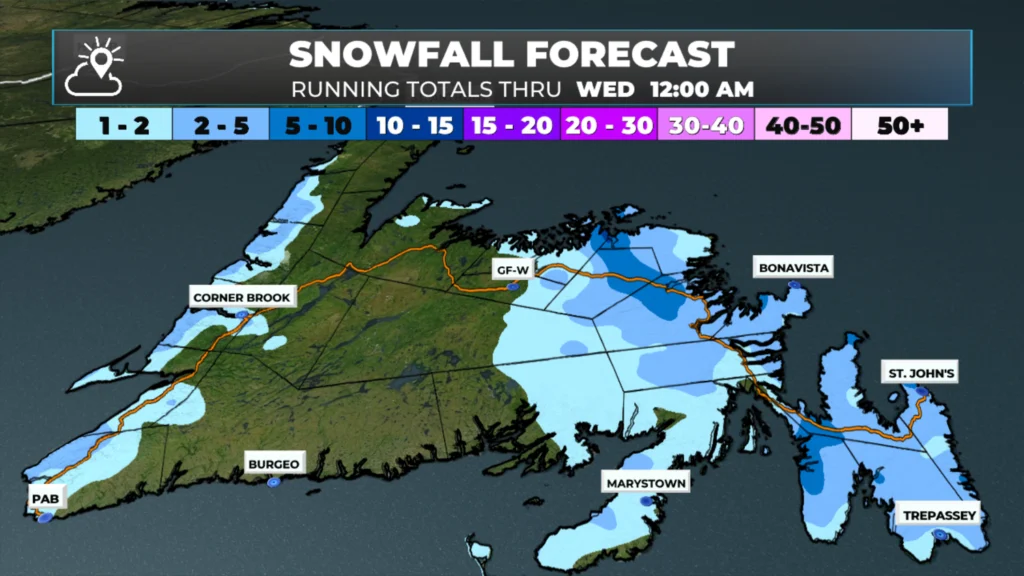
Today’s snowfall forecast — December 23 at 6 AM into the December 24 at 12 AM (2025).
Outside the snowy areas today, the weather across NL appears relatively tranquil, with cold temperatures and a mix of sun and cloud. Tomorrow will be simliar, albeit a bit colder.
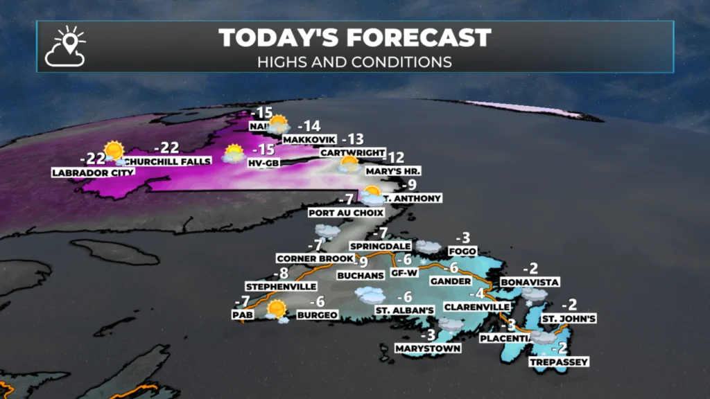
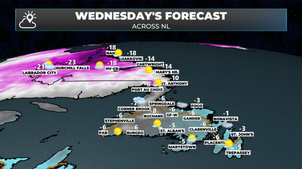
Thursday, Friday, and even Saturday will not be. Weather Alerts are already in effect for part of that time frame. I’ll have more details on the Holiday forecast this afternoon.
I’ll have my next update posted later today!
📱 Get the Sheerr Weather App in the Apple App Store and Google Play Store.
🗺️ Check out the Map Room to see all the latest weather observations for the Province.
🎥 Check out the Provincial Highway Cams to see 👀 what’s going on around our highways and
Thank you for the update,
Merry Christmas to you and your family 🎅🏻🎄
Thanks for the update Eddie Merry Christmas to you and your family🎄🧑🏻🎄
👍 Merry Christmas! 🎄
Love your Forecasts! You are the Best! Merry Christmas to you and your family! 🎄