
Tuesday Morning Weather Brief — September 23, 2025
Good Tuesday morning!
We officially said goodbye to summer yesterday at 3:49 PM NDT (3:19 PM ADT) as the sun shone directly on the earth’s equator, indicating the Autumnal Equinox. Today, the sun will be ever so south of the equator as we continue our seasonal journey toward the winter solstice, the official start of winter and the shortest day of the year. And even though that is all happening, the weather across NL will remain quite warm (for most areas) for the next few days.
This morning’s update is sponsored by Roebothan, McKay, and Marshall.

Visit MakeTheCall.ca to learn more about what the law firm can do for you.
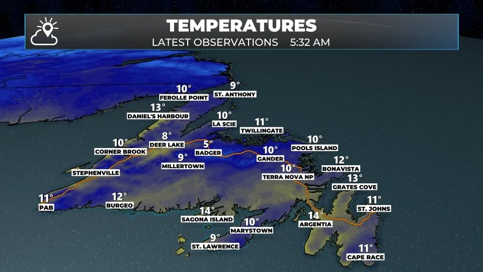
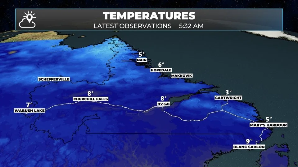
Temperatures as of just after 5:30 AM NDT (5:02 AM ADT) are hovering in the single digits to lower teens across the Province. Many areas are starting the day dry, but Cartwright, Nain, Wabush Airport, and St. Anthony are all reporting light rain or light rain showers at this early hour. Simulated radar suggests there is an area of rain that stretches from Labrador to the Northern Peninsula.
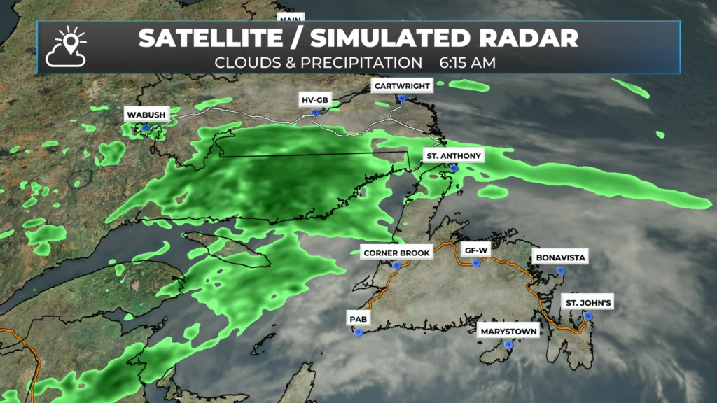
As the day progresses, the rain will become less widespread for Labrador; however, it will continue on the Northern Peninsula. The West Coast will also see some showers this afternoon. Showers also exist in Central and eastern Newfoundland today, although the chances of seeing rain aren’t as high as farther west.
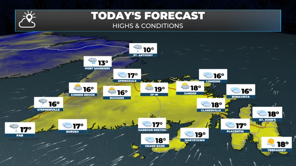
Even with showers in the area, temperatures will still be on the mild to warm side today. I expect mid-to-upper teens for the majority of the Island south of the Northern Peninsula. For the Northern Peninsula and the Big Land, highs will reach the lower to middle teens today. Skies will be sunny in northern Labrador, and partly to mostly cloudy elsewhere.
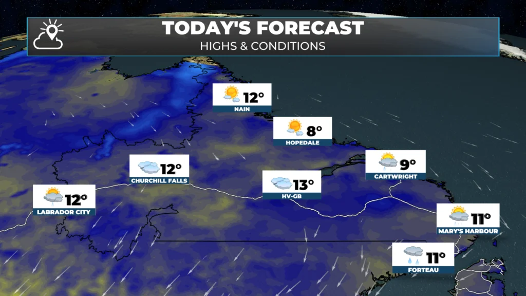
The showers out west today will sink southeast overnight in conjunction with a cold front, and areas of central and eastern will see them overnight into early Wednesday. Wednesday will be cooler, with some morning showers, but once past the morning, I expect a fair bit of sunshine. I will have an update on tomorrow’s forecast, as well as the forecast for the days beyond, this afternoon.
Hurricane Gabrilee
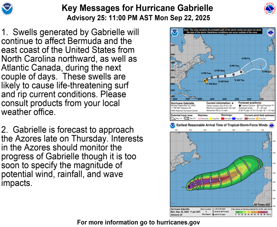
Hurricane Gabrielle is still an extremely dangerous Category 4 hurricane churning in the Atlantic. The storm is packing sustained winds of 220 km/h and is moving toward the northeast at 20 km/h. The centre is located 355 kilometres east of Bermuda. The storm will continue on a northeast to easterly track and will not pose a direct threat to NL. Swells from the storm may impact some of the near and offshore waters, granted, I’m not expecting large waves at this time.
My next update will be posted by 4 PM this afternoon. Have a great Tuesday!
And now my day is sent. Thanks Sheerr Weather.
Good Morning Eddie!
I’d call this forecast favourable heading into Fall. Time to be putting away garden tools for another year! Thank-you!
Thanks for keeping us informed. I will always trust your forecast
Thanks for your info !
Thanks Eddie, happy Tuesday
Have a great one!
Thank you so very much Eddy I hope you have a wonderful day!!!!!
Thanks for the update
Tks Eddie.have a great day.