
Tuesday Morning Weather Brief — November 25, 2025
Good Tuesday morning!
We are waking up to quiet and chilly conditions across much of the Province. The temperature at this hour (6 AM) is generally near or well below freezing. There are likely many of you who will have frost on your vehicles this morning, so allow a bit of extra time to scrape or thaw that off.

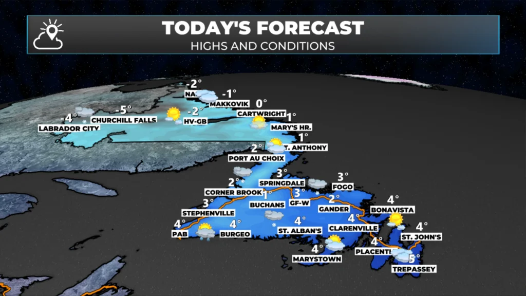
Weather-wise, today we start quietly with some flurries in Labrador West. Those flurries are part of a disturbance that will pass over the Island this afternoon and this evening. As that happens, expect areas of light snow and rain to move into western and southwestern Newfoundland early this afternoon. That moisture will move eastward and reach Central and eastern areas just before or during early evening.

This morning’s update is sponsored by Roebothan, McKay, Marshall.
MakeTheCall.ca
This little disturbance is a fast-mover, so I’m not anticipating much snow accumulation on the Island today outside of the West Coast and higher terrain. Temperatures will peak in the single digits above freezing for most areas today on the Island, and will remain below freezing in the bulk of Labrador. The animation below shows today’s precipitation and temperatures.
After this system clears, the weather for Wednesday looks fairly quiet and comfortable across the region. The next weather-maker arrives on Thursday, and this will be another system that cuts into Labrador. That track means another round of mild temperatures and rain for the Island and snow for Labrador. This system will last into Friday or early Saturday. The snow could be significant in parts of Labrador.
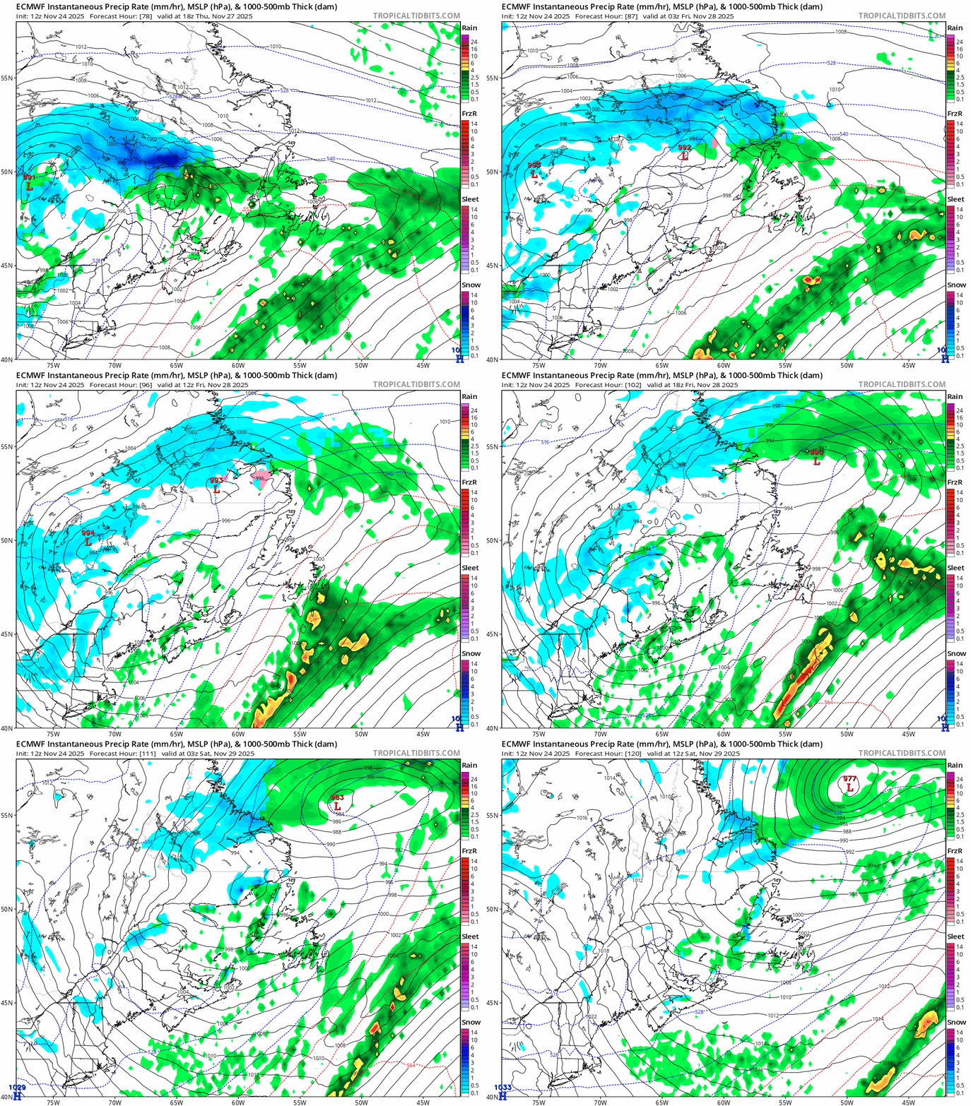
ECMWF model look of the Thursday into Saturday system.
This is not expected to be a major windmaker on the front side, meaning Thursday or Friday, but may produce more widespread gusty conditions Saturday as it pulls away and strengthens in the Labrador Sea.
More details on this one later today!
My next update will be posted this afternoon.
Stay tuned!
I’ll have my next update posted later today!
📱 Get the Sheerr Weather App in the Apple App Store and Google Play Store.
🗺️ Check out the Map Room to see all the latest weather observations for the Province.
🎥 Check out the Provincial Highway Cams to see 👀 what’s going on around our highways and byways!
Good Morning Eddie! Thanks for the weather update. Enjoy your day
Thank you Eddie and have a great day.
Always a pleasure to see your forecast and read your weather stories. Keep up the great work. Weather in NL is sheerweather!
👏
Good morning Eddie, thanks for weather update.