
Thursday Morning’s Weather Update — March 12, 2026
WEATHER ALERTS AS OF 6 AM NDT ON MARCH 12, 2026
Good Thursday Morning!
Here are today’s weather highlights:
Various weather alerts are in effect for NL this morning and they range from the following
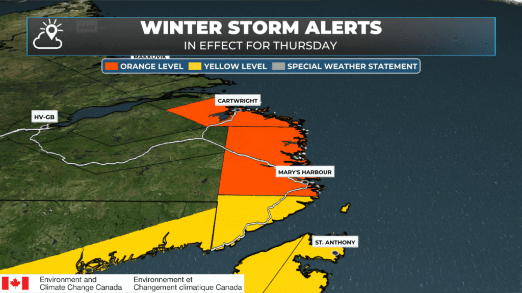
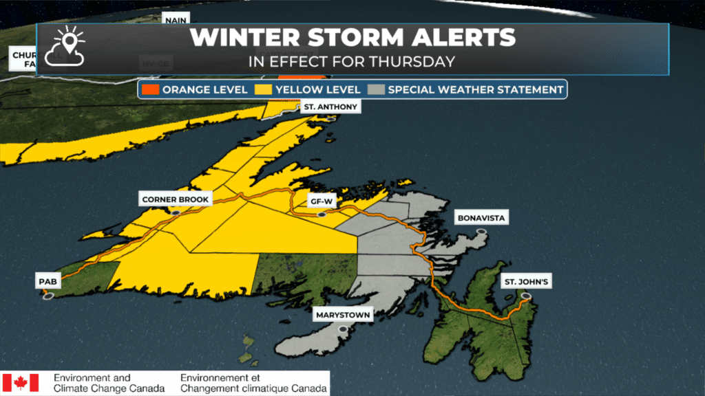
Winter Storm (Yellow and Orange) – Parts of Newfoundland and southeast Labrador
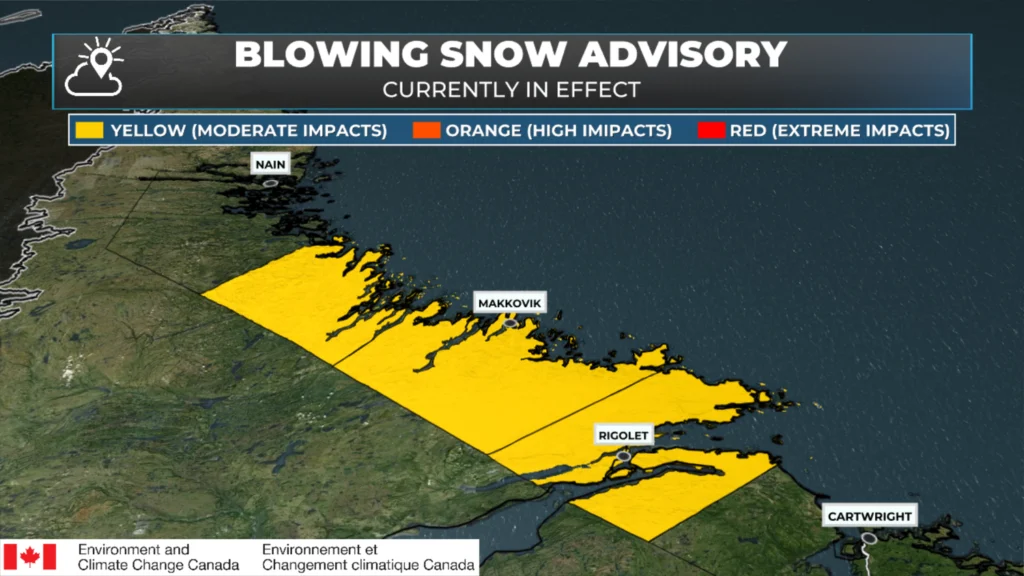
Blowing Snow (Yellow) – Labrador Mid Coast
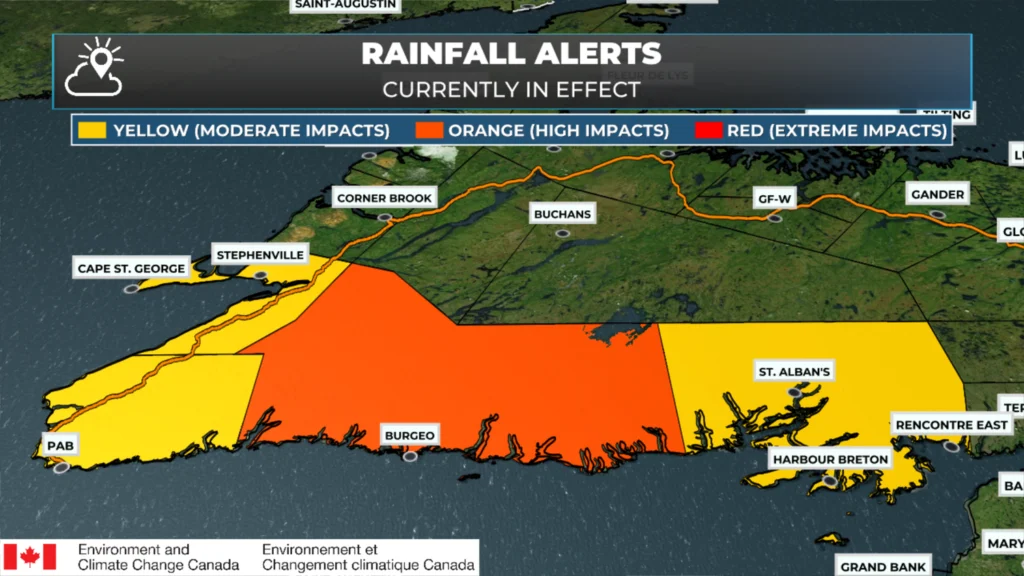
Rainfall (Yellow and Orange) – Southern Newfoundland
Wreckhouse Wind Warning (Yellow) – Channel – Port aux Basques
Special Weather Statement – Eastern Newfoundland
Snow is flying across much of the Province this morning, although it’s a messy mix in the south. Roads are in poor shape for much of western Newfoundland this morning. For instance, the Burgeo Highway is closed just east of Stephenville.
Many schools are closed or closed for the morning. Find a live-updating list in the Storm Centre!
Today’s Forecast for Newfoundland & Labrador
Snow and ice pellets are flying across much of Newfoundland early this morning. The ice pellets are currently over the southern areas. As the low drives this system, warm air is eroding the cold from the top down, and the snow/ice-pellet line will continue to move north. South of the ice pellets, there is an area of freezing rain; beyond that is an area of rain. All of this is moving north, and much of Newfoundland will transition today from snow to ice pellets to freezing rain and then to rain. The question isn’t so much whether it will happen, but when. In the south and east, most precipitation will end up as rain after a short period of snow and ice this morning — this includes the Avalon. The animation below illustrates this well.
The heaviest snow will fly in Labrador, where amounts up to 50 cm are possible for parts of the coast, which is why that area is under an Orange Level Winter Storm Warning. The snow there will continue through today and a large part of Friday before ending.
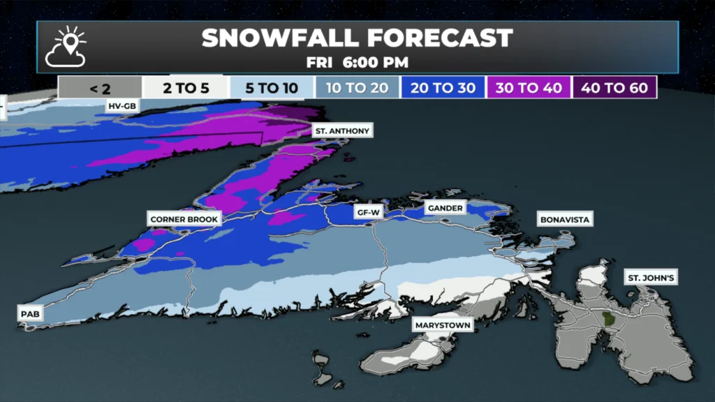
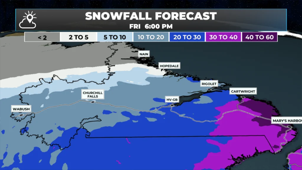
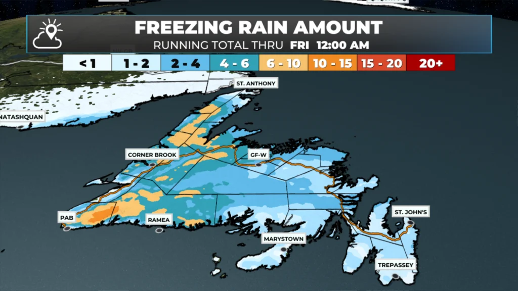
While the snow will make travel messy this morning, my main concern is the freezing rain expected today and how long it will fall over parts of interior, central and western Newfoundland, along with the Northern Peninsula later this morning into the afternoon. Several millimetres of ice accretion appear possible, which could be enough to cause localized power outages in some areas — especially where significant ice builds up on trees and power lines. The image below shows expected ice amounts; anything above 6 mm is concerning, and values over 10 mm reach a threshold that can produce more widespread disruptions.
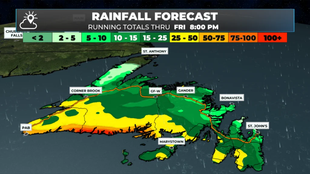
Rainfall will also be significant today into Friday, with amounts over 50 mm possible along parts of the south coast. This will most certainly lead to localized flooding due to the combination of melting snow, falling rain and mostly frozen ground (the water has no place to go). The rain will come in two phases: one today and another later tonight into tomorrow. The image below shows the expected rainfall totals for this time frame.
There is certainly more to cover this morning, and I’ll have a more comprehensive update within the next few hours.
📱 Get the Sheerr Weather App in the Apple App Store and Google Play Store.
🗺️ Check out the Map Room to see all the latest weather observations for the Province.
🎥 Check out the Provincial Highway Cams to see 👀 what’s going on around our highways and
Good morning Eddie,thanks for weather update.
Good morning Eddie. Even though I don’t like the snow I appreciate our weather man!
Good morning Eddie , Thanks for the update….
Good Morning Eddie. Another very messy day. There’s just no end this season, is there! Thanks for keeping us updated
Thanks Eddy
Enjoy your Day
Good morning Eddie, I don’t like freezing rain but here it is. You have a nice day and be careful if out walking
Good Morning Eddie thanks for keeping us informed stay safe underfoot