
Thursday Morning’s Weather Briefing — April 23, 2026
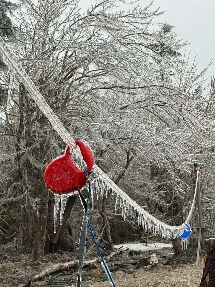
Ice accretion in Airport Heights on April 22, 2026. Credit: Hayley Amy
Good Thursday morning!
Here are today’s weather highlights:
The weather will be quieter on the Island today, with only a few flurries flying on the West Coast. The exception is the top of the Northern Peninsula, where rain will change to snow later this morning and continue into the evening… and possibly Friday morning.
Coastal Labrador will see snow and ice this morning, changing to rain this afternoon from near Hopedale points south. To the north, the dominate precipation type will be snow.
High temperatures will be near 0ºC on the Island and for much of the Big Land’s coastline. Highs in the Churchill Valley, back to Labrador West, will be between -3º and -5º. Skies are cloudy to mostly cloudy across the board.
My forecast confidence is growing on a significant late-season winter storm for eastern Newfoundland beginning Friday afternoon and continuing into Saturday.
The slow-moving low-pressure centre and its associated frontal boundary, which brought significant amounts of freezing rain to eastern and northeast Newfoundland yesterday, have moved north toward the Strait of Belle Isle. This has taken the bulk of the snow, ice and rain with it. Labrador will see the mixed bag of precipitation persist through today, while the Island will generally be quieter, under mostly cloudy skies. The exception is the West Coast, where flurries will be found, and the top of the Northern Peninsula, where snow will fly through much of the day. It will be locally heavy. The animation of future radar and satellite (below) highlights this well.
High temperatures today reach near or slightly above freezing across Newfoundland, while Labrador will see highs near freezing along the coast, with -5ºC in the west. The takeaway is that in any areas seeing snow today, that snow will be wet and heavy.
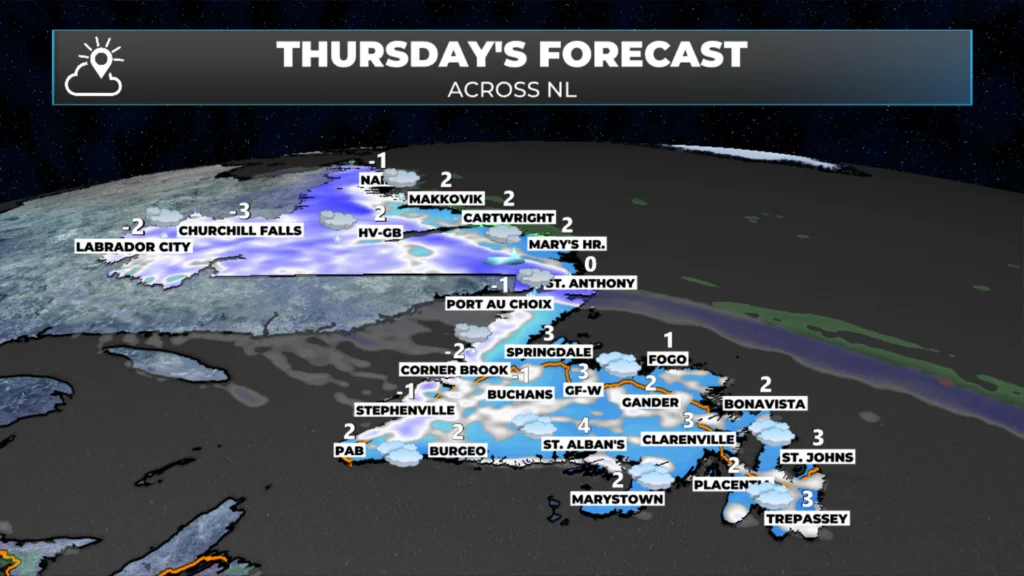
Today’s forecast for Newfoundland & Labrador – April 22, 2026
The next item on the docket will be an area of low pressure that will develop south of the Avalon Peninsula on Thursday night. This low will rapidly intensify as it approaches southeastern Newfoundland on Friday. Temperatures are just cold enough that this low will bring snow to much of eastern Newfoundland, starting Friday afternoon. Snow will more than likely continue, heavy at times, Friday night into Saturday morning before changing to rain at some point Saturday as we run out of cold air.
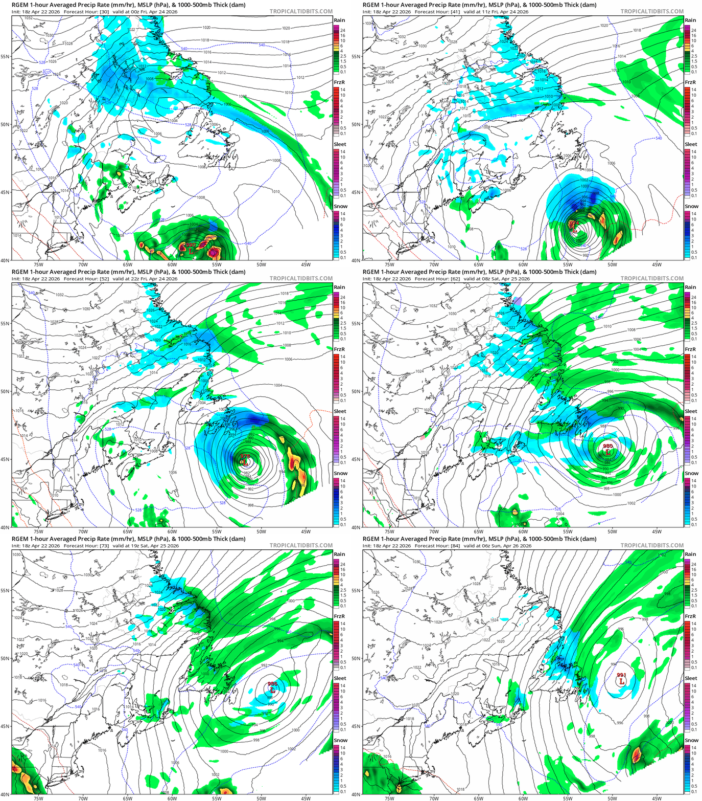
Animated GIF loop of the low expected Friday evening through Saturday/Sunday
The question right now is how much snow will fall before the changeover… and odds are high that more than 15 cm will fall over a large area. I’ll have a more comprehensive update on this later today… but expect travel to be difficult across much of the area Friday evening through much of Saturday morning.
📱 Get the Sheerr Weather App in the Apple App Store and Google Play Store.
🗺️ Check out the Map Room to see all the latest weather observations for the Province.
🎥 Check out the Provincial Highway Cams to see 👀 what’s going on around our highways and
Thanks Eddie
Good Morning Eddie!
Another snow storm tomorrow!!!!!!
There’s nothing left to be said ….. just got to grin and bear it.
Eddie, approximately what time in the afternoon do you think this will start? I have a group luncheon booked, so I’m wondering if I should cancel a 12 oclock reservation. Thanks for update
Good morning Eddie wow more snow, enjoy your day and thanks for updating us
More snow ! Our Church has it’s Spring Sale on Saturday morning, yikes !
Thanks for the update bring on spring and summer
Thanks Eddie
Thank you Eddie.