Thursday Morning Weather Briefing — October 9, 2025
By Eddie Sheerr·
Good Thursday morning!
Temperatures to start the day are still in the teens for much of the Island, while Labrador is in the single digits. The cold air in Labrador will make a push across the Island between today and tonight.
This morning’s update is sponsored by Roebothan, McKay, and Marshall.
Sponsored
Visit MakeTheCall.ca to learn more about what the law firm can do for you.
We are waking up to rain, wind, and/or showers across the island this morning. Temperatures vary, but are warmest over the eastern half and cooler over the western half. The rain will persist throughout the day as a cold front moves through the area. It will be heavy at times for most areas. Amounts will vary, but I expect widespread rainfall of 10 to 20 mm over the Island today, with locally higher amounts.
It will also be downright windy today. Winds on the GNP may gust near 90 km/h this afternoon, and winds in the south and east will peak in the 70 to 80 km/h range between now and early afternoon.
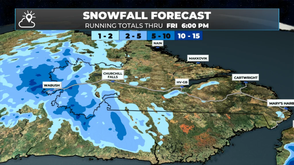
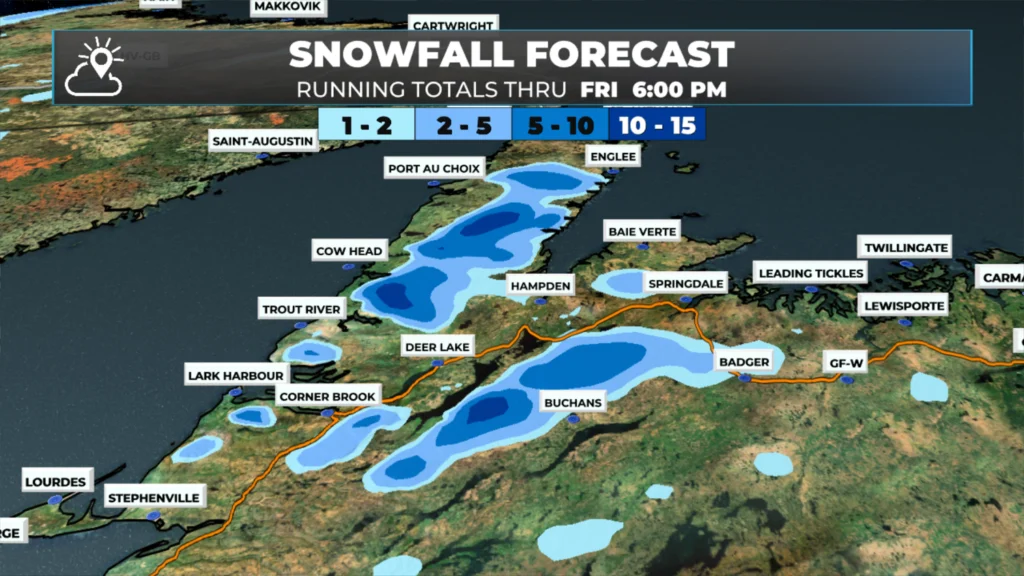
Some of the higher terrain in western and interior Newfoundland may see wet snow later today and tonight as cold air moves in. Parts of Labrador will experience snowfall tonight through Friday. Amounts in the Big Land look to be in the 2 to 5 cm range, while on the Island, I don’t expect much outside of the higher terrain. In the highest peaks, there may be a slushy few centimeters by Friday morning.
The bullseye type snow amounts you see there are the highest peaks of the terrain on the GNP, and north and west of Buchans. Most of the lower terrain will not see snow, and if snow does fall, it’ll be very wet and likely mixed with rain, as temperatures are quite marginal.
I’ll have my next big update later today. Be sure to follow along on socials and the app for more frequent updates!
Sponsored
8 Responses
Love starting my day with these updates. Thank you Eddie.
⚠ Storm ModeGet warnings pushed to your phone the moment they’re issued.Get the app
By using this website, you agree to our use of cookies. We use cookies to provide you with a great experience and to help our website run effectively. Privacy Policy


Love starting my day with these updates. Thank you Eddie.
Thank You for your updates 👍
Thanks for the update Eddie
Thanks for the update Eddie love starting my day with your forecast keep up the great work
Thanks for the update!☔️
Good Thursday morning Eddie & thank you for the update!
Have a great day!😊
Thanks for the update Eddie, it’s become my morning ritual.
Kevin
Thanks Eddie