
Environment Canada Weather Summary Showcases Impressive Snowfall and High Winds From Latest Winter Storm
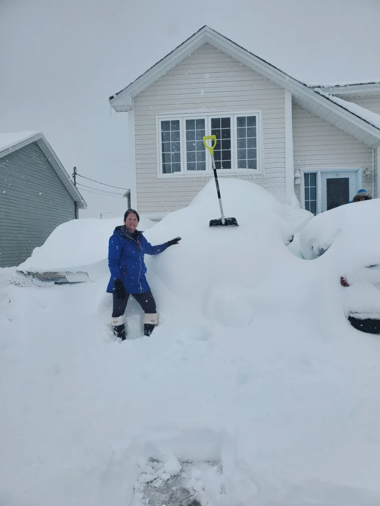
There is an SUV there… somewhere! Credit: Vera Brook (Paradise, NL) after our latest winter storm. Nearly 80 cm fell on the community between the 17th and 19th of February 2026.
Environment Canada issued a ‘weather summary’ earlier today, highlighting the snowfall amounts and maximum wind gusts from our latest high-impact winter storm. The summary is below, in its entirety, with only slight formatting changes.
What Happened?!
An intense low-pressure system tracked just southeast of Newfoundland on Wednesday, February 18. Snow began across southeastern areas as early as Tuesday evening, spreading northward to the island’s northeast coast later that night and continuing into late Wednesday night. While some coastal communities received only modest accumulations, many other areas (particularly over the northern Avalon Peninsula) experienced substantial snowfall totals. Strong winds accompanied the storm, producing widespread blowing snow and reduced visibility.
The event led to numerous closures of schools, businesses, and government offices. Airport, ferry, and transit operations were also disrupted, and hazardous winter driving conditions were reported across the eastern half of the island.
This storm marks the latest in a series of systems to affect eastern Newfoundland this winter. Since November 1, St. John’s has reported 328 cm of snow, while the Gander area has recorded 434 cm. These totals are roughly 40 to 60 percent higher than what is typically observed by this point in the season.
Snowfall Totals and Peak Wind Gusts
The following is a summary of weather event information received by Environment and Climate Change Canada as of 11:30 A.M. NST.
Snowfall in centimetres:
Paradise: 74.3 *
Mount Pearl: 65.0 *
St. John’s (Blackhead Road): 62.8 *
St. John’s East: 56.0 *
St. John’s International Airport: 48.0
Conception Bay South: 42.5 *
Lethbridge: 39.0
Gander West: 33.8 *
Terra Nova (auto): 33.0
Note: Snowfall from automated (auto) stations was derived using data from a combination of weighing gauges and snow depth sensors.
Maximum wind gusts in kilometres per hour.
Bonavista: 109
Cape Pine: 105 *
Sagona Island: 105
Grate’s Cove: 99
St. John’s International Airport: 96
Pool’s Island: 93
Marticot Island: 89
Argentia: 86
Twillingate: 85
* Denotes data from unofficial reporting stations.
Please note that this summary may contain preliminary or unofficial information and does not constitute a complete or final report.
Don’t forget to…
📱 Get the Sheerr Weather App in the Apple App Store and Google Play Store.
🗺️ Check out the Map Room to see all the latest weather observations for the Province.
🎥 Check out the Provincial Highway Cams to see 👀 what’s going on around our highways and
Thanks Eddie for weather update
This storm seems like it’s never going to end ….. nerve wracking!
Thanks Eddie for the weather forecast…..
Thanks Eddie.