Thursday Morning Weather Brief — September 18, 2025
By Eddie Sheerr·
Good Thursday morning!
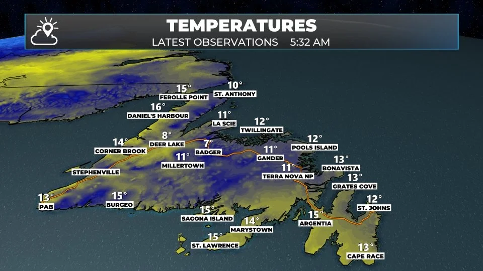
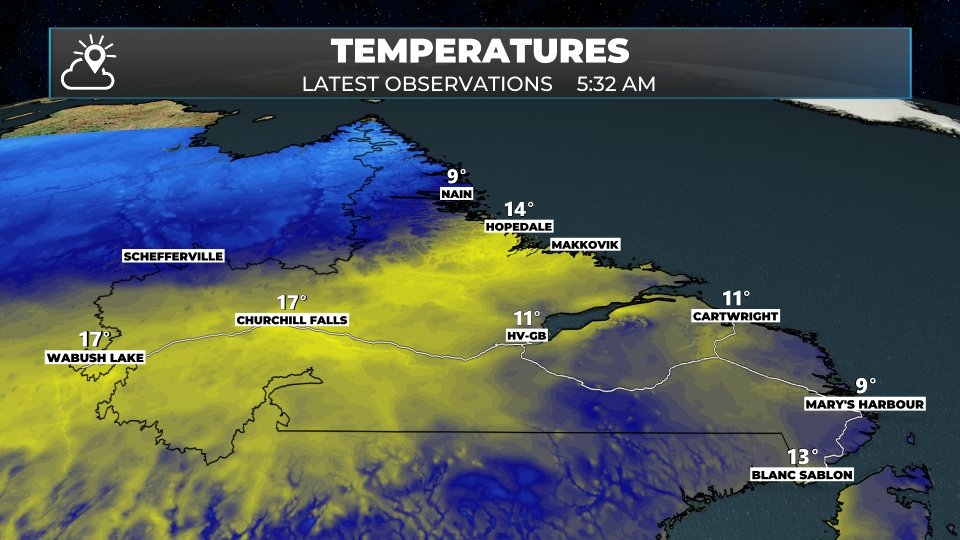
Temperatures across the Province this morning vary from the single digits in northern Labradodr to the upper teens in the west and lower to mid teens across much of the Island. The exception is Daneil’s Harbour, which has clocked in at 17º just before 6 AM.
This morning we are looking at an area of low pressure over northern Labrador, with its associated cold front draped back toward the southwest, located almost directly along (or as close as it can be) to the Labrador/Quebec border. Behind the front temepratures are much cooler, near 10º.
Along and near the boundary, we are also seeing areas of showers, which have already arrived in Labrador West. Those showers will turn into a steadier rain over much of western Labrador this morning, before ending in the early afternoon. Once the showers end, temperatures will drop to near 10º as much of the precipitation is along and near that cold front.
This morning’s update is sponsored by Roebothan, McKay, and Marshall.
Sponsored
Visit MakeTheCall.ca to learn more about what the law firm can do for you.
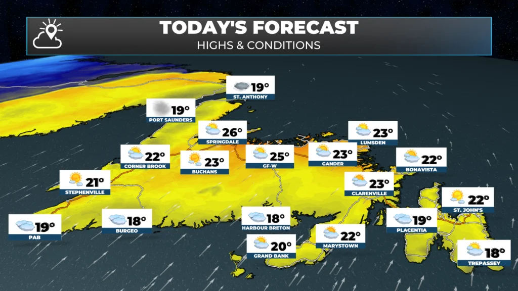
Temperatures on the Island today will climb into the lower and mid 20s for many areas, including for the Avalon Peninslua and St. John’s Metro. The normal high for the time of year is in the upper teens for many areas, which means today will be unseasonbly warm.
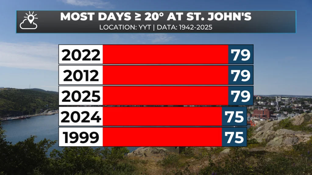
Assuming St. John’s records a high of 20.0º, or higher today, a new record would be set for days with a high of at least 20º in a given year. The current records stands at 79, which 2025 shared with 2012 and 2022. Today would make the 80th day! Tomorrow could mark 81, but the high temperature forecast looks to remain below 20º by a shade for the time being.
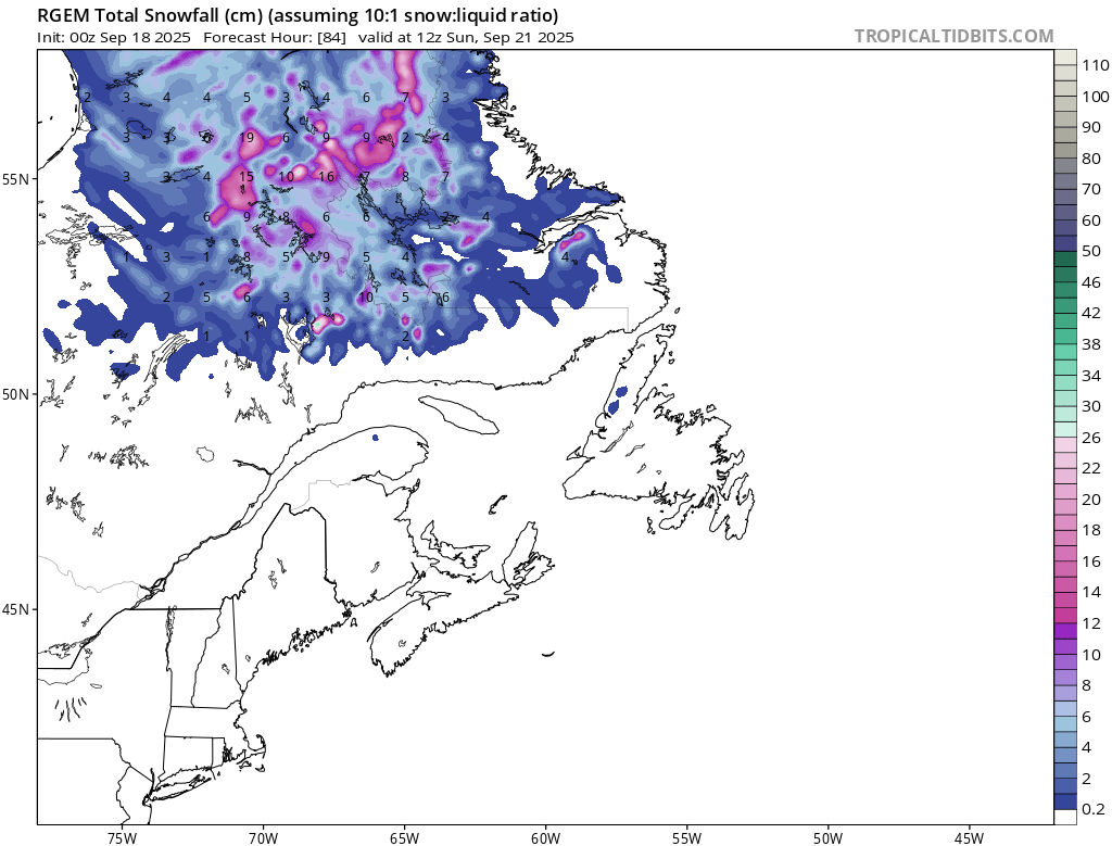
The cooler air in the Big Land will begin to make its presence known on the Island tomorrow as the cold front begins to move through. That will become much clearer over the weekend, as temperatures will only be in the mid-teens for highs. Cooler in the higher terrain! Labrador is likely to see the first snowflakes of the season Friday into Saturday, as temperatures only reach the single digits for highs tomorrow and Saturday… and lower single digits at that in the north and west.
Snowfall from today through Saturday morning (September 20, 2025)
Good Morning, Eddie. Loving this forecast for Newfoundland, not so much for Labrador’s forecast but, I know, it won’t be long when we’ll have it coming. Thanks, enjoy your day!
⚠ Storm ModeGet warnings pushed to your phone the moment they’re issued.Get the app
By using this website, you agree to our use of cookies. We use cookies to provide you with a great experience and to help our website run effectively. Privacy Policy



Thank you Eddie!! Have a great day!!
Good Thursday morning Eddie!…..Thank you for the updated forecast
Have a great days!
Good Thursday morning Eddie
Good Morning, Eddie. Loving this forecast for Newfoundland, not so much for Labrador’s forecast but, I know, it won’t be long when we’ll have it coming. Thanks, enjoy your day!
Good morning Eddie! Have a great day…
Good morning Eddie I hope we break the record.Enjoy the rest of your day
Good morning Eddie
Thanks Eddie!!! Keep the warm days coming.