
Thursday Morning Weather Brief — November 20, 2025
Good Thursday Morning!
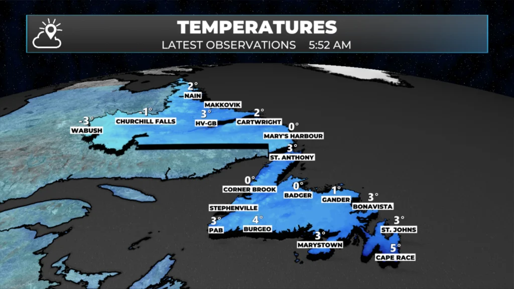
Our Thursday is starting off on the quiet side, with just a few isolated showers or flurries over western Newfoundland and a few scattered showers over eastern areas. Temperatures as low as just before 6 AM range from just below freezing in Labrador West to about 4º above freezing at the “warmest” spots on the Island.

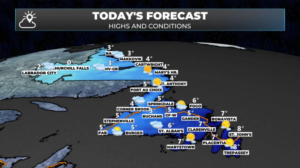
Across the Province today, we are looking at quiet weather and a fair bit of sunshine. The exception on the sun looks to be a good chunk of western Newfoundland and western Labrador, where mostly cloudy skies will be the rule. Temperatures peak in the single digits below freezing in western Labrador to single digits above at the warmest locations on the Island.

This morning’s update is sponsored by Roebothan, McKay, Marshall.
MakeTheCall.ca
Just yesterday, the forecast for Friday looked great… this morning, not so much. A wave of low pressure will move up from the south and begin bringing rain to the southern areas of the Island later in the afternoon or by early evening. At the same time, a separate area of low pressure will move through Quebec, pushing light snow into Labrador West by late afternoon or early evening. Most areas of the island will see rain from Friday night into Saturday morning. Parts of eastern Newfoundland will experience the rain lingering into early Saturday afternoon. Much of Labrador will see snow during the same time frame.
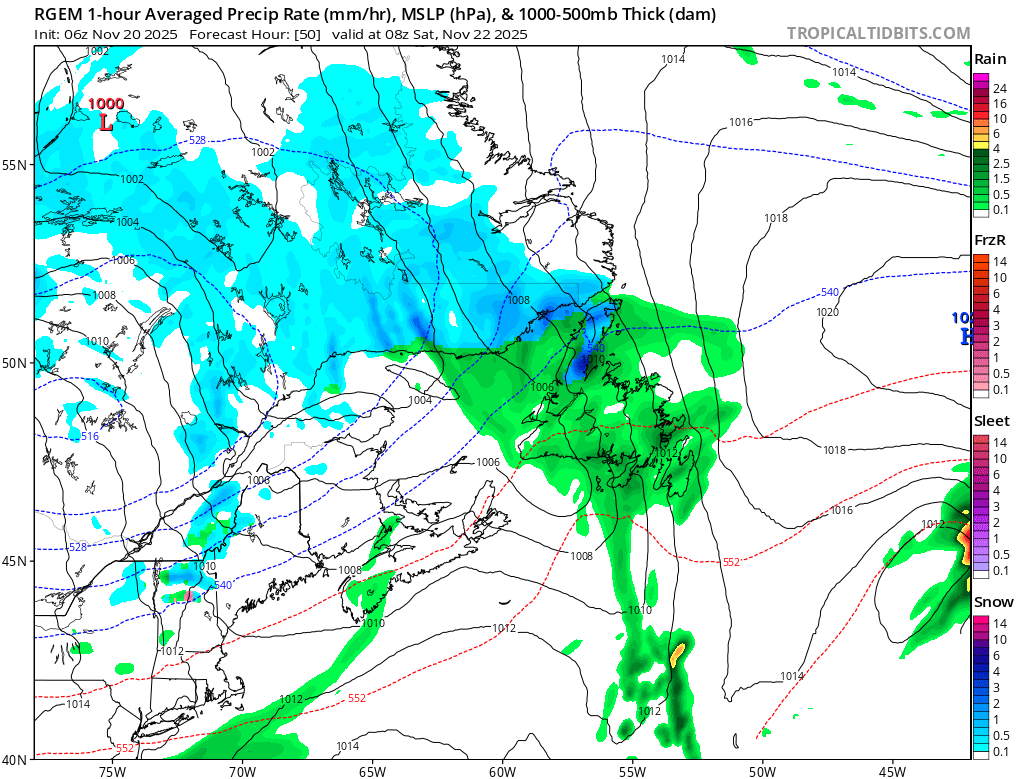
RDPS Model’s depiction of the weather early Saturday morning (4:30 AM NST)
As quickly as that low departs, another low will move over eastern Newfoundland Saturday night into Sunday. This promises to bring another round of rain, wind, and possibly west snow to the Island in that time frame. The best chance of snow will be on the western side of the low, and odds favour central/western Newfoundland at this time. The good news is that it will be a fast mover. The bad news is that it will intensify quickly, which means there is a high chance of a brief period of high winds across parts of eastern, southern, and northern areas of the Island.
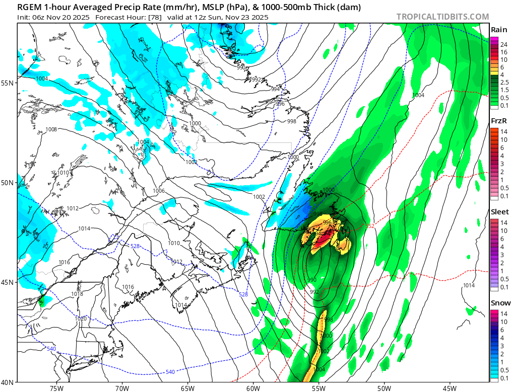
RDPS Model’s depiction of the weather early Sunday morning (8:30 AM NST)
Stay tuned for more updates on these two events!
I’ll have my next update posted later today!
📱 Get the Sheerr Weather App in the Apple App Store and Google Play Store.
🗺️ Check out the Map Room to see all the latest weather observations for the Province.
🎥 Check out the Provincial Highway Cams to see 👀 what’s going on around our highways and byways!
Thanks Eddie for the update. Look forward to them.
George
Thanks Eddie, Still MISS YOU AND YOUR HUGE PRESENCE ON NTV. I Actually turn it OFF after the local news. You brought yourself and your presence through the big box Right Into the Room. God Bless You and Yours. 🙏❤️
Good Morning!Thanks Eddie for the update!
Not toooo bad for the Avalon
Tks for the heads up
Thanks Eddie, thanks update
Thank you for the update Eddie. Appreciate knowing the changes in the forecast early in the day