
Thursday Morning Weather Brief — November 13, 2025
Good Thursday morning!
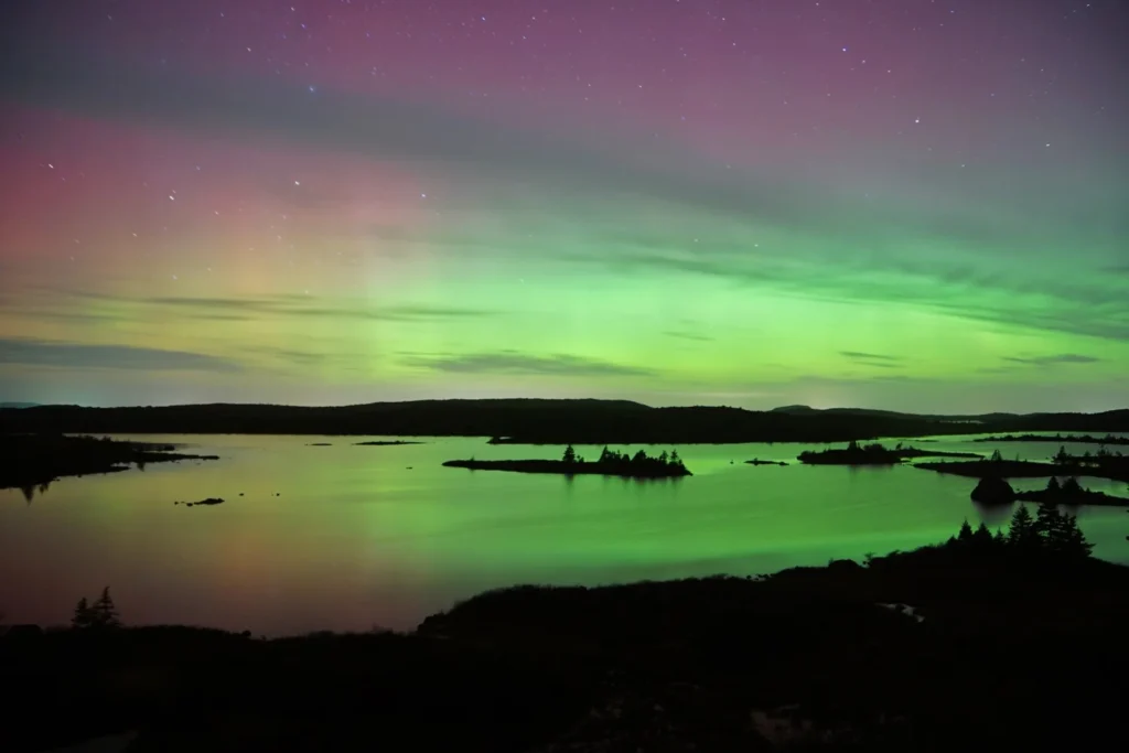
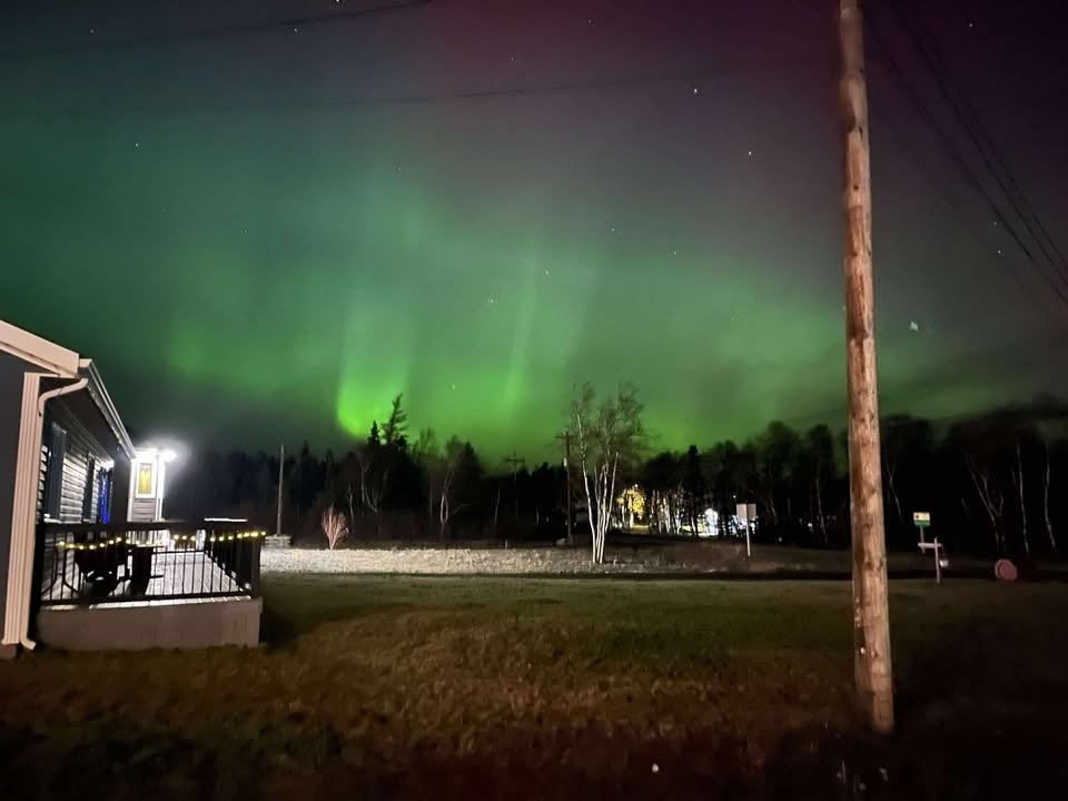
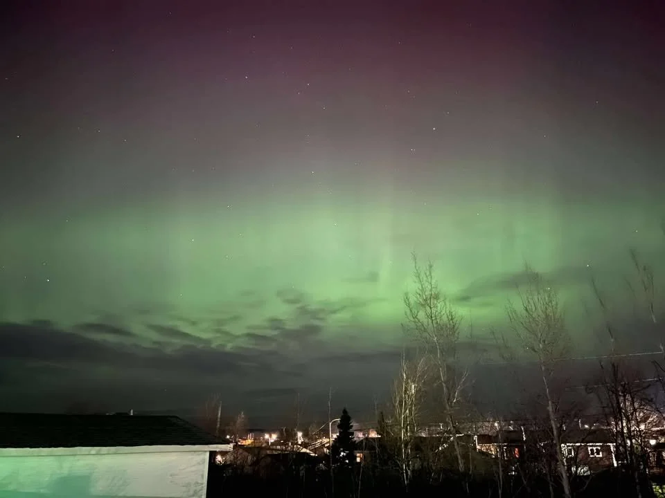
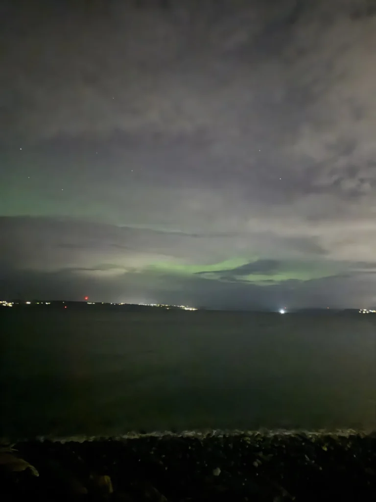
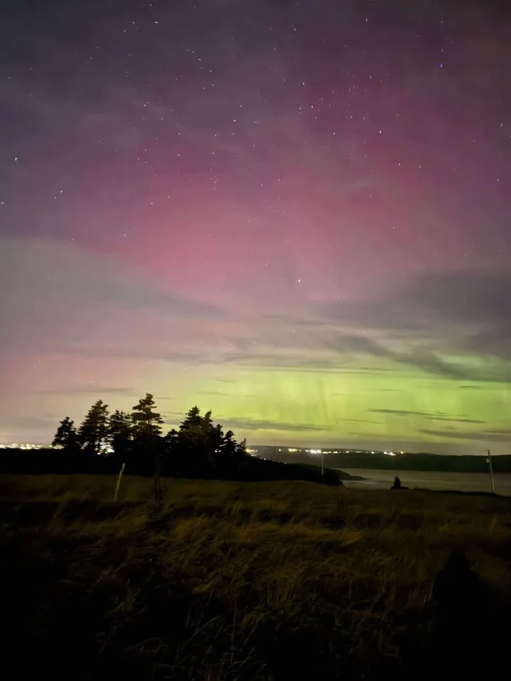
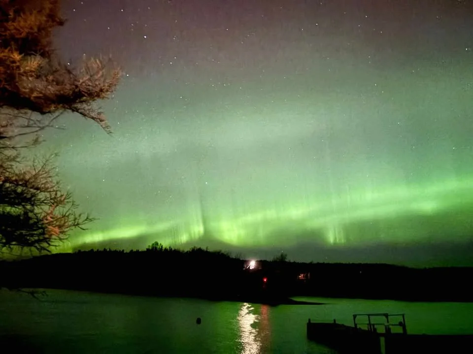
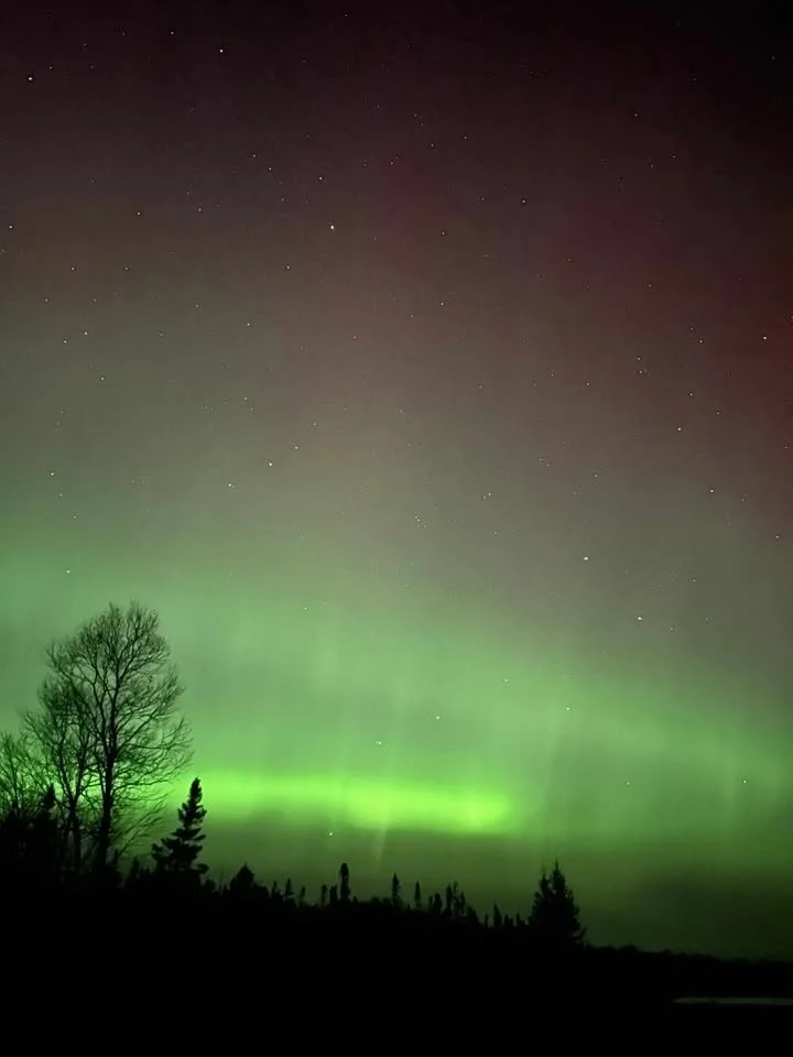
The Aurora Borealis put on quite a show overnight! I’ve received dozens of photos taken from all over the Province (and even the country) of them. I’ve put together a little gallery (below) for you to see! From my understanding, it appears that the peak of the activity occurred around 3 AM.

This morning’s update is sponsored by Roebothan, McKay, Marshall.
MakeTheCall.ca
Here is a gallery of some of the imamges I received!
Temperatures are starting off on the cool side this morning and range from near 6º in southeastern Newfoundland to nearly -10º in Labrador West as of just after 6 AM NST.
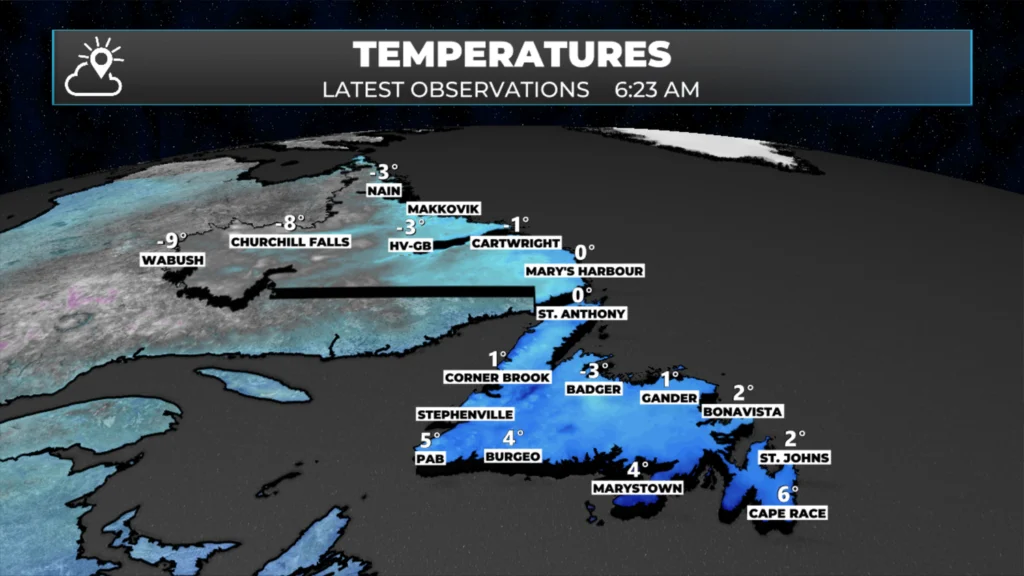
We rebound today into the single digits on the Island and near or below freezing in the Big Land.
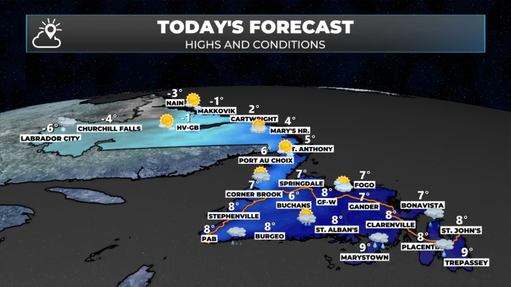
There are a few showers showing up on the Burin Peninsula this morning, but the rest of the province is dry for now. However, that won’t last long. Another area of low pressure, already developing east of Nova Scotia, is set to bring more rain to southern and eastern regions by late morning or early afternoon, with wet weather spreading to the rest of the island from tonight into early Friday.
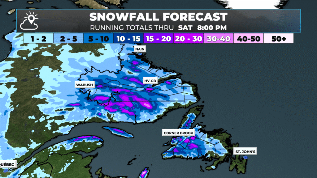
There may even be some wet snow inland and over higher terrain tonight—especially west of the Avalon and north of the South Coast. Areas such as Bay d’Espoir, the Burgeo Highway, and the higher terrain of the West Coast are expected to receive some wintry precipitation. And as quickly as that system moves in, another one will be right behind it for Friday afternoon and Saturday. The second will have less snow and more rain associated with it for the Island. Both systems will bring more rain and snow to Labrador.
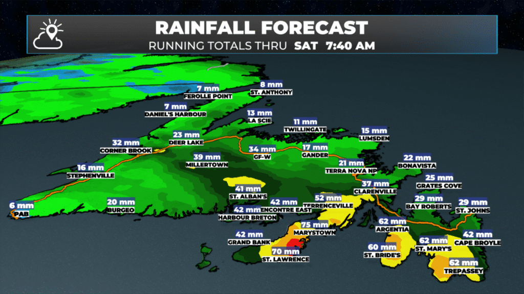
While neither of these systems is a major rain or snow producer like the last one we had, combined, they will produce a significant amount of rain and snow across different parts of the Province. The Avalon is expected to receive another 50+ mm of rain in the next 48 hours, with smaller amounts to the west. The coast of Labrador may be similar, especially south of Rigolet.
Meanwhile, in the higher terrain of interior Newfoundland, the Long Range Mountains and parts of Labrador will see snow piling up, with well over 15 cm falling in some areas. If you have a cabin located in interior Newfoundland, you might find quite a bit of snow if you visit this weekend.
My next update will be this afternoon, and I’ll be hanging out at NL Kubota in Gander, highlighting the snow show happening today!
Good Morning. Thank you for the beautiful photos of the Northern Lights!!
Thanks Eddie for weather update and pictures of the northern lights.
ThanksEddy welcome to gander
Thanks Eddie!
Thank you
Thanks Eddie, have a great day
Thanks for the latest updates!
Love the northern lights pictures! Wondering the locations?
Thanks Eddie
Thanks Eddie!
Beautiful pics! Where were they taken? Thanks
Beautiful pictures of the Northern Lights. Thanks, Eddie.