
Thursday morning weather brief — August 28, 2025
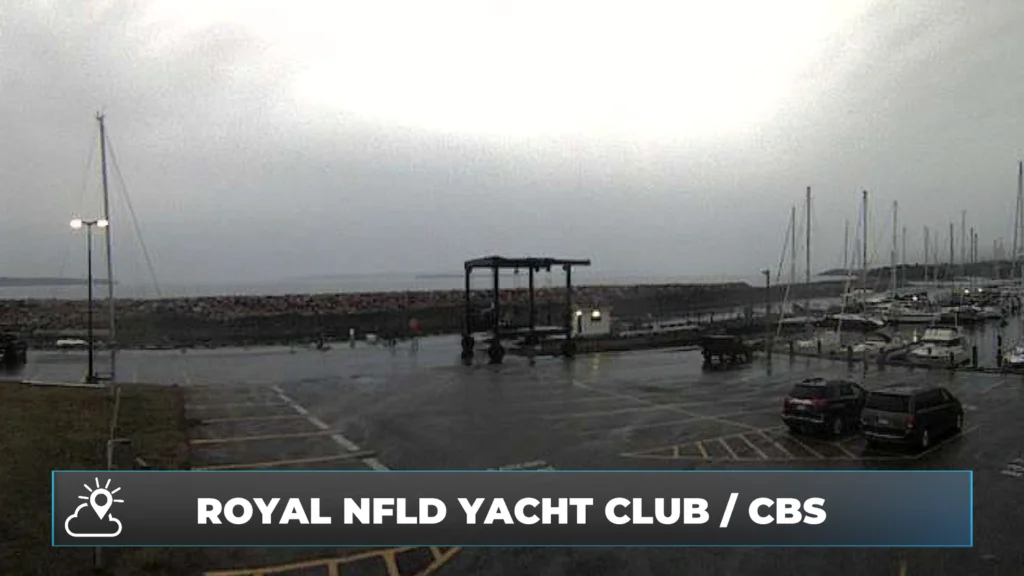
The webcam at the Royal Newfoundland Yacht Club in Conception Bay South this morning, August 28, 2025
Good Thursday morning!
We are waking up to some rain over the eastern and northeast sides of the Island. The heaviest rain is located on the Avalon, with lighter rainfall to the west. The rain and showers we are seeing at this early hour will end from southwest to northeast over the next couple of hours. Then the skies will turn partly cloudy over much of this area.
Weather-wise, today looks generally quiet to start the day across the Province, and we can expect a mix of sun and cloud for much of the day. Highs reach the teens and 20s across the board for Newfoundland, and teens to almost 20 in most of Labrador. Temperatures for coastal Labrador and much of central and northeast Newfoundland will drop into the lower teens this afternoon/evening as a cold front moves in from the north.
Be sure to consult the hourly forecast in the Sheerr Weather app to find out when the drop will happen for you!
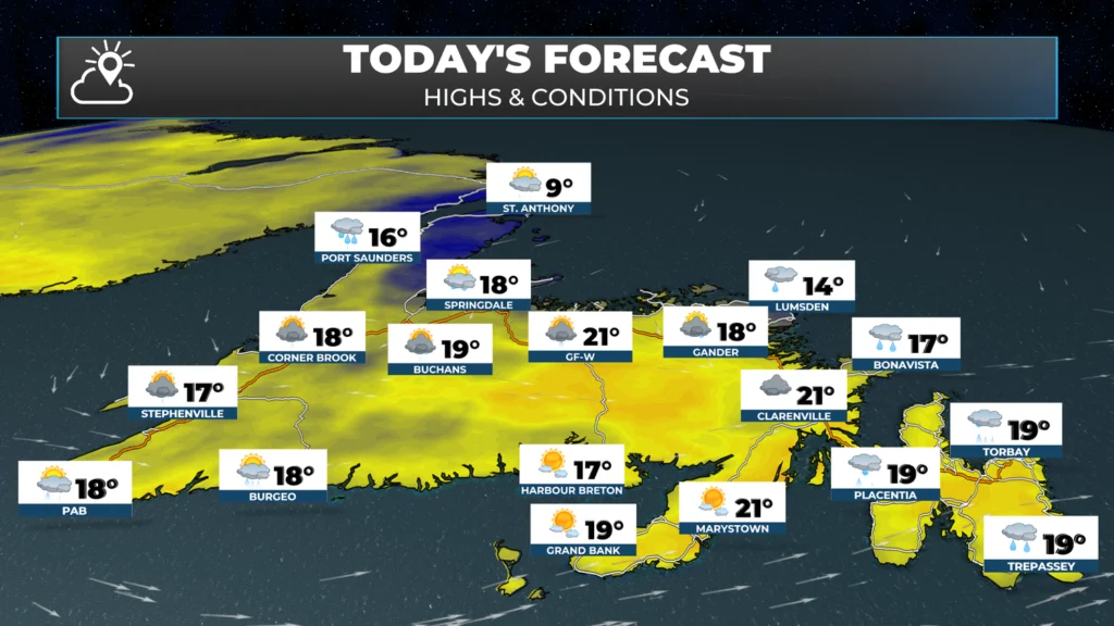
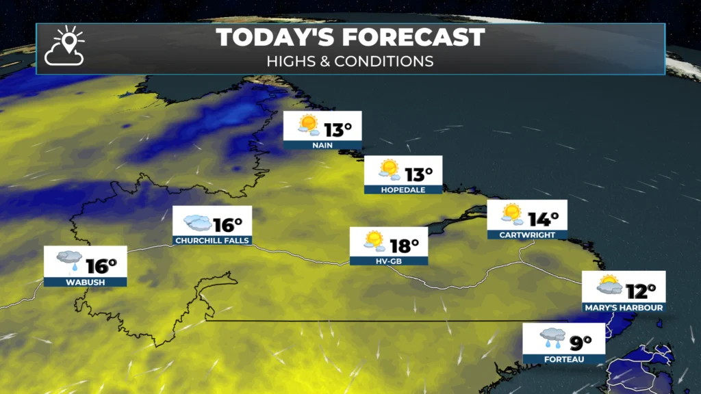
There will be afternoon showers and thunderstorms over much of the Island. The storms will initiate over western and interior areas first, early this afternoon, before moving east. Any storms that develop will bring brief heavy rainfall, frequent thunder and lightning, and potentially gusty winds and small hail. The animation below shows the timing of storm chances across the Island. Note that the exact placement may differ from the computer model’s depiction. There may also be a few afternoon showers and storms in and around Labrador West.
This morning’s update is sponsored by Roebothan, McKay and Marshall.

Visit MakeTheCall.ca to find out what this law firm can do for you!
The storms end this evening, and that will set Newfoundland and Labrador up for a lovely Friday and a great start to the Labour Day long weekend. Saturday may not be as nice… especially for eastern Newfoundland.
In yesterday’s forecast, I mentioned the possibility that an area of low pressure may be close enough to bring a good bit of eastern Newfoundland significant rainfall on Saturday. That is looking more likely this morning. As of now, it looks like rain will arrive late Friday night and continue into Saturday afternoon before ending.
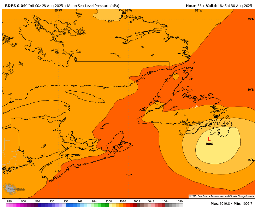
This rainfall has the potential to be significant over eastern areas (more than 15 to 30+ mm) and will be a HUGE help to the crews battling the Kingston Fire. I’ll have a more detailed update on the weekend forecast later today.
Have a great day and stay safe!
Good morning Eddie
loving the app
Good morning Eddie. The rain is a blessing with all the fires we’ve had. Stay safe. Thanks for the updates. I love when I get the alerts from your app
Good morning, thanks for the update
Really love this format and the detail. Great job, Eddie
Thank you Eddie. Loving your app.!
Hi. Great app. Use it a lot .. Could you explain what the dew point means?
Thanks
Tks Eddie for the update 🤗
Thanks Eddie. Love your app.
Thanks Eddie …