
Thursday Morning Weather Brief — August 21, 2025
Good Thursday morning!
Here is the latest on the wildfires from the Provincial Government:
Kingston FIre
No change in size as of last evening’s update
Lots of aerial support on Wednesday
Fire has been most active on the southern and western boundary, and that’s where the actioning was on Wednesday.
Ground crews from NL and ON continued suppression efforts on the northeastern edge and along the southern boundary of the wildfire. CAF addressed persistent hot spots
Paddy’s Pond Fire
Classified as ‘Being Held’.
Ground crews from BC worked the southeast corner and western edge along the transmission line. This work continues today.
Martin Lake Fire
Classified as ‘Being Held’
Future growth is not anticipated at this time.
Ground crews continue to make good progress on those spots throughout the day with helicopters bucketing to assist with containment.
Today will be very much the same.
This morning’s update is brought to you by Roebothan, McKay and Marshall.

Visit MakeTheCall.ca for more!
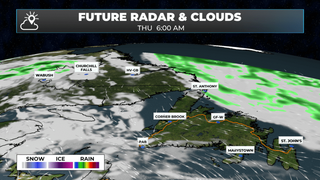
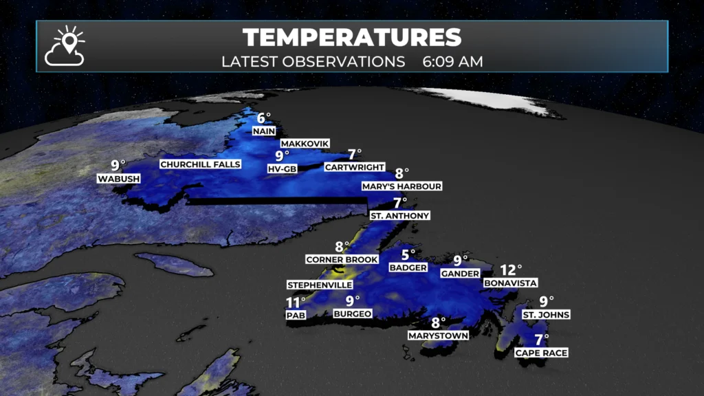
We are starting the day with clear skies across the Province as we begin the day. Temperatures range from near 4º in Nain to the lower teens in southern areas of Newfoundland as of 5:30 AM (5 AM ADT). As we begin the day and start to roll out the door(s) temperatures may be a tad warmer within the next hour or so.
Expect a sunny day over much of the Province with temperatures climbing into the upper teens to lower 20s this afternoon. The wind speeds will generally be lower than yesterday for most areas as an area of high pressure builds in between yesterday’s low and Hurricane Erin.
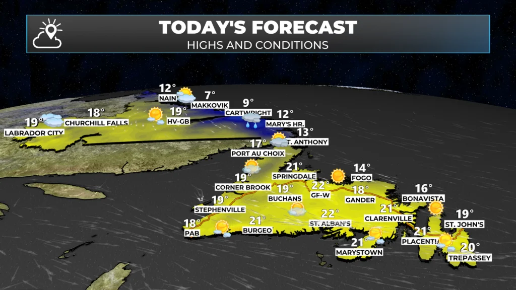
The exception to the sun today will be for coastal Labrador and the Northern Peninsula, where clouds and even some showers will move in later today as the low-pressure centre from yesterday moves back in from the North Atlantic a little bit. Temperatures in these areas will be cooler, particularly in coastal Labrador, where highs only reach the single digits.
Hurricane Erin Update
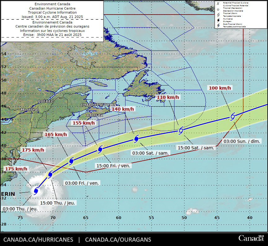
Hurricane Erin remains a Category 2 Hurricane this morning, with sustained winds of 165 km/h (105 mph). The storm is moving north-northeast at 28 km/h (17 mph) and has a central pressure of 945 mb. The centre is located 320 km southeast of Cape Hatteras, North Carolina, and 750 km west of Bermuda.
Tropical Storm conditions are occurring on the North Carolina Outer Banks as Erin is turning north-northeast. Beachgoers on the United States East Coast are being cautioned not to swim into the life-threatening surf and rip currents.
8:00pm EDT: #Erin remains a very large category 2 hurricane this evening. Flooding has been observed by storm chasers Paige Berdomas and Bryce Shelton this evening along North Carolina's Outer Banks resulting from storm surge and large waves. #NCwx pic.twitter.com/MQFVaqDjRW
— RadarOmega (@RadarOmega) August 21, 2025
Thanks, husband!
Welcome wife!
Thanks for the update
Thanks Eddie, great synopsis as usual.
Thanks eddy. Great job on weather in the early morning. Have a great day.
Thanks Eddie so informative as usual.Go back to bed now and get a few cat naps before the next update.
Thanks Eddie for the update
Love your weather app.. Eddie are the web cams live. Can’t seem to get it..
Thanks Eddie.
Thank you for keeping us informed
Thanks Eddie have a wonderful day!
Thanks Eddie, have a great day, hopefully the fires will be held over the next few days.
Thanks Eddie
Thanks Eddie!!!! Keep the good weather coming.