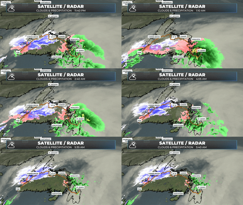
Some areas of eastern Newfoundland are waking up to rain, fog, and mild temperatures, while other eastern areas (west of the Avalon) are seeing rain and freezing rain.
Central, southern and interior Newfoundland are seeing snow and/or freezing rain this morning.
The West Coast and Northern Peninsula are seeing snow this morning, and it will last through much of the day.
Labrador will see a few flurries today; otherwise, the weather will be on the quiet side.
This update is sponsored by Roebothan, McKay, Marshall.
Sponsored
Visit MakeTheCall.ca TODAY to learn more about what the law firm can do for you.
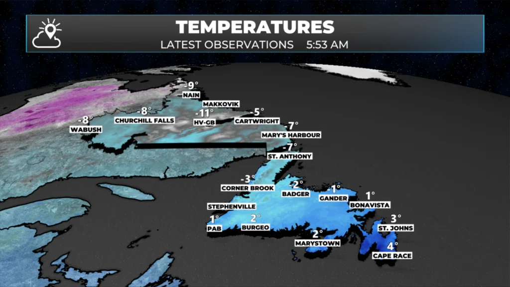
An area of low pressure is currently situated between Cape Breton Island and the Burin Peninsula. To the north and west of this low, snow is falling; to the east and northeast, we are experiencing rain or freezing rain. Temperatures range from 1º to 5º across the eastern three Peninsulas and the South Coast, with some areas near freezing. Labrador is seeing temperatures closer to -10º.
Temperatures across Newfoundland & Labrador, the morning of January 8, 2026.
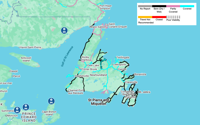
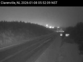
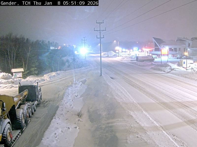
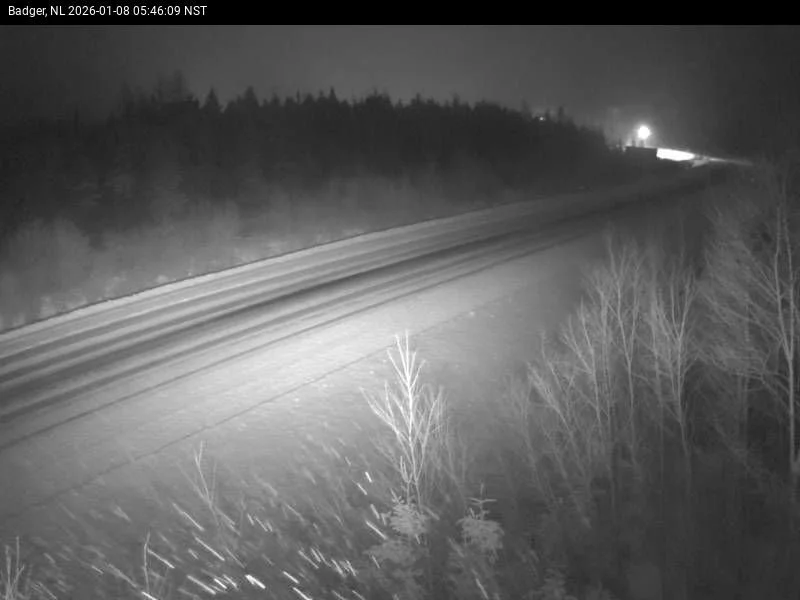
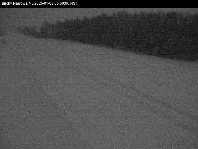
It seems the freezing rain mainly affected the interior and eastern parts of the Island, just west of the eastern three peninsulas, overnight. The 511NL.ca road report indicates that roads are snow-covered or partly snow-covered from Clarenville westward.
Road conditions as of 6 AM on January 8, 2026.
Webcams confirm this, and I’ve got a few images below that show it quite well. From Clarenville, Gander, Badger, and Birchy Narrows, these are good samples of how the roads are currently looking in many areas.
As the day progresses, the area of low pressure will pass over eastern and northeast Newfoundland and pass into the North Atlantic. As that happens, the snow will continue over much of the Island west of the Avalon Peninsula, which means that travel across most of Newfoundland today will be less than ideal. While I don’t want to say the forecast was incorrect, it does appear more areas are seeing snow than forecast yesterday, and that will continue through today. Future radar and satellite show this well.
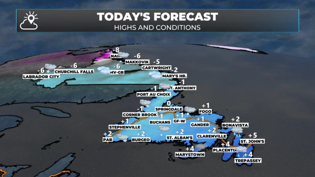
Temperature-wise, today, many areas will be near or below freezing for much of the Island (except the east) while Labrador will see readings near -6º for the afternoon today. Areas of flurries will be found in the Big Land, while snow will persist over much of the Island (as seen above). In fact, on the Avalon, temperatures will fall this afternoon, and the rain showers will change to flurries or wet snow this evening.
Today’s overall forecast — January 8, 2026.
The weather will improve across much of NL tonight, and it will stay that way into Friday. That being said, Labrador West will see snow arriving during the second half of Friday. That snow will work its way toward the coast Friday night and will set the stage for another round of rain and snow on the Island Saturday.
I’ll post my next update later today, which will provide more detail on the above.
⚠ Storm ModeGet warnings pushed to your phone the moment they’re issued.Get the app
By using this website, you agree to our use of cookies. We use cookies to provide you with a great experience and to help our website run effectively. Privacy Policy



Good morning Eddie, thanks for the update.
Thanks Eddie
Good morning Eddie, thanks for the update. Have a great day.
Thanks Eddie for weather update
Good morning Eddie have a great day and thank you
Good morning Eddie. Thanks for update. Check on your weather forecast every day. Have a great day 👍
Good morning and thanks. You start my days off with your weather forecasts.
Thanks Eddie. I look forward to your updates. I live on the West Coast. It was beautiful this morning. A very light snow is falling now at 11:50am.