
This week will not end as quietly as it started!
This forecast is sponsored by:

Atlantic Edge Credit Union is proud to support the communities and businesses of Newfoundland and Labrador. Buy local. Bank local. Grow local—with Atlantic Edge Credit Union. Visit aecu.ca or stop by one of their 16 branches across the province.
Tonight and Thursday
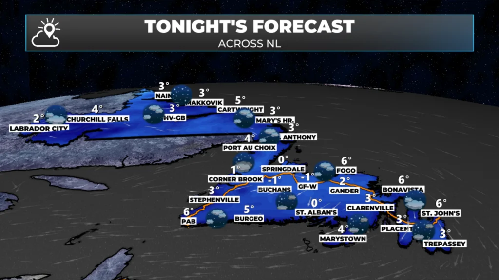
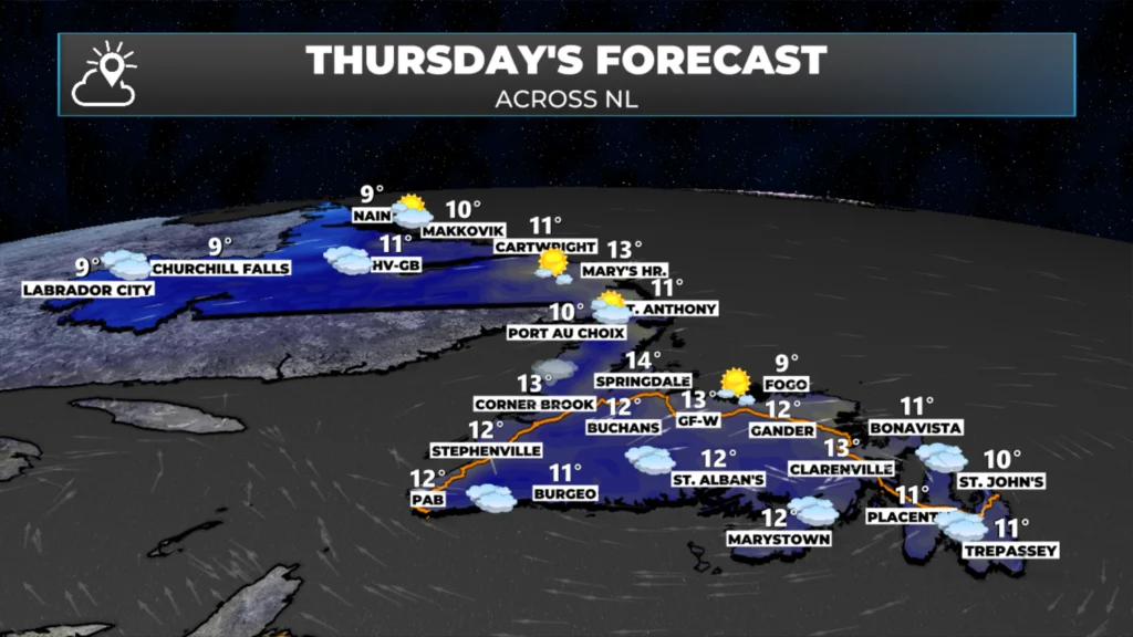
The weather across the Province tonight and Thursday looks fairly quiet. There will be a slight increase in cloud cover for some areas tomorrow compared to today, but beyond that, the days will be similar. There will be some late-day showers along the west and southwest coast of the Island. Lows tonight dip to near freezing in many areas, and highs tomorrow will average 10º across most of NL.
Halloween’s Forecast and the Weekend
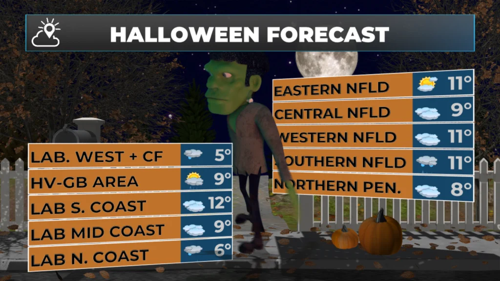
This forecast looks trickier than treat-y. The day will start dry across much of the region, but that will not last. Showers and light rain move into Labrador West during the afternoon, and rain will start to overspread the Island during the late afternoon or early evening. The Avalon and parts of central may see the rain hold off until evening, but at this point, that is not a guarantee. Sadly, it looks like it is going to be a wet night for the trick-or-treaters. Temperatures will be in the lower to mid single digits in Labrador and middle to upper single digits on the Island for highs and will stay there into the evening.
Friday night into early Saturday will see a period of rain over the Island from a combination of a low moving in the Maritimes and Hurricane or Post-Tropical Storm Melissa. The rain will be very heavy at times across much of the Island Friday night into Saturday morning as these two systems phase, or combine. The rain over the Island will ease by Saturday morning. Depending on Melissa’s track, some high winds may accompany the rain over eastern Newfoundland. (More on that below this section.)
At the same time, rain will change to snow in Labrador Friday night, setting the stage for the first widespread snowfall of the season for northern and western areas. The snow will end by Saturday evening. It’s still a bit early, but to me it looks like a solid 5 to 10 cm is likely for many areas, with the higher terrain seeing significantly more. Even the higher terrain of the Long Range Mountains could see some snow.
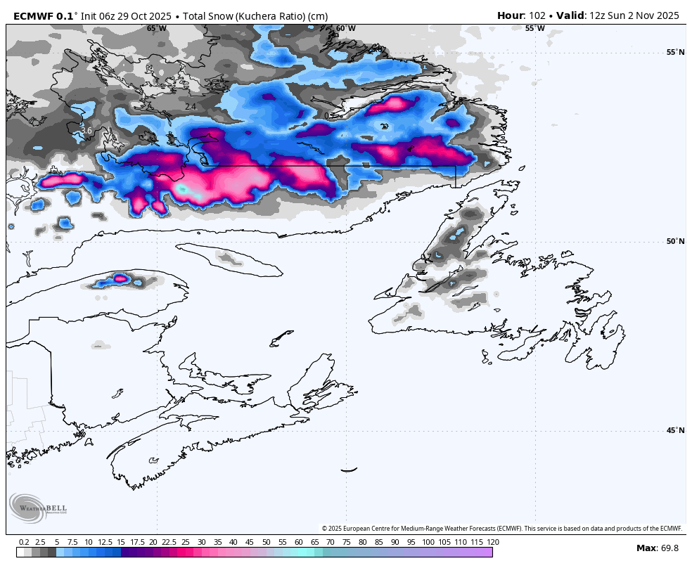
ECMWF model snowfall forecast between late Friday and early Sunday.
This entire system will kick out on Saturday night, setting the stage for a calmer Sunday. Temperatures on Saturday will be near 10º for much of the Island while Labrador struggles to reach freezing. Sunday will be cooler across the board, with highs near or below freezing in the Big Land between 1 and 4 on the Island.
Hurricane Melissa Updae
Forecasts for Hurricane Melissa have started to trend northwest, and the centre of the storm is now forecast to be close enough to the Avalon that direct impacts for portions of Newfoundland between late Friday evening and Saturday morning look more likely. Melissa will be a weakening hurricane or post-tropical storm when it nears this part of the Atlantic. While it will still have a wind core, it will not be anything like what Jamaica and Cuba are dealing with. It will also be moving quite fast.
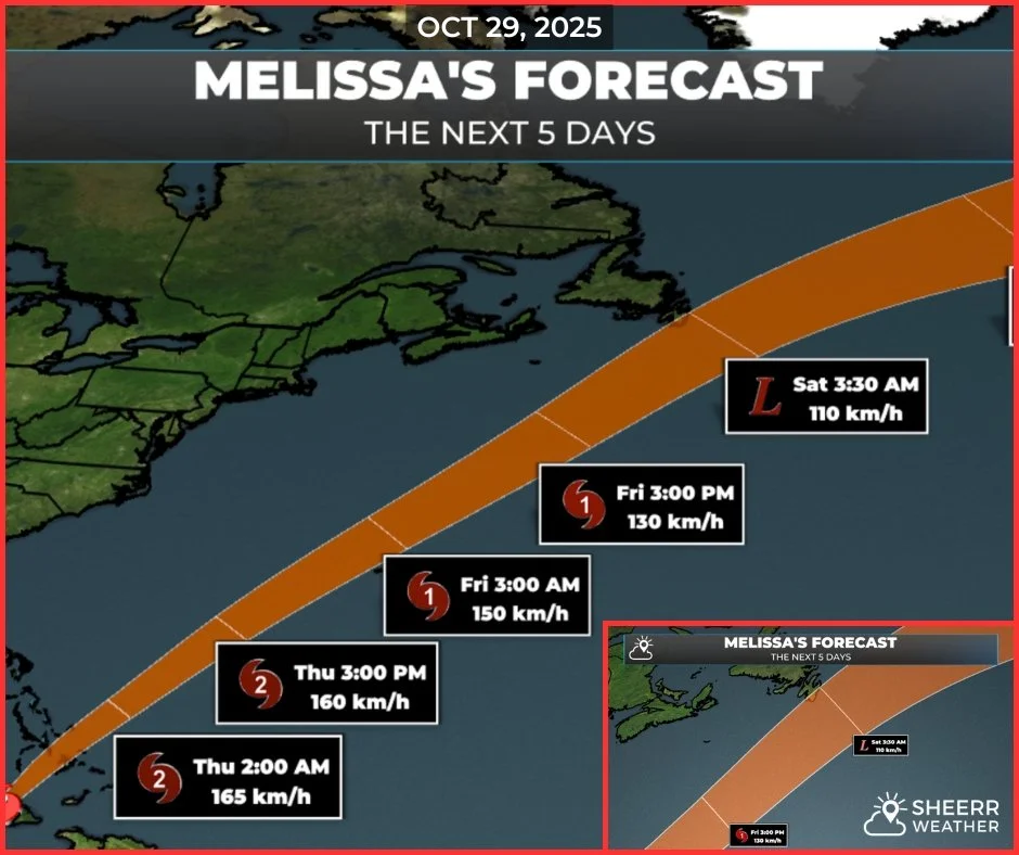
There will be rain associated with Melissa AND a system coming in from the west. The rain will fall from Friday evening into Saturday. It may be here early enough to put a damper on Trick-or-Treating. These storms have a structure where the wind is on the east side of the low and the rain is on the north and west side. There will be a wind core with this storm, and gusts will easily exceed 100 km/h in it. Where those gusts are located will be determined by the track. If the track is east of the Avalon, the wind stays offshore. If the track is over or west of the Avalon, those high winds will be onshore.
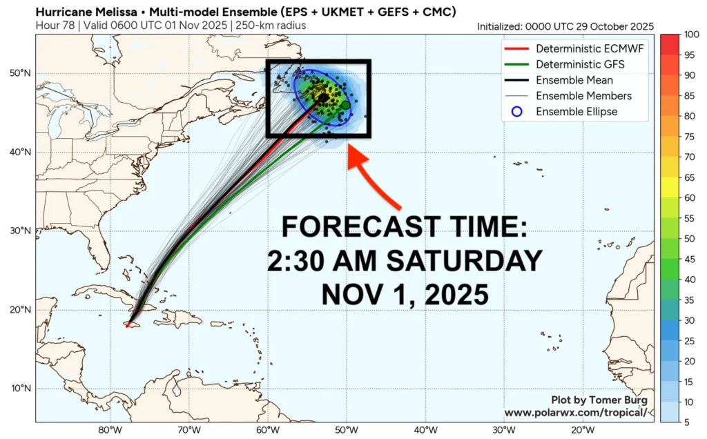
Right now, I think we will see the rain, while the wind stays offshore or grazes the southeast Avalon. That being said, a continuation of the westerly trend would shift more of that wind onshore over a larger area. And also keep in mind that while wind speeds of 100+ are common-ish in the winter, this time of year, the
I’ll have my next update posted tomorrow morning!
📱 Get the Sheerr Weather App in the Apple App Store and Google Play Store.
🗺️ Check out the Map Room to see all the latest weather observations for the Province.
🎥 Check out the Provincial Highway Cams to see 👀 what’s going on around our highways and byways!
Thanks Eddie for ur very detailed weather forecast 👍🏻 Love ur app ❤️
Thanks for the weather update Eddie
Thanks Eddie