
Potent fall storm set to bring rain, snow, and hurricane-force wind gusts starting Tuesday
EVENING UPDATE | 8:45 PM
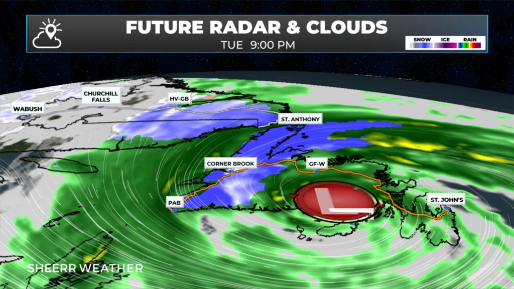
A rapidly strengthening low-pressure system will approach Newfoundland from the south on Tuesday, crossing the Island between Tuesday evening and Wednesday morning. This type of system is often called a “bomb cyclone” — a term used when a storm undergoes bombogenesis, meaning its central pressure drops by 24 millibars or more within 24 hours.
The track and strength of this low means much of the Island and parts of Labrador will experience significant, wind-driven rainfall.
The higher terrain of western Newfoundland and coastal Labrador is expected to receive very heavy snowfall.
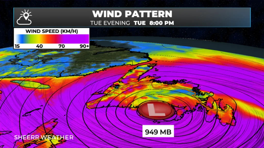
A storm of this strength — nearing hurricane-force intensity — will bring widespread high winds across Newfoundland and parts of coastal Labrador. Most of the Island can expect gusts of at least 80 km/h between Tuesday afternoon and late Wednesday or early Thursday.
The South Coast, Burin Peninsula, Avalon Peninsula, Bonavista Peninsula, Bonavista Bay, Notre Dame Bay, and Green Bay–White Bay regions will likely see gusts exceeding 100 km/h. In particular, the Burin, Avalon, and Bonavista Peninsulas may experience gusts over 120 km/h from Tuesday evening into early Wednesday morning, especially along exposed coastal areas.
Wind speeds will be lower inland, but stronger over open water and along the coastline.
There will also be storm surge with the high tides on Tuesday afternoon along southern-facing shores, and then on Wednesday along north-facing shores. Areas of Placentia Bay, especially near the north end of the bay, may experience a significant surge with Tuesday evening’s high tide and large waves.
If you have marine interests in ANY of the areas I’ve mentioned.. essentially anywhere from Placentia Bay, the Southern Shore, Conceptiom Bay, Trinity Bay, Bonavista Bay, and Notre Dame Bay, and possibly farther west and the coast of Labrador, NOW is the time to start making your preparations.
That’s all I have for you this evening. More updates to follow starting tomorrow morning. Be sure to get the Sheerr Weather app if you don’t have it already!
Thanks bud
Rock star.
Thanks Eddie for weather update
My nerves are shot just reading this! I can take the rain,snow,sleet, whatever. But hate the wind!
Many don’t like it!
I live in Placentia, will we get the storm surge and higher winds?
My wife has a scheduled flight from Ottawa to St John’s on Wednesday early morning, do I expect a cancellation or delay? Thanks in advance.
I guess we will have to tie everything down..thank you for keeping us updated Eddie
Thanks for keeping us updated Eddie