
Monday Morning’s Weather Briefing — September 28, 2026

Good Monday Morning! Here are today’s highlights
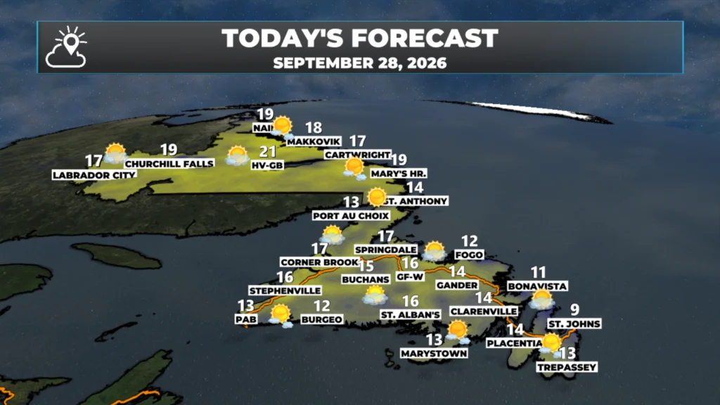
This morning’s cool start will give way to a comfortable afternoon for the vast majority of the Province.
High temperatures will reach the lower teens to about 20ºC across the Province.
Expect sunny skies as a high-pressure system settles overhead.
To my eye, there is potential for frost on the Avalon tonight, and Environment Canada agrees and has issued a Frost Advisory for the easternmost Peninsula.
This morning’s update is sponsored by Roebothan, McKay, Marshall.

Visit MakeTheCall.ca today to learn more about how the law firm can help you!
Good Monday morning! It’s a cool start out there, with temperatures in the single digits above freezing to start the day. The maps below update throughout the day, so when you’re reading this, they may not be as low as they were when I was typing this up (5 AM). The coolest readings look to be in Badger, Millertown, and Deer Lake, where lows this morning were all near 0ºC.


The reason temperatures dropped so far last night into early this morning was due to clear skies and light winds under a large high-pressure center. That high will remain overhead today, and will give the Province another sunny, and comfortable, late September day. Highs reach the lower teens to near 20ºC this afternoon. Wind speeds will be light to moderate.
The large high-pressure center will keep skies clear, and wind speeds light across much of NL again tonight, but the lightest winds will be under the high, which will be settled almost directly over the Avalon Peninsula. This will set the stage for the potential of widespread frost on the easternmost Peninsula tonight into early Tuesday morning. Environment Canada has issued a Frost Advisory for the Avalon tonight, with temperatures near 0ºC inland and around +6º on the coast.
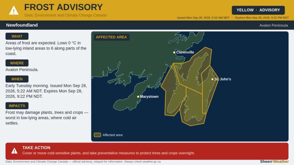
Frost Advisory in effect for the Avalon Peninsula tonight (Sep 28-29, 2026).
Not all areas of the Avalon have the same potential of seeing frost, so this map below should give you a better idea of where it is most likely overnight. The light blue represents where frost is possible but will be more patchy. The darker blue indicates where temperatures should be low enough to allow for a freeze. If you know you live in a normally colder area, expect frost. I know, for instance, my house in Torbay is located in a colder area and I’ve already seen frost a copule of times this month.
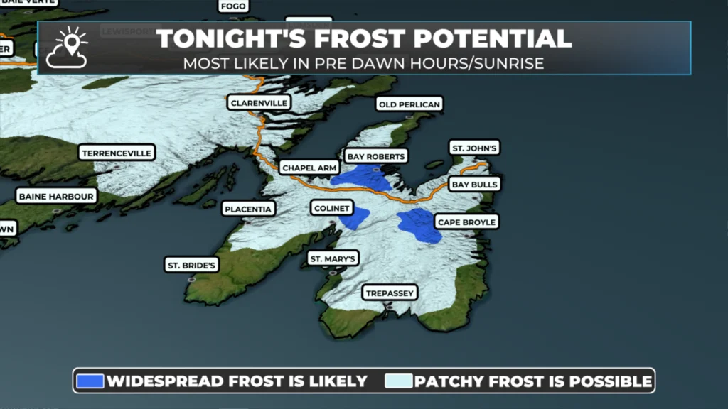
Tonight’s frost potential for the Avalon and surrounding areas (September 28-29, 2026)
Have a great day and follow along for updates!
📱 Get the Sheerr Weather App in the Apple App Store and Google Play Store.
🗺️ Check out the Map Room to see all the latest weather observations for the Province.
🎥 Check out the Provincial Highway Cams to see 👀 what’s going on around our highways and
Good Morning Eddie!
Such a beautiful day already! Looks like it’s our area’s turn to possibly get frost tonight…… goodbye annuals!!! Thanks for keeping us updated Eddie, enjoy your day.
Good morning Eddie have a great day