
Monday Morning’s Weather Briefing — May 11, 2026
This morning’s update is sponsored by Roebothan, McKay, Marshall.

Visit MakeTheCall.ca today to learn more about how the law firm can help you!
Good Monday morning!
Here are today’s highlights:
An area of low pressure moving through Quebec will bring rain and showers to Labrador and western Newfoundland today.
Areas of fog will be found along and near east-facing shores of eastern/central Newfoundland.
Highs reach the upper single digits to lower teens, except cooler in onshore winds.
RDF will be a common theme across much of Newfoundland on Tuesday and Wednesday due to two more fast-ish-moving lows.
This Morning & Today
An area of low pressure moving through eastern Quebec will bring rain and showers to Labrador, the western third of Newfoundland, and the South Coast. Radar on Marble Mountain is detecting rain this morning, with some heavy pockets. As of this writing, the heaviest appears to be between Port aux Basques and the Codroy Valley. Radar indicates the rain is moving from south to north. The showers and rain will generally remain in the aforementioned areas today.
A Wreckhouse Wind Warning is also in effect at this hour. The warning will remain in place until this afternoon. Gusts will reach 100 km/h. When combined with the heavy rain, it will resemble a high-end tropical storm in that area. Please exercise caution and follow the signage if you intend to go through that area today.
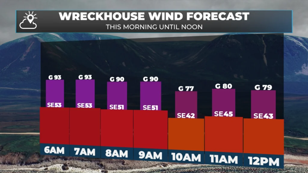
Expected wind speeds, gusts and direction in the Wreckhouse area today (May 11, 2026).
Eastern, central and northeastern Newfoundland will see some sunshine today, with fog in places, especially near east-facing shores in the southeast flow. Clouds will increase this afternoon.
Temperatures will reach the upper single digits to the lower teens across much of Newfoundland & Labrador today. The exception will be areas with onshore winds, where readings will be closer to 5º or lower. If you’re planning to go iceberg hunting today, dress in layers. Expect areas of showers.
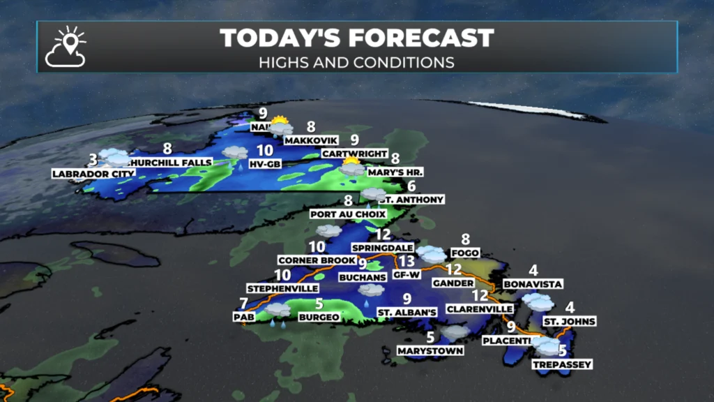
Today’s highs and conditions, on average, for Newfoundland and Labrador (May 11, 2026).
Tomorrow and Wednesday
Two areas of low pressure will move from south to north across the Island. This will set the stage for a couple of days of rain, drizzle and fog across most of the Island, while Labrador remains outside the influence of these two systems. Over the two days, much of the Island will receive 20 to 40+ mm of rain.
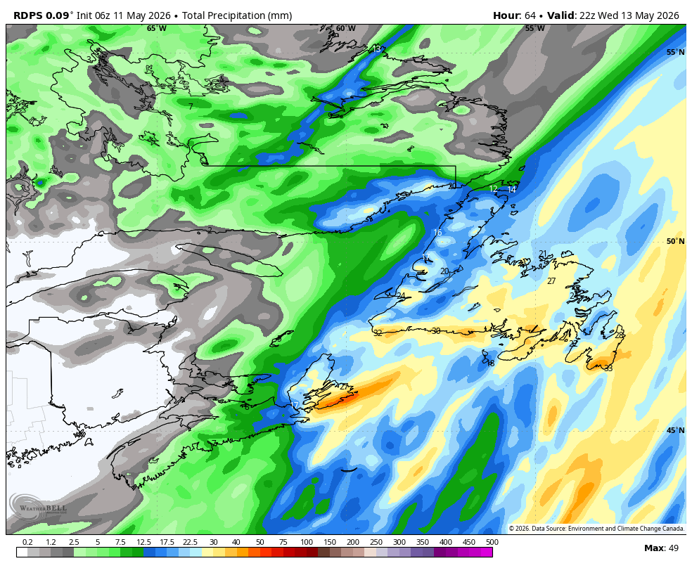
Expected rainfall totals from today through Wednesday (May 11 to 13, 2026)
The rain clears out by Thursday, which will set us up for a decent start to the Victoria Day long weekend… however, the forecast (at the moment) isn’t looking great with a chance of rain across much of NL from a slow-moving low. Stay tuned for updates on this one!
📱 Get the Sheerr Weather App in the Apple App Store and Google Play Store.
🗺️ Check out the Map Room to see all the latest weather observations for the Province.
🎥 Check out the Provincial Highway Cams to see 👀 what’s going on around our highways and
Good morning Eddie and thanks for the update
Thanks. Always look forward to your forcast
Good morning young man. Thanks for your forecast, and, as always have a great day
Thanks for the forecast, it is pouring rain here in Stephenville.
Have a great day.
Thank you Eddie !! Yes, i also, look forward , to your Very Dependable and Most Interesting Forecast. Eddie, Have a Great day!!……R”