
Monday Morning’s Weather Brief | July 28, 2025
Happy Monday!
The weather this morning is starting on the active side for some! We are already seeing areas of rain, showers, and even some isolated thunderstorms over the Northern Peninsula, the West Coast, and eastward toward Central. Some of the showers are heavy and producing locally heavy rainfall. The radar loop from the last 3 hours shows this very well. The showers and rain is along a cold front that will play a role in the weather later today for parts of central and northeastern Newfoundland.
The areas of rain, showers, and embedded thunderstorms will roll eastward and mostly offshore by late morning or early afternoon. They also will not dip much farther south of where they are now, so much of the Island will remain dry throughout the day. That being said. it does look like some afternoon showers and thunderstorms will develop over the interior and will drift east toward Bonavista Bay this afternoon. If you’re anywhere from Eastport to Clarenville, keep an eye to the sky later today. Future Radar should give you a good idea of the possible timing of this.
Remember, this is model data and it cannot precisely depict where showers are going to develop. However, it does a great job of indicating that showers are likely to develop. I’ll be watching the radar and will pass along updates today (on my socials) and weather app if needed!
TODAY’S TEMPERATURES
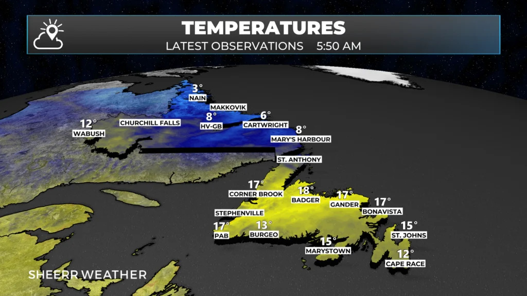
Temperatures as of 5:50 AM NDT across NL
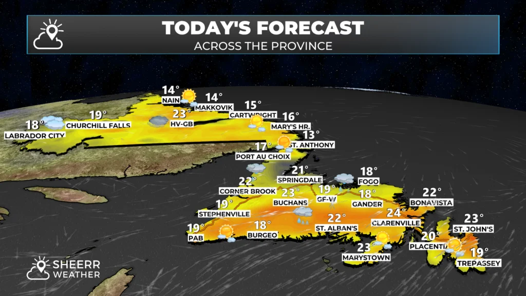
Temperatures today will climb from where they were early this morning into the teens and 20s for the Island portion of the Province for highs, while Labrador will see more in the way of teens and isolated 20s for highs today. I’m expecting a mix of sun and cloud across most of Labrador and southeastern Newfoundland. Areas of central, the West Coast, and the GNP will remain mostly cloudy due to showers in the area.
THE BACK DOOR FRONT — WHAT IS THAT?
A backdoor cold front is a type of cold front that moves in from the east or north, rather than the usual west or northwest direction. It’s called a “backdoor” front because it sneaks in from the opposite side you’d expect—almost like coming in through the back entrance of your home instead of the front.
This type of front is expected to move into parts of central and northeast Newfoundland later today and will quickly drop temperatures from the 20s to the teens. The timing appears to be after 3 PM. How far south the cooler air makes it is also up for debate, but the loop of today’s predicted temperatures (below) illustrates this point very well.
Looking ahead to the rest of the week, there is no major weather at play. However, for folks in St. John’s, Regatta Day is on Wednesday, and the big question looms: will the big day go ahead? I’m working on that forecast and will have my next update posted for you this afternoon.
Have a great Monday!
Eddie
Good morning Eddie thanks again for your update
Happy Monday Eddie, great App , very informative. Wishing you great success in your new venture.
Good morning Eddie!Thanks again for the update….
! Best weather App I’ve found to date!
I’m loving this app and your explanations!
App is so good so far…keep up the good work.
Love the app it’s so informative!
excellent app. my #1 weather source. thank you!
Good morning Eddie . Loving the app , thanks for the detailed weather forecast. Have a great day 😊
We are on our way to portabass crossing tonight what will the weather be like
Olive Hutchings
Good morning Eddie!….Thank you for the update!
Hope you have a super day
Great Job Eddie!!!. Concise, easy to use and accurate!!
Thanks, Eddie! Our whole family is using your app. Loving it 💕