
Monday Morning Weather Update — December 22, 2025
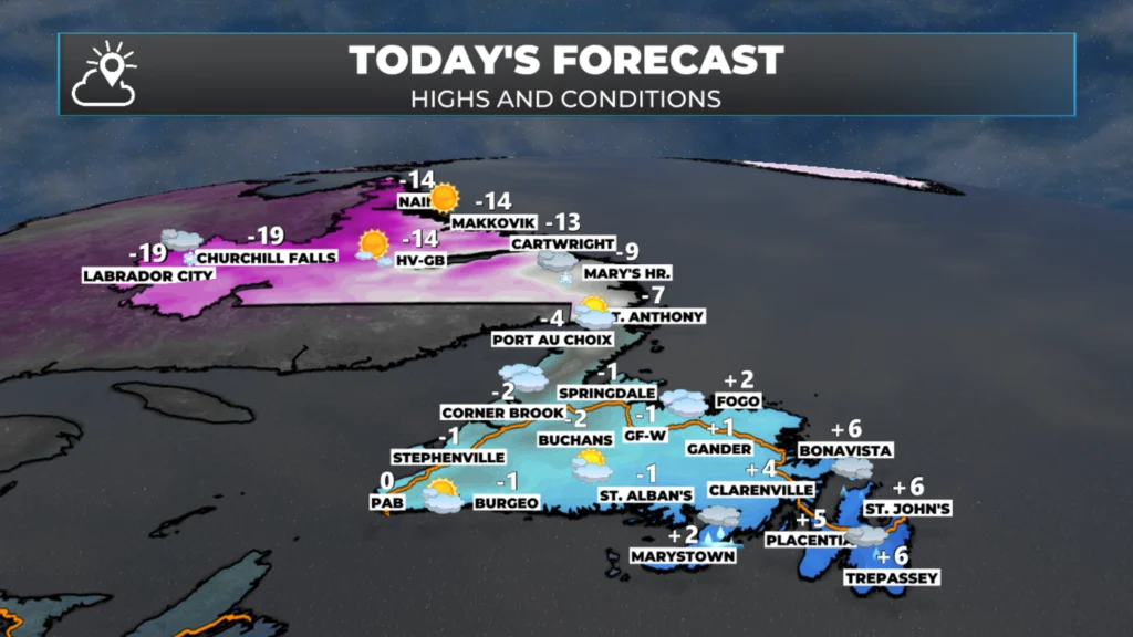
Good Monday morning!
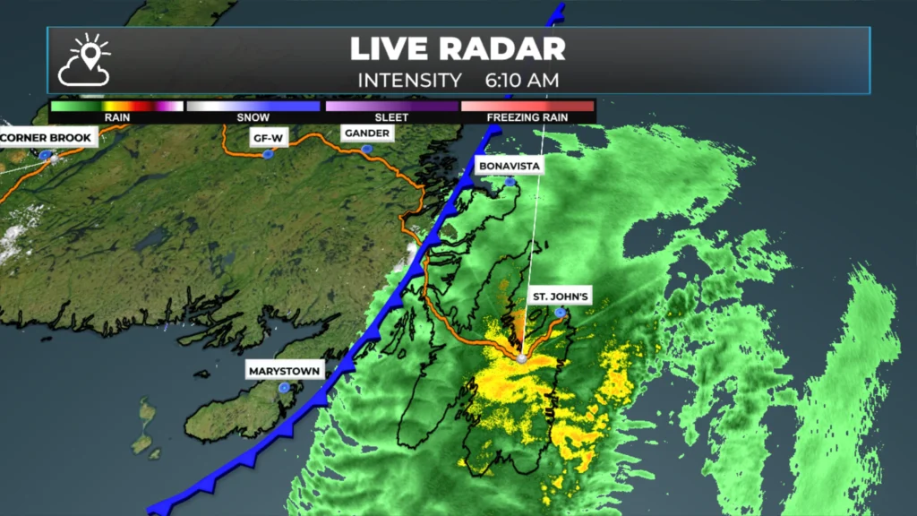
We are waking up to an area of low pressure east of Labrador and north of Newfoundland, and its attendant cold front is located between Bonavista and Burin, bringing rain to the Avalon Peninsula and some adjacent areas just to the west. The rain is not overly heavy and is moving eastward fairly quickly. In fact, any remaining showers will be done on the Avalon by 10 AM.
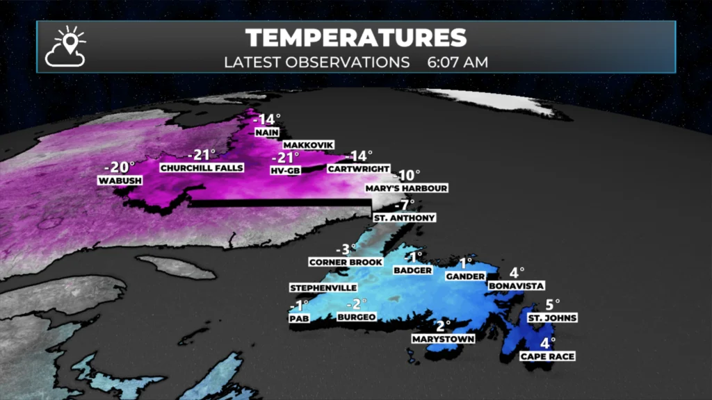
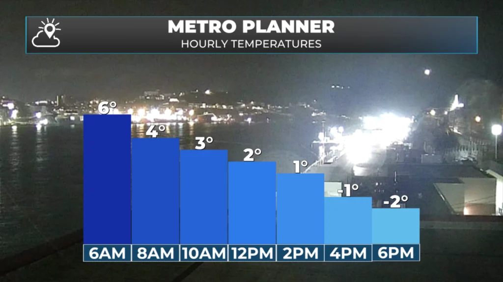
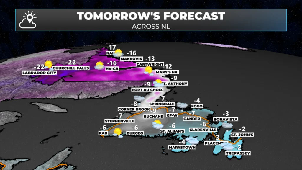
Behind the front, temperatures are cooler than ahead of it. For instance, as of 5:30 AM NST, it was about 6º in St. John’s, while Corner Brook was -1º and Rocky Harbour was -4º. Readings in Labrador are into the minus teens and minus 20s. That cold air is moving eastward, so eastern areas of the Island are currently as warm as we expect today. Temperatures will generally fall to near ro below freezing through the day.
Outside of the rain this morning, there will not be much active weather across the Province today. Expect a few flurries on and near Newfoundland’s West Coast and generally a mix of sun and cloud elsewhere. There also may be some flurries that develop over northern areas of the Avalon Peninsula, the Bonavista Peninsula, and the northeast coast this afternoon and evening.

This update is sponsored by Roebothan, McKay, Marshall.
Visit MakeTheCall.ca TODAY to learn more about what the law firm can do for you.
Tuesday will see an area of high pressure building into Labrador and an area of low pressure east of the Province. While the low will directly impact the weather, the proximity of the two elements will bring some breezy conditions and enhance flurries along most north-facing shorelines of Labrador and Newfoundland. While I don’t expect these flurries to be heavy, some areas will see a few centimeters of snow throughout the day, and that happening in the Metro area and Avalon North is certainly a possibility. The flurries will get less active and widespread throughout the day.
CHRISTMAS EVE, CHRISTMAS DAY, AND BOXING DAY NOTES
Christmas Eve: No major weather events across NL, or Atlantic Canada for that matter.
Christmas Day: Snow likely over eastern areas by before sunrise, central/northeast in the morning, and eventually the Northern Peninsula and southeast Labrador late in the day.
Start time looks to be around 1 to 3 AM on the Avalon, and later in the morning, farther west it will be later.
Snowfall amounts across much of the area will be significant (15+ cm), and travel will be difficult due to snow and wind that create areas of blowing snow.
Details get clearer over the next day or two.
Boxing Day
There is the potential of a second low bringing more heavy snowfall to much of the Island between mid-morning Friday and Sunday, and Labrador between later Friday and Sunday.
While there is much uncertainty with this system (far more than Christmas Day’s), if it does happen, it would be another round of heavy snowfall due to the cold nature of the air west of the low, and its slow movement.
Details will be cleared up in the next day or two.
I’ll have my next update posted later today!
📱 Get the Sheerr Weather App in the Apple App Store and Google Play Store.
🗺️ Check out the Map Room to see all the latest weather observations for the Province.
🎥 Check out the Provincial Highway Cams to see 👀 what’s going on around our highways and
Thanks for the update
I guess the forecast is not looking good for helicopters to fly offshore Christmas morning. Also, just an FYI, your app doesn’t work on offshore installations due to not being available in certain areas. Not sure if you have any control over that. Cheers!
Thank Eddie and Merry Christmas
Good Morning Eddie! Thanks again for keeping us updated. A white Christmas it is it seems … just a light dusting of snow is enough for me!!!! Have a good day!
Thanks Eddie for weather update
Good morning Eddie! Thanks for the update… Just a little bit of snow for Christmas Eve would be great enjoy the rest of your day…