
Tuesday Morning Update — January 6, 2026
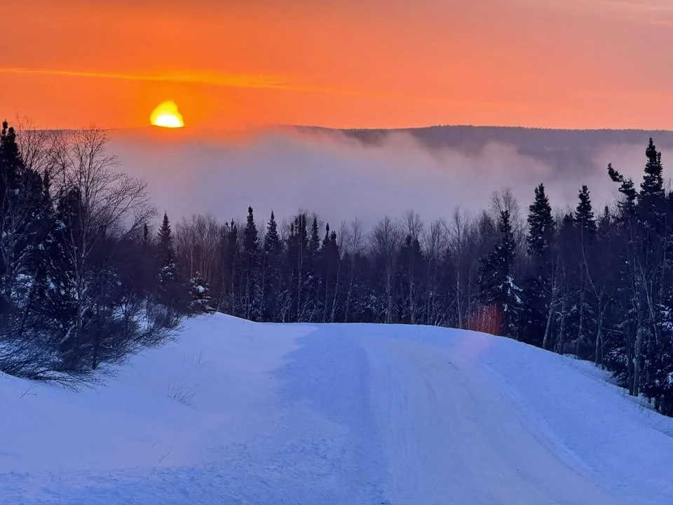
Churchill Falls, NL this morning – January 6, 2026. Credit: Sam Hardy
Good Tuesday Morning!
Here are today’s weather highlights:
It’s a cold start this morning with readings into the minus single digits to minus 20s across Newfoundland and Labrador.
The weather recovers nicely today, with lots of sunshine across much of the Province. The exception will be the West Coast and parts of the Northern Peninsula, where scattered flurries will be found. Some will be intense. Isolated flurries will also be found on the South Coast, Burin Peninsula, and Avalon Peninsula.
Another mild system moves in tomorrow, bringing rain, snow, and wind to various parts of Newfoundland and southern Labrador into Thursday. Special Weather Statements have been issued.

This update is sponsored by Roebothan, McKay, Marshall.
Visit MakeTheCall.ca TODAY to learn more about what the law firm can do for you.
TODAY’S OVERVIEW
Temperatures this morning are certainly on the cold side of the spectrum to begin the day, with readings into the minus single digits to minus 20s across the Province. Wind chills are into the minus teens and minus 20s as of just after 7 AM. If you’re going to be heading for a walk later this morning to enjoy the snow, be sure to bundle up as it won’t be much warmer than it is now.
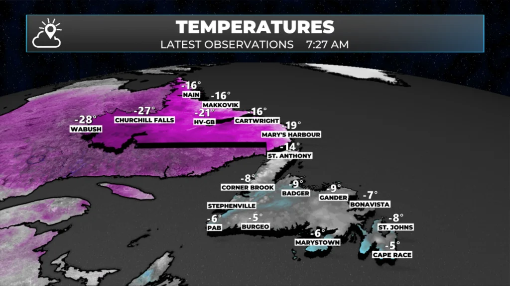
Temperatures as of 7:27 AM NST on January 6, 2026.
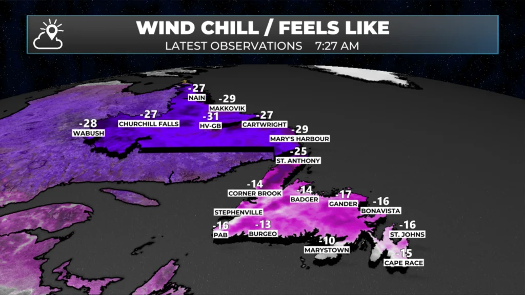
Wind Chills as of 7:27 NST on January 6, 2026.
Expect a fair amount of sunshine across the province today, with scattered flurries along the West Coast, South Coast, and even parts of the Avalon at times, especially this morning. The most intense activity will be along and near the West Coast and the Great Northern Peninsula, where there could be brief, locally stormy squalls. Temperatures will rebound into the minus single digits across much of Newfoundland, while Labrador remains into the minus teens. Wind chills will make it feel even colder.
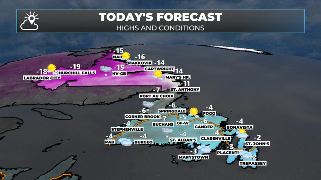
Today’s forecast — January 6, 2026.
The Next One…
Enjoy the weather today, because the next weather-maker moves in tomorrow—and this one will be a mild one. Rain will fall over much of eastern Newfoundland from the afternoon into early Thursday. Central and western areas will see a mix of snow transitioning to rain during the same period, while much of the Northern Peninsula and parts of southern Labrador will see mostly snow.
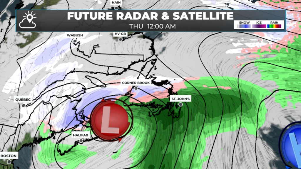
The weather pattern setup for midnight tomorrow night (Wednesday (Jan 7, 2026) into Thursday (Jan 8, 2026).
The Environment and Climate Change Canada Weather Office in Gander has issued three separate Special Weather Statements for the Island ahead of this inbound weather maker. There is one in effect for the Burin and Avalon Peninsulas (rain and wind), another for western, southern, central, and northeastern Newfoundland (snow, ice, rain, and wind), and a third for the Northern Peninsula (snow and wind).
Enjoy today, because tomorrow will not be like today!
I’ll post my next update later today, which will provide more detail on the above.
📱 Get the Sheerr Weather App in the Apple App Store and Google Play Store.
🗺️ Check out the Map Room to see all the latest weather observations for the Province.
🎥 Check out the Provincial Highway Cams to see 👀 what’s going on around our highways and
Thanks for update…… brrrrr!!
Good Morning Eddie! Another weather-maker on the horizon! Heavy rain, on top of all this snow that’s piled up, doesn’t sound good to me. I guess you’re still enjoying the Florida sunshine …. Lucky you!
Thanks for the update
Thanks Eddie for weather update
Thanks for the weather update….It’s a chilly one this morning…
Thank you Eddie