
Monday Morning Update — January 19, 2026
Good Monday Morning!
Here are today’s weather highlights:
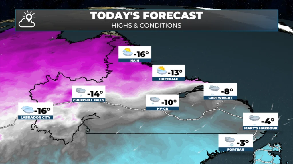
🌧️❄️ Another winter storm rolls through today and brings the wonderful combination of snow, rain and ice to Newfoundland and parts of Labrador. Not all areas will see the three precipitation types; however, the rain will be limited to eastern areas.
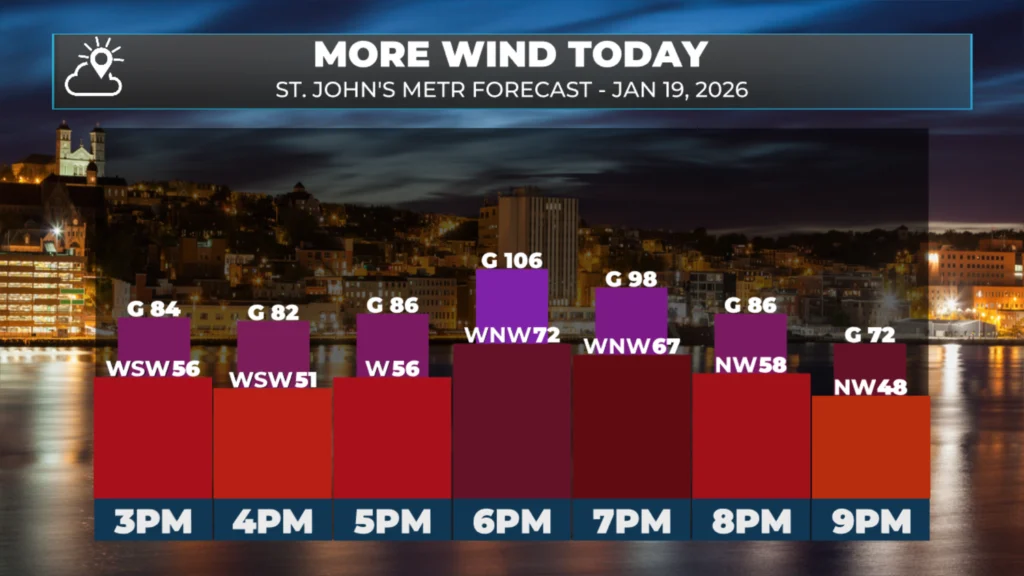
Another round of wind will be felt over eastern areas this afternoon and evening, with gusts expected to reach or exceed 100 km/h (again) over exposed areas. This includes the Avalon and St. John’s Metro.
Winter Storm, Snowfall, Wind and Rainfall Warnings (yellow level) are in effect.
Travel conditions will be poor across much of the region today and will generally improve tonight as this latest weather maker departs.

This update is sponsored by Roebothan, McKay, Marshall.
Visit MakeTheCall.ca TODAY to learn more about what the law firm can do for you.
Another area of low pressure will pass over Newfoundland today, bringing more snow, rain and wind to the Island and portions of southern Labrador throughout the day. This system will depart this evening, and the weather conditions will improve overnight behind it. The animation below times that out quite well.
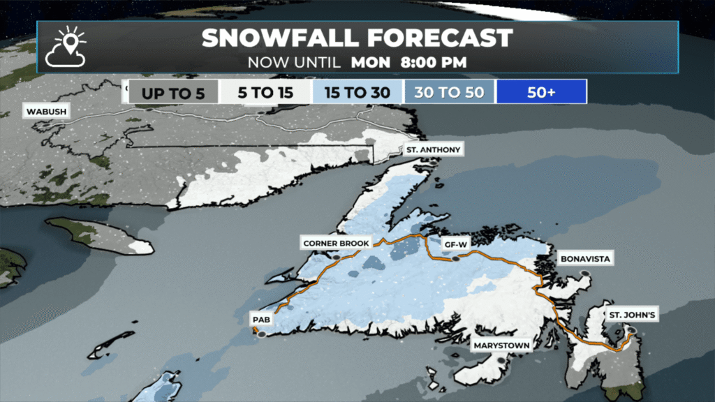
Snowfall for a large chunk of the central and western halves of the Island will be in the 15 to 30 cm range. The highest amounts will be just west of the rain/snow line and also in the higher terrain of western Newfoundland. The image below shows the expected snowfall today.
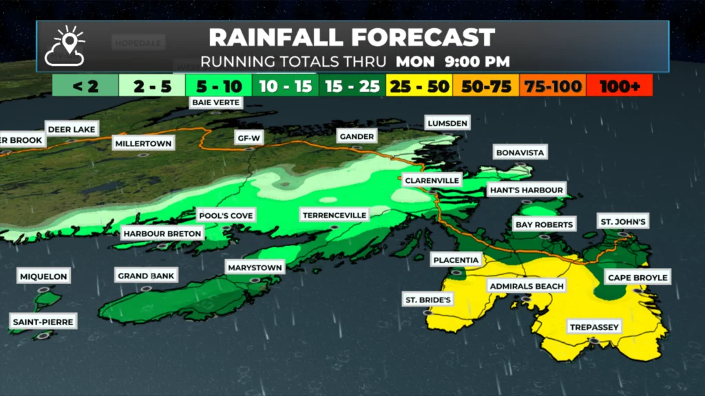
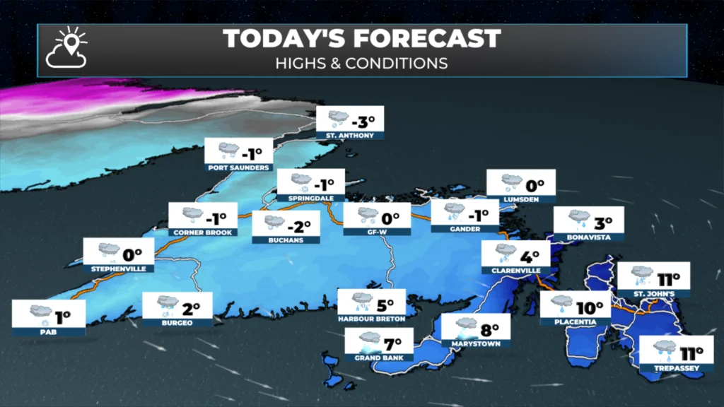
Eastern areas will see a switch to rain this morning, and it will rain heavily for several hours this afternoon and evening. On top of that, temperatures will rapidly rise to 5º to 10º in many areas today, with the warmest readings on the Avalon Peninsula. HOpefully that will take the snow as I don’t plan to deal with it this morning…
The other aspect of this will be the wind; areas of eastern Newfoundland will see high winds this afternoon and evening. Gusts will be near 100 km/h (or more) on the Avalon Peninsula and some adjacent areas. The good news is that this burst of wind will not last as long as the last few rounds have.
Have a great Monday and stay safe!
Updates to come throughout the day.
📱 Get the Sheerr Weather App in the Apple App Store and Google Play Store.
🗺️ Check out the Map Room to see all the latest weather observations for the Province.
🎥 Check out the Provincial Highway Cams to see 👀 what’s going on around our highways and
👍
Good morning Eddie and thanks for the update, enjoy your day
Good Morning Eddie! I’m sooo sick of this “Wonderful combination of
snow, rain, ice and wind”.
Thanks for the update, enjoy your day!
Good morning Eddie, thanks for the update. Have a great day.
Good morning Eddie, thanks for the weather update.
Good morning Eddie. Thanks for the update thus morning!
Love that radar. Really gives a good indication of what and when to expect during the day. Thanks