
Monday Morning Update — August 18, 2025
Good Monday morning!
Key Highlights to start the day
There will be an update on the fires from the NL Provincial Government at 10:15 AM today. Find it here or here.
The Kingston Fire did not grow significantly Sunday, and progress was made with aerial and ground suppression efforts.
Paddy’s Pond Fire boundaries are holding, and crews continue to be on scene.
Martin Lake Fire remains active, and the size remains at ~1770 hectares. Weather conditions in the area yesterday allowed four water bombers, a bird dog, and bucketing helicopters to continue suppressions. Ground crews continue their work on structure protection in cabin areas along the southwest boundary.
Weather conditions are expected to make a significant contribution to fire suppression, as rain is forecasted to fall over eastern Newfoundland tonight and Tuesday.
For the latest on the fires from the Provincial Government, bookmark this link.
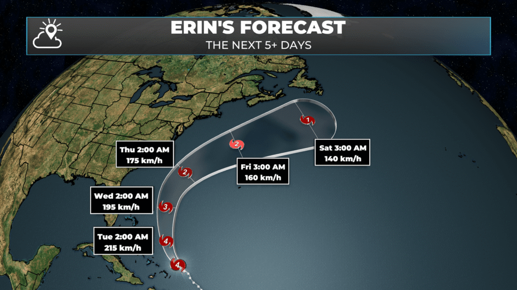
Hurricane Erin is a dangerous Category 4 Hurricane located 175 kilometers northeast of Grand Turk Island. The storm is currently forecast to pass SOUTHEST of Newfoundland between Friday and Saturday. Impacts, at this time, on NL Weather appear to be minimal. Those with ferry crossings slated for Friday/Saturday will want to be on the lookout for Marine Atlantic schedule changes.
This morning’s update is brought to you by Roebothan, McKay and Marshall.

Visit MakeTheCall.ca for more!
The Forecast
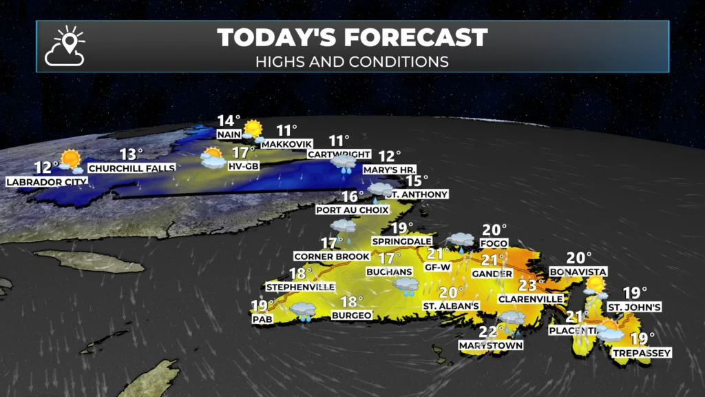
Temperatures will peak in the lower to middle 20s for eastern, northeastern, and central Newfoundland today. Areas farther west and in Labrador will be cooler due to clouds, showers, and overall a cooler airmass.
The sun will shine over eastern Newfoundland for most of the day before clouds begin to increase. The sun will shine in northern and western Labrador today as well. Between those two areas, I expect more clouds than sun and rain (already occurring in the west) or rain arriving (central/South Coast) at some point today.
A cold front is located over western Newfoundland this morning, which is bringing rain to the West Coast and parts of southern Labrador as we start Monday morning.
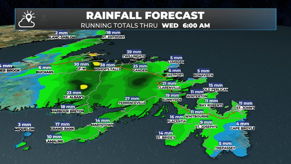
This front is expected to move east today, and an area of low pressure will begin to develop along its path. This will cause the rain to become WIDESPREAD over much of the Island, west of the Avalon Peninsula, throughout the day. As the front and low continue moving eastward, they will slow down, and it will take until Wednesday for this system to pull away. This setup will allow a period of light to moderate rainfall to set up over eastern Newfoundland from tonight through Tuesday or early Wednesday. The rain showers are expected to end on Wednesday morning.
Rainfall amounts will be significant in some areas, but we are expecting widespread rainfall of 15 to 30 mm across much of the Island, with locally higher amounts possible. Latest projections for wildfire areas:
Kingston Fire area: 10 to 15 mm
Paddy’s Pond Fire area: 10 to 20 mm
Martin Lake Fire area: 20 – 30 mm
The weather will dry out on Wednesday behind the departing system. Temperatures will remain near or below average, with highs in the teens and lower 20s across much of NL. There is a chance of some warmer air by the weekend. To get the forecast for YOUR area, be sure to GET THE SHEERR WEATHER APP 🙂
I’ll have my next update this afternoon.
Really foggy in Carbonear this morning (6:00 a.m.) ,not smoke but heavy fog…..
Loving the fog…hopefully suppresses the fires! Thank you. My go to app every morning!
Great. We need the rain
I check this page every morning. Thanks Eddie. I also love that I get an alert for updates. Awesome app.
Good morning
Thanks for the forecast. I am looking forward to the rain and I cannot believe I said that but this summer is one for the books. Enjoy your day and bring on the rain!
Thanks for the extra work you put in to get communication out there, your app is the only app I allow notifications from. Great job using tools at your disposal to help people in our communities.
Thanks for accurate forecasts now and in the past. Hoping for good weather after Wed to finish out the Canada Games.
Up The Pond
Thanks Eddie ! We need rain ….
Thank you Eddy!
Thank you Eddie. Your app is the only app I enable notifications because they are revelant to me, timely and accurate. You obviously put a lot of effort into the app content and it shows. Congratulations I love it! And I will forever more celebrate the rain and when the time comes, the snow too
Thank you Eddie
Thank you Eddie
Thanks Eddie