
Monday Evening’s Forecast | July 28, 2025
FORECAST SPONSOR
The Apex Team with RE/MAX Infinity – taking you to the Apex of your real estate journey. Connect with one of their experienced agents today and get top dollar for your home. Visit: www.ReachTheApex.ca for more or find them on Facebook.

Temperatures fell sharply for portions of central and northeastern Newfoundland, as expected, between this morning and afternoon. This morning at 8:30 AM, Gander International Airport was sitting at nearly 18ºC with a nice southerly wind. Throughout the day, rain showers moved in, and then the wind shifted to a northerly direction. As of 3:30 PM, the temperature had dropped 14º, and it was the lowest reading of the day.
The cooldown is from a cold/stationary front that has settled across the Island this afternoon. Areas north of the front are in the cooler, marine layer, and areas south are in the warm and humid air. Temperatures as of 4:15 PM across the Island show this setup rather well
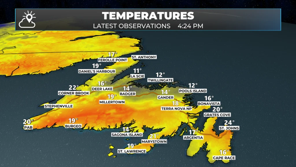
Temperatures will continue to drop for areas north of the front through the evening. South of the front temperatures will also drop overnight as they do. By tomorrow morning, many of us are waking up to readings in the teens to near 10º. Labrador will see similar overnight lows, but there is no front driving those temps down.
Be sure to check out the MAP ROOM for the latest weather observations from around NL!
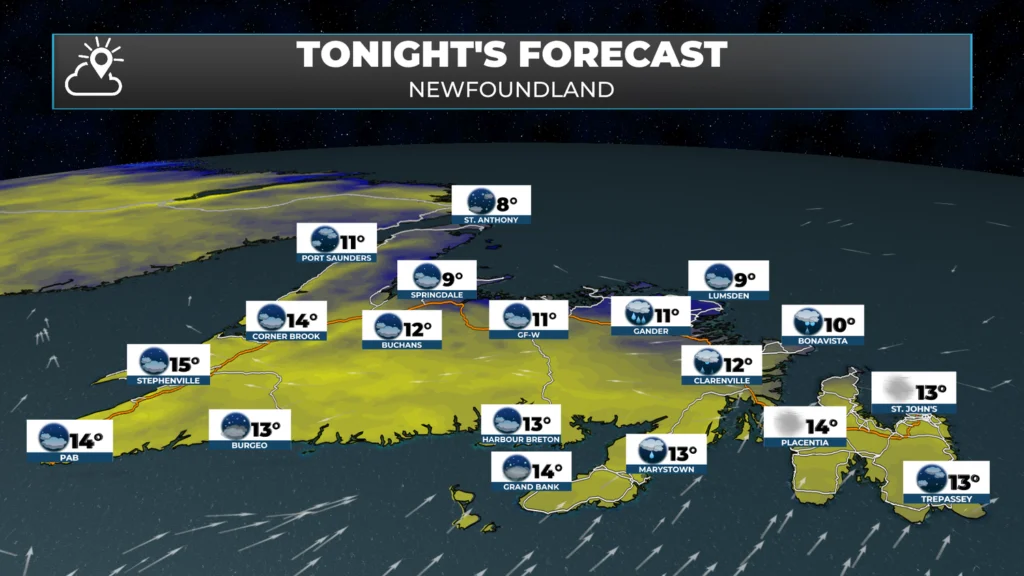
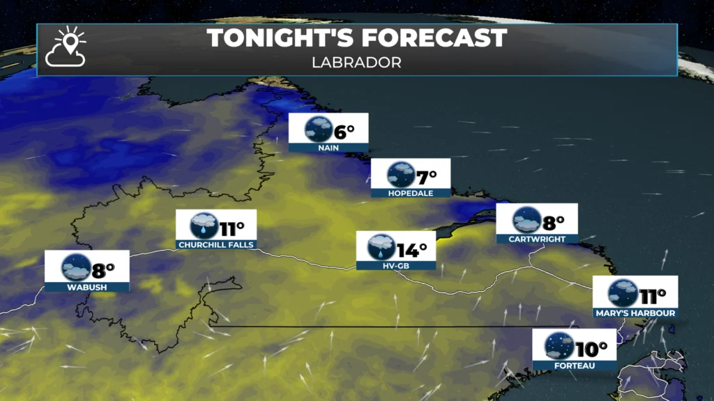
TONIGHT AND TOMORROW’S WEATHER
Weather-wise, overnight and Tuesday, we aren’t looking at major weather. That being said, it appears that there will be some afternoon showers and thunderstorms over parts of western, interior, and central Newfoundland once more. I’ll be watching the radar closely during the second half of the day and may even pop on and do a live stream if we get some storm to initiate (fire up).
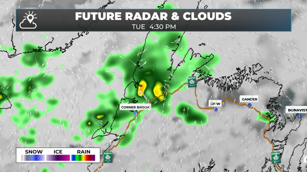
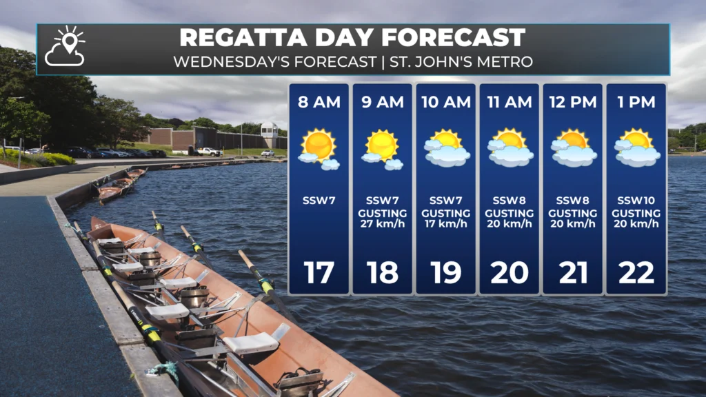
Beyond that, the weather this week is looking pretty… boring. And that’s a good thing! Regatta Day is this coming Wednesday and is taking place earlier than normal due to the Canada Games, which will be held in early August. The forecast is looking good (for now) with light to moderate wind speeds, comfortable temperatures, and sunshine. If that changes, I will let you know!
Remember that the Regatta committee doesn’t make the go/no-go call until very early Wednesday morning… so for those of you who want to play Regatta Roulette… Good luck!
My next update will be posted bright and early tomorrow morning.
Have a great evening!
Eddie
Thanks Eddie , this works for me , it’s not too fast and I can follow the weather forecast much better than the tv screen .
Thanks Eddie now I don’t have to look at the evening news now
Tks sir
Thank you Eddy have a great night checking in tomorrow 👍🏻👌
Great job on the app Eddie. I find the updates and alerts I get from you here living in Calgary to be very timely and informative. I’m using your app daily for our local forecast here in the mountains. Thanks Again.