
Latest Winter Storm Leaves 50 to 80 cm across the eastern Avalon – EC Weather Summary
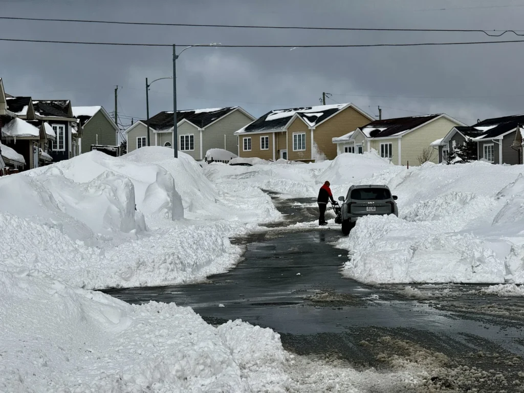
Paradise, NL after the latest winter storm. Over 144 cm of snow has fallen in parts of this community in less than one week.
Environment Canada issued a weather summary earlier today highlighting the latest winter storm. The summary, in its entirely with only formatting changes, has been placed below.
WHAT HAPPENED?!
A low-pressure system developed off Cape Cod Friday night and tracked east-northeastward while intensifying. It became nearly stationary over the Grand Banks Saturday night into Sunday morning before gradually departing eastward later in the day. Meanwhile, a trough of low pressure originating over the Labrador Sea advanced southward over the weekend and was absorbed into the southern system’s circulation on Sunday.
The interaction of these features produced heavy snowfall across the eastern Avalon Peninsula. Amounts were considerably lower west of the Avalon; however, strong winds generated significant blowing snow across much of eastern and northeastern Newfoundland.
This event followed closely on the heels of a previous major storm earlier in the week. The storm caused widespread business closures and major transportation disruptions, many of which have continued into today. Public transit services, along with operations at St. John’s International Airport, have been suspended pending sufficient snow clearing to allow services to resume.
Impacts have been further compounded by the limited recovery time following the previous storm, with many areas receiving more than 100 cm of snow in less than a week.
The following is a summary of weather event information received by Environment and Climate Change Canada as of 11:30 A.M. NST.
Snowfall in centimetres:
Paradise: 79.5 *
Trepassey (auto): 72.0 *
Ferryland: 70.0 *
Bay Bulls (auto): 60.0 *
Conception Bay South: 59.0 *
St. John’s East: 55.6 *
St. John’s International Airport: 38.8
Bay Roberts (auto): 25.0 *
Victoria (Conception Bay North): 21.0 *
Snowfall from automated (auto) stations was derived using data from a combination of weighing gauge and snow depth sensors.
Maximum wind gusts in kilometres per hour.
Sagona Island: 133
Cape Pine: 114 *
Bonavista: 107
St. John’s International Airport: 105
Grates Cove: 103 Twillingate: 102
Fogo Island: 98 *
Pool’s Island: 96
Argentia: 90
* Denotes data from unofficial observing stations. Please note that this summary may contain preliminary or unofficial information and does not constitute a complete or final report.
Can it take a break please, I’m trying to fly back to St.John’s😂
Thanks, Eddie
Thank you Eddie. I’m assuming Mount Pearl totals were very similar to Paradise
Eddie, I’m so happy you got some sleep because you were giving the weather updates like four times or more a day. Thank you for keeping us in the loop. 👍
Just wondering what the total would be for Holyrood. Lots of snow buildup here also
Thanks for weather update Eddie