
Heat Warnings and Thunderstorms Highlight Monday’s forecast
Good Monday morning!
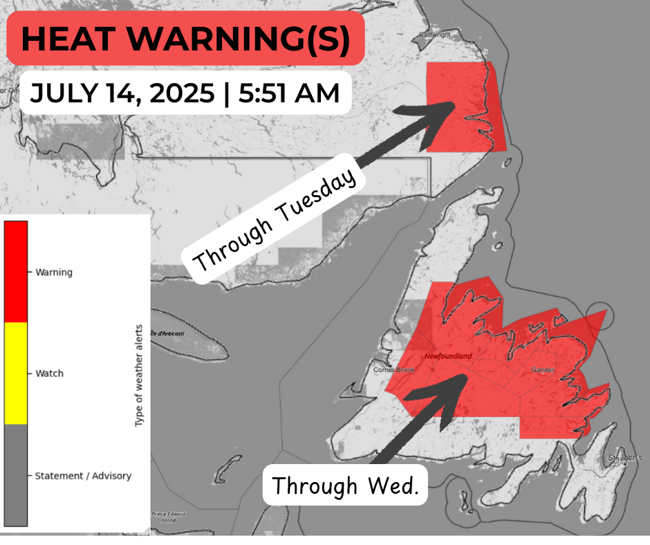
It is going to be another hot day across much of the Island and parts of Labrador. A Heat Warning remains in effect today for Norman Bay to Lodge Bay in Labrador, and through Wednesday on the Island from Deer Lake – Humber Valley and Green Bay – White Bay to the Bonavista Peninsula. Highs will be near 30ºC (or more) under the warning, with lows in the upper teens.
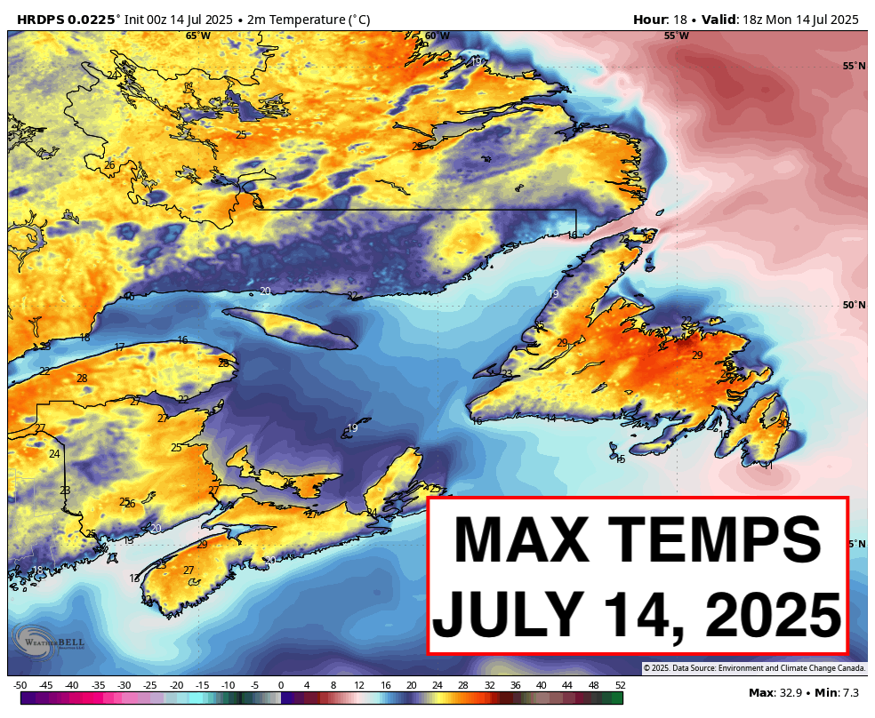
Weather-wise, today we are looking at sun and cloud across the Island, with highs in the upper 20s to lower 20s for many areas (including St. John’s Metro). There will be some cooler locations, particularly along south and west-facing shores, where onshore winds will knock temperatures down. Fog will become more widespread today, too, in the south.
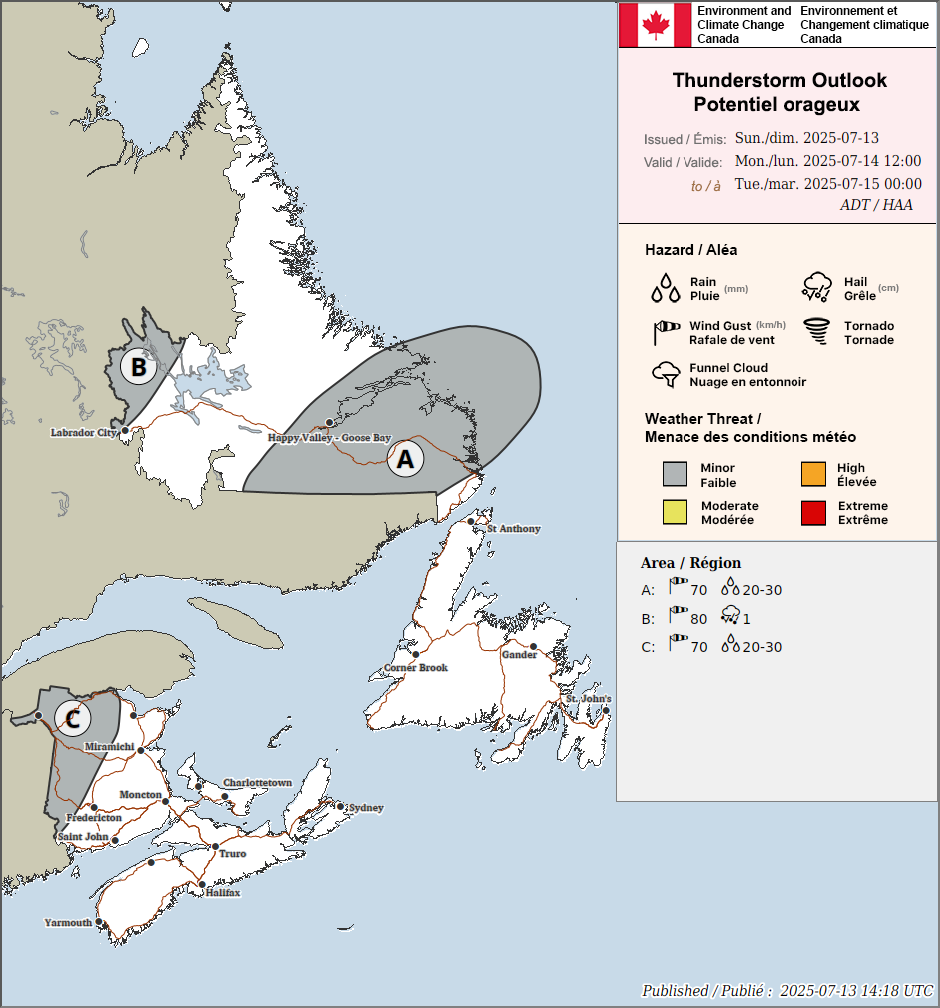
Expect a bit more cloud cover across the Big Land today with a good chance of afternoon thunderstorms. Some of the storms may be strong and will produce locally gusty winds, heavy rainfall, frequent thunder and lightning, and small hail. The highest risk of storms will be around Upper Lake Melville this afternoon.
Some relief from the heat is in sight… but not until later in the week.
I’ll have your full forecast later today. And don’t forget, Sheerr Weather launches at 12 PM today, live on Facebook and YouTube. The links are on my pages!
Have a great day!