
Friday Morning’s Weather Briefing: More Snow On The Way — April 24, 2026
Good Friday morning!
Here are today’s weather highlights:
Light rain and snow will continue to fall throughout coastal Labrador and Newfoundland’s Northern Peninsula. Flurries will be more scattered for interior and western Labrador.
The majority of the Island will see a quiet and dry start this morning.
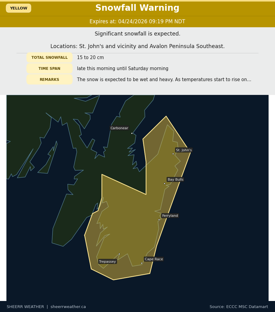
Snow develops on the Avalon this afternoon, and light rain and snow become more widespread over much of the Island, north of the South/Southwest Coast. A Yellow Level Warning for Snowfall is in effect for the Avalon Peninsula Southeast and the St. John’s Metro area.
Snow will fall heavily at times overnight on the Avalon, with areas of light snow and rain across the rest of the island, except the South Coast. Coastal Labrador will see the same.
Temperatures at this hour are near or below freezing across Newfoundland and Labrador, and areas of light rain and snow are being reported over much of Labrador and parts of western and northwestern Newfoundland. Even with the wintry precipitation falling, most roads across the Province are in good shape to start the day.
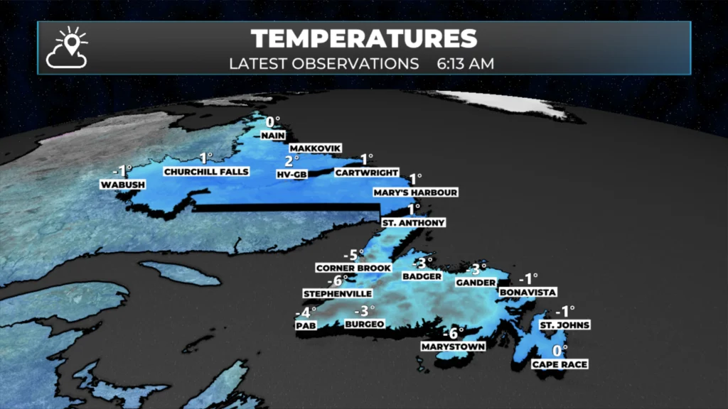
NL observed temperatures as of 6:13 AM on April 24, 2026
Across the province today, we can expect cloudy to mostly cloudy skies, with high temperatures near the freezing mark. There will be areas of light rain and snow over the GNP and throughout much of Labrador today, while the rest of NL is generally cloudy and quiet. The exception is the Avalon, where snow will arrive this afternoon as an area of low pressure slowly moves toward the eastern part of the island.
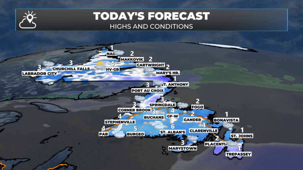
NL’s forecast highs and conditions for today – April 24, 2026
That low will bring significant snowfall to the Avalon Peninsula between this afternoon and tomorrow morning or early afternoon, before the snow mixes with or changes to rain. For the Metro area, I’d think somewhere between 20 and 30 cm of heavy, wet snow is a good bet by the time we’re all said and done, with the bulk of that falling overnight. Snowfall will not be as significant over the western Avalon and the for areas over eastern Newfoundland. The map below shows that well.
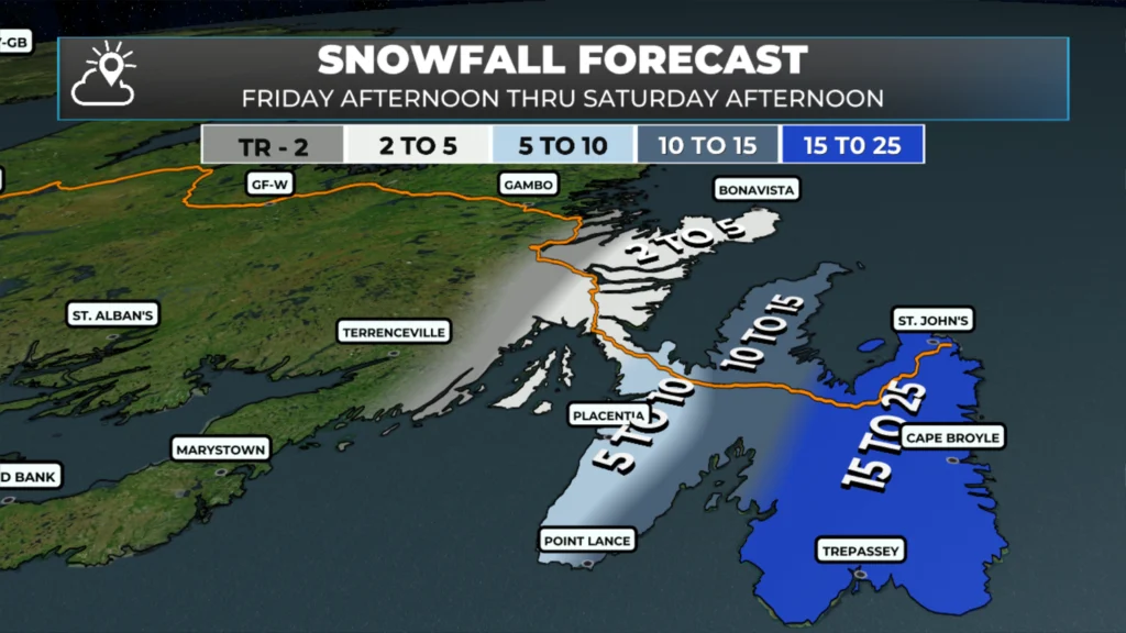
NL’s expected snowfall from this afternoon until Saturday morning (April 24 – 25, 2026)
Future radar and satellite imagery show how the snow will play out today and tonight. It also shows how the low moving in will enhance the light rain and snow over central and northeastern Newfoundlands, the GNP, and coastal Labrador later tonight into Sunday. In fact, parts of central and northeastern Newfoundlands, inland over higher terrain, will see significant snowfall Saturday afternoon and night before it ends Sunday. On the Avalon, the rain and snow will continue through Saturday, before changing back to snow Saturday night and ending Sunday morning. Not much additional accumulation is expected in that time frame at this time.
Once past Sunday morning, it seems as though the weather is going to improve… perhaps significantly as we get into next week!
I’ll have my next update for you later today!
📱 Get the Sheerr Weather App in the Apple App Store and Google Play Store.
🗺️ Check out the Map Room to see all the latest weather observations for the Province.
🎥 Check out the Provincial Highway Cams to see 👀 what’s going on around our highways and
Good Morning Eddie! It’s hard to believe what I’m reading, it’s been one day after another of lousy weather. Surely, it has to improve soon! Thanks for all the hours you put in keeping us up to date! Have a good weekend!
Good morning Eddie thank you for the update. I thought it was spring lol looks like old man winter has a hard grip on us.
Great job Eddie enjoy your weekend
Good Morning Eddie…Thanks for all you do..Looks like we are not done with old man winter yet..Hoping this is the last bout of snow but never know in Newfoundland…Have a great weekend and thanks again…
Good morning Eddie! Thanks for the update….