
Friday Morning’s Weather Briefing — May 1, 2026
Good Friday morning! Welcome to the month of May!
Here are today’s weather highlights:
Temperatures across NL are in the single digits above and below freezing this morning.
High temperatures peak in the mid-single digits to mid-teens this afternoon.
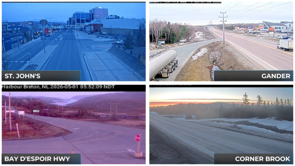
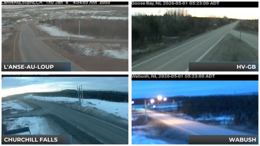
Skies are cloudy for many areas; however, there does not appear to be much fog showing up on the webcams. Skies will turn mostly sunny for much of the Province as the morning goes along.
Showers arrive in Labrador West this afternoon, and some fog will be present along the shorelines of the Avalon and Bonaivsta Peninsulas, the northeast coast, part of the Northern Peninsula and southern Labrador.
This morning’s update is sponsored by Roebothan, McKay, Marshall.

Visit MakeTheCall.ca today to learn more about how the law firm can help you!
Today will be another nice one for much of Newfoundland and Labrador, with partly cloudy to mostly sunny skies, light to moderate wind speeds an comfortable temperatures. There will be a few “trouble spots” in Labrador West and throughout some coastal areas of Newfoundland.
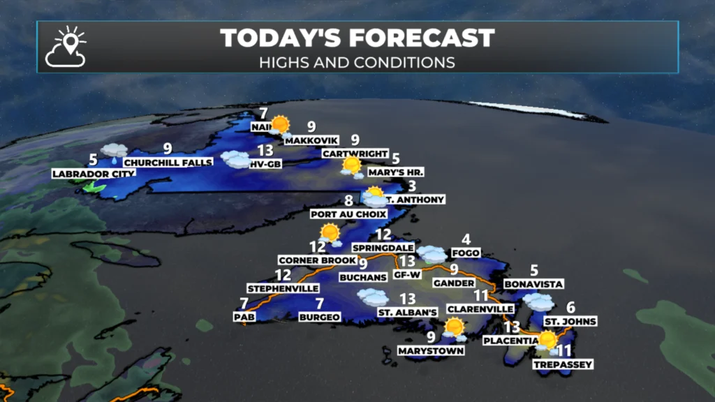
Today’s forecast for NL — May 1, 2026
We will start with the island, where the day will be dry and generally sunny. The exception will be along and near the east-facing shores of the Avalon Peninsula, Bonavista Peninsula, northeast coast and the Northern Peninsula, where low cloud and fog will be very persistent today. To me, it looks like the majority of the fog sticks on the coast. This animation of future cloud cover shows that well.
Labrador West will have a dry start to the day, but showers and light rain will arrive this afternoon, ahead of a low moving north through New Brunswick. This low will have a prominte roll to play in our weather over the weekend, but today this is all it will do. Future radar shows that well.
Sneak Peek at the weekend
The weather pattern will turn a bit more unsettled on Saturday as an area of low pressure passes south of Newfoundland. This will bring widespread rain and showers, along with a bit more fog, to east-facing shores for the first half of the weekend. Sunday looks a bit nicer, as we will be between systems. A potent low will move through Atlantic Canada between Sunday night and Monday, bringing a healthy dose of rain, wind, and even some snow. Wind gusts of 80 to 100 km/h will be possible across much of the Island from Sunday night into Monday. Stay tuned for details on this!
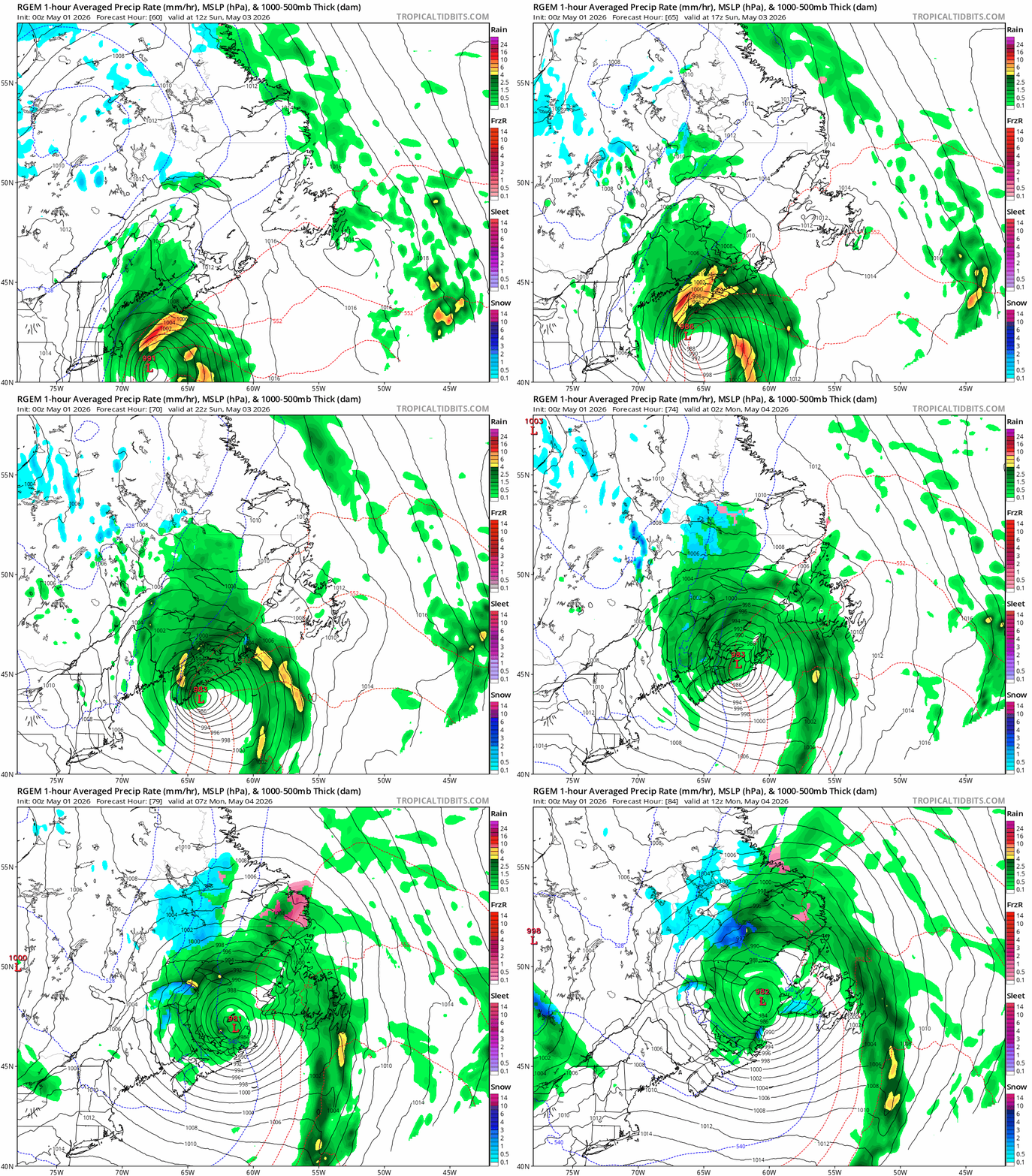
An animation of the Sunday night to Monday morning low pressure centre.
I’ll have a full forecast posted later today!
📱 Get the Sheerr Weather App in the Apple App Store and Google Play Store.
🗺️ Check out the Map Room to see all the latest weather observations for the Province.
🎥 Check out the Provincial Highway Cams to see 👀 what’s going on around our highways and
Thanks Eddie for the update. Have a great day!
Good morning Eddie thanks for updating us, have a great day