
Friday Morning’s Weather Brief — September 5, 2025
Good Friday morning!

We are waking up this morning to cool temperatures and some stubborn areas of low clouds over parts of the Great Northern Peninsula and central and interior Newfoundland, along with the majority of Labrador. The clouds that are seen this morning will clear off over the next few hours for the vast majority of areas currently seeing them. There will be some fog along the south-facing shores of the Island this morning, which will linger through the day as a more humid weather pattern sets up shop.
This morning’s forecast is brought to you by Roebothan, McKay and Marshall.

Visit MakeTheCall.ca to learn more about what the law firm can do for you.
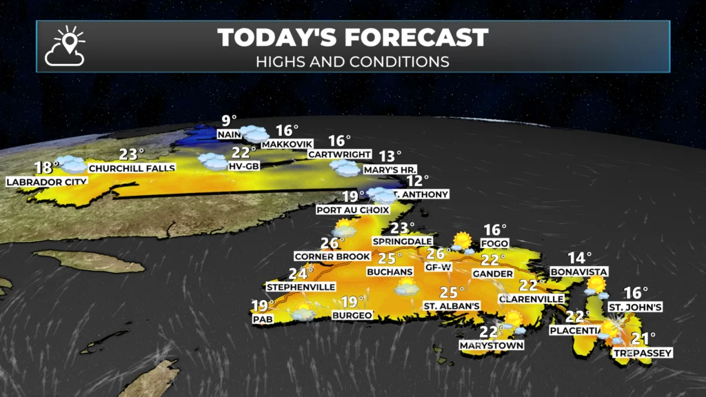
Temperatures today will peak into the teens and 20s across the Province. In fact, today will be the warmest day of the week for areas of coastal Labrador, which were stuck in the single digits and low teens for the last several days. There are a few more challenging details of this forecast to talk about.
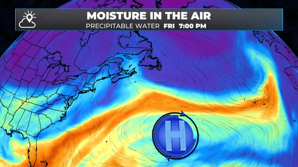
An area of low pressure is going to build north-northeast of the Island portion of the Province today. The position of this high will turn the wind direction onshore for most areas of the Island from the eastern side of the Northern Peninsula to the Avalon.

Good morning Eddie!…Thank you for the update
Have a great day!
Thanks for the update
Thanks Eddie
—Your maps Speak to us! A hint of the Jet stream—Thanks so much!
Thanks Eddie have a great day 👍🍷
Thank you so much for the updates
Eddie, I am LIVING for your app and your daily forecasts!!!!!! THANK YOU
Thanks for always getting my day off on the right foot.