
Friday Morning Weather Update — December 19, 2025
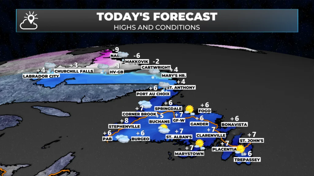
Good Friday morning!
We are waking up to a quiet morning (weather-wise, at least) on the Island, while snow is already falling in parts of interior and western Labrador as our next weather maker moves in. The webcams in Churchill Falls and Wabush show that the snow is certainly impacting travel in those areas of the Big Land.
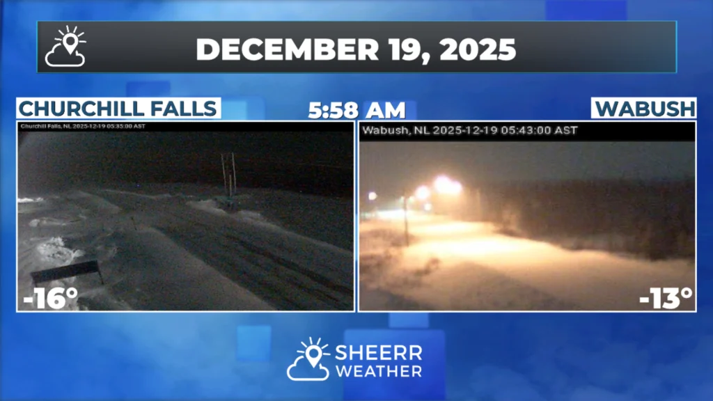
Travel conditions across other areas of Labrador, farther east, will deteriorate this morning as snow moves in. The best place to track those conditions would be the 511NL.ca website. Find the real-time travel updates and road conditions there. You can also use the webcam page on my website to easily view all the cameras on the Province’s road network.
The weather on the Island today will be decent and mild. Conditions will deteriorate tonight and Saturday as the rain moves in and wind speeds increase.

The area of low pressure moving in today, while it is bringing snow this morning, will be warm, and by afternoon, many areas of Newfoundland and Labrador will be near or above the freezing mark. The animation below shows how the rain and snow pattern will evolve today as the system moves into Quebec.
As this moves in, wind speeds will also increase later today or tonight. Wind gusts will be as high as 100 km/h for many areas of eastern and central Newfoundland, and as high as 120 km/h for regions of the west coast that see enhanced easterlies. Wind speeds will increase later today and remain high through Saturday. Wind speeds drop off later Saturday or early Sunday.

This update is sponsored by Roebothan, McKay, Marshall.
Visit MakeTheCall.ca TODAY to learn more about what the law firm can do for you.
Due to the expected wind, rain, and snow (Labrador), Environment Canada has issued various weather alerts for Newfoundland and Labrador. In addition, a Flash Freeze Warning is in effect from Churchill Valley to Labrador City for Saturday, as colder air rapidly sweeps back into the region following today’s thaw.
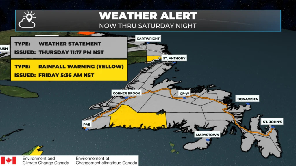
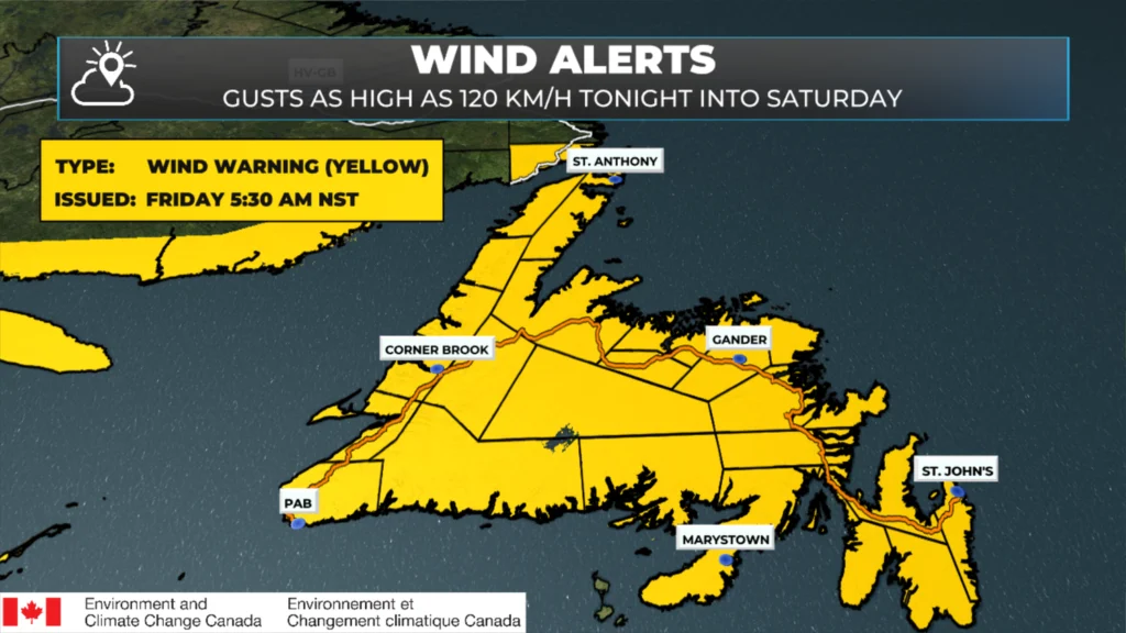
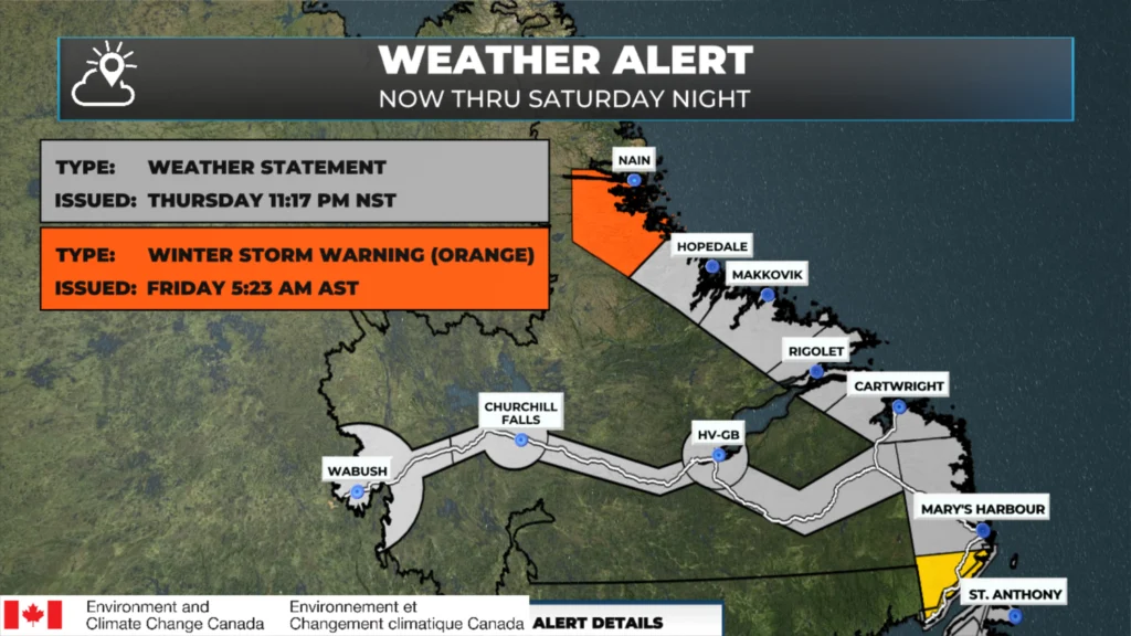
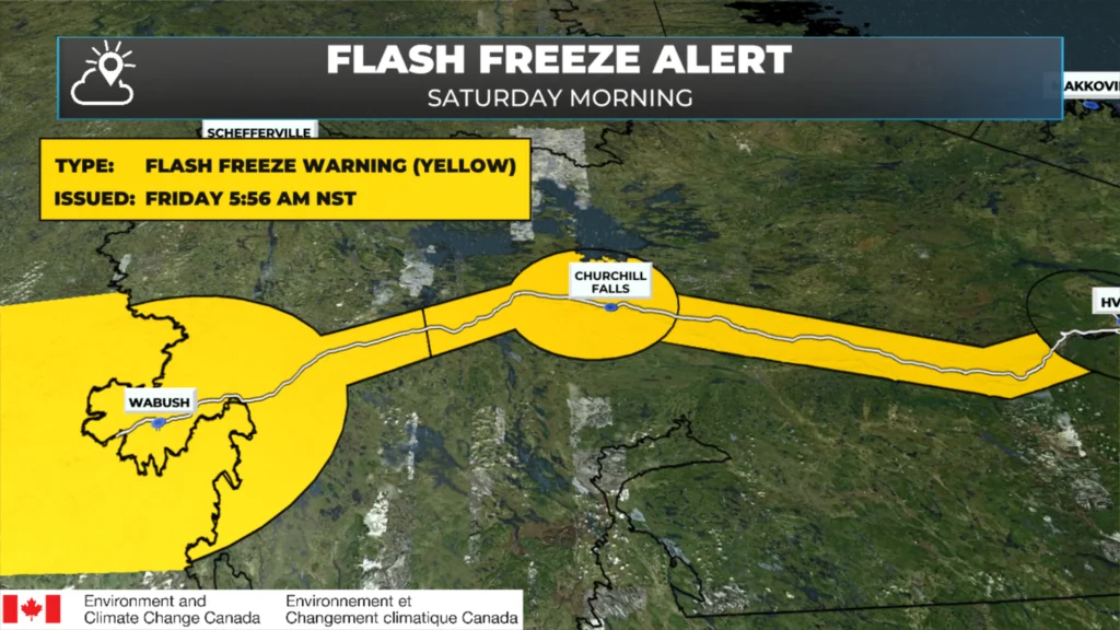
A Coastal Flood Statement is also in effect for the West Coast of Newfoundland and the shorelines of the Strait of Belle Isle for waves of 4 to 6 metres breaking upon approach to shore, leading to higher than normal water levels, particularly around high tide. If you’re in an area prone to coastal flooding, pay close attention to the water levels on Saturday morning.
I’ll have my next update posted later today!
📱 Get the Sheerr Weather App in the Apple App Store and Google Play Store.
🗺️ Check out the Map Room to see all the latest weather observations for the Province.
🎥 Check out the Provincial Highway Cams to see 👀 what’s going on around our highways and
👍
Thanks Eddie for keeping us all updated, have a wonderful day
Good Friday morning ☕️Eddie!
Thank you for the weather update!…Have a great day & weekend!
Thank you Eddie
The west coast (Deer lake area) is getting 75-80km/h winds currently
Hi Eddie today weather it nice here in up too airthert heights nice and sunny in st John’s today by lyñnanne auchinleck ☀️☁️🌥️❤️💕🌼🌝
Good morning Eddie. Thanks for keeping us informed. Have a great day!