
Friday Morning Weather Brief — September 19, 2025
Good Friday morning!
It’s the tale of two very different seasons across the Province this morning. On the Island, the majority of locations are reporting temperatures in the mid- to upper-teen range at this early hour. The warmest spots appear to be St. John’s and Bonavista at 17º.
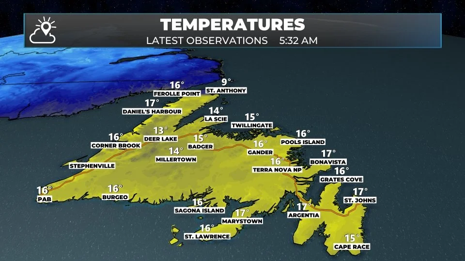
Click or tap on this image to enlarge
Meanwhile, in most of Labrador, it feels a lot like… autumn! Temperatures are near 1º in the north and west. Along with that, rain showers are currently being reported at Wabush Airport. I’d suspect that in the higher terrain, there may be some snowflakes mixing in with those raindrops. And if they’re not yet, that will be the case later today.
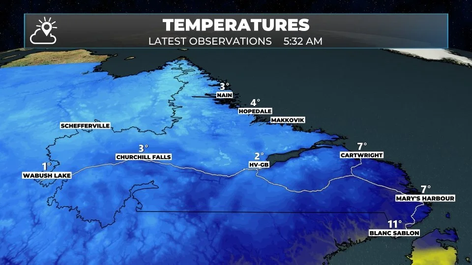
Click or tap on this image to enlarge
Today’s Forecast | Newfoundland
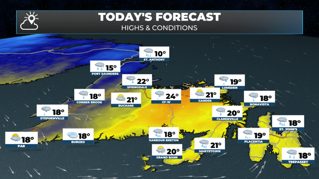
As a cold front moves across the Island, scattered showers this morning will become more numerous for eastern and southeastern areas, which include the Avalon and Burin Peninsulas. The West Coast and Northern Peninsula will see rain arrive this morning, if it hasn’t already, and that will continue through much of the day. The areas between, which are essentially central, the South Coast, and the interior, will be mostly dry this morning before rain and showers arrive this afternoon. Granted, the South Coast is dealing with fog and drizzle, and that will be the case until the cold front. moves through.
Click or tap on this image to enlarge
This morning’s update is sponsored by Roebothan, McKay, and Marshall.

Visit MakeTheCall.ca to learn more about what the law firm can do for you.
Temperatures will again be warm today, with highs in the mid to upper teens and even the scattered 20º reading. For western areas, the maximum temperature will occur this morning because temperatures will drop this afternoon behind the cold front. Central and the South Coast will see the drop this afternoon, and eastern areas will see that occur overnight.
Today’s Forecast | Labrador
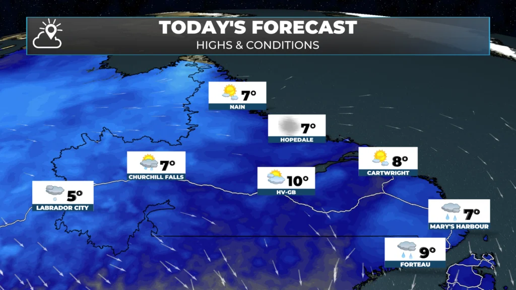
Partly to mostly cloudy skies with scattered showers and flurries in the west. High temperatures reach the lower to mid single digits for most. The exception will be near the Straits, where highs will be closer to 8ºC or 9ºC. It’ll be breezy as well, with westerly gusts to 50 km/h, making it feel much cooler than the air temperature suggests.
Click or tap on this image to enlarge
Click or tap on this image to enlarge
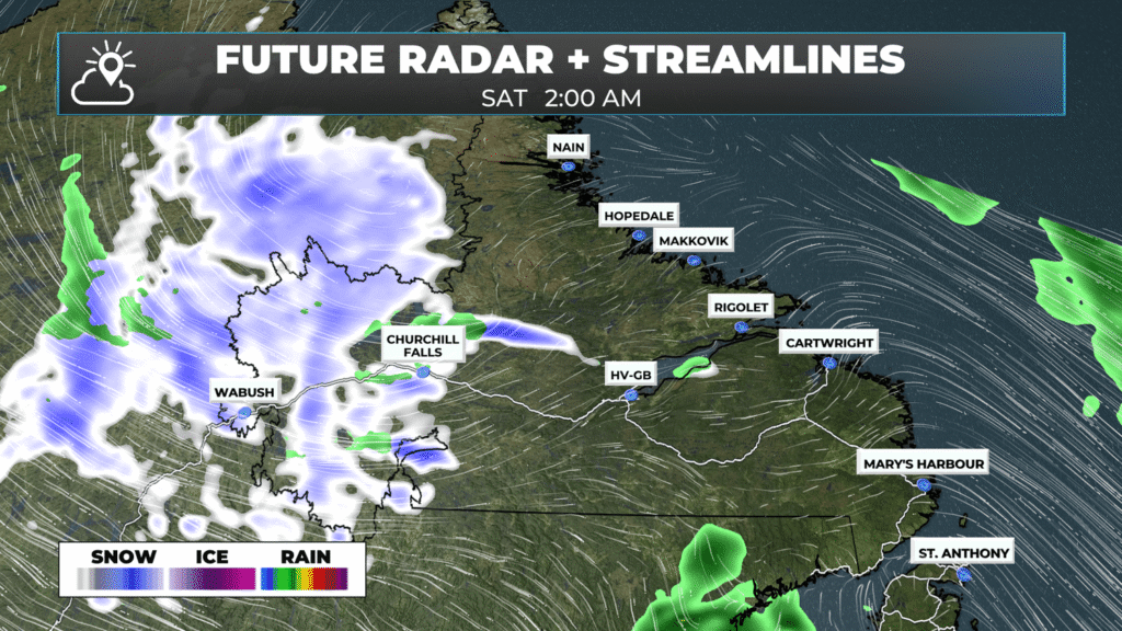
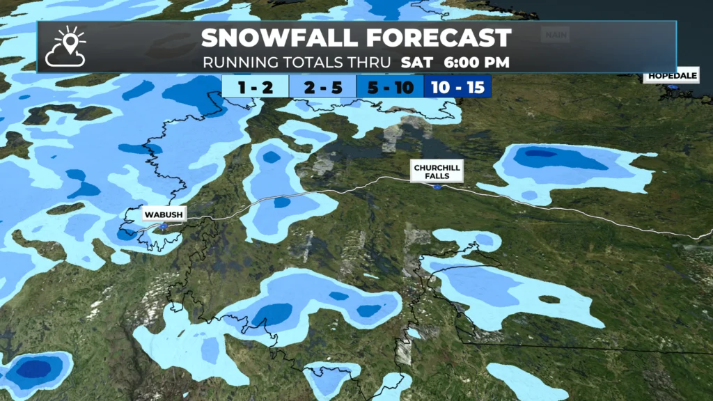
A trough (convergence zone) will bring the first widespread snowflakes of the season to parts of Labrador West and eastern Quebec overnight into Saturday morning. While I’m not expecting widespread significant snowfall, there will be a slushy accumulation in some areas, particularly in higher terrain. While not a major event, it is a sign that the fall is just about here and winter isn’t too far away.
Click or tap on this image to enlarge
The weekend looks calmer, but not entirely dry. I’ll have my next update with a detailed look at the weekend forecast posted later today. Have a great Friday!
Good morning Eddie, thanks for weather update.