
Friday Morning Weather Brief — October 31, 2025
Good Friday morning! Here are today’s weather highlights:
Halloween will start dry, and it looks like the rain will hold off over most of the Island until after 6 or 7 PM… so get the trick-or-treating done early. Areas along the south and west coasts may see rain start before then. It will also become increasingly breezier with winds from the east on Friday afternoon.
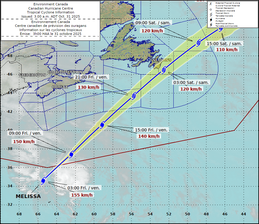
Hurricane Melissa is currently located 240 km north-northwest of Bermuda and is moving northeast at 65 km/h. Maximum sustained winds are 150 km/h, which makes it a Category 1 Hurricane as of 3:30 AM NDT.
It appears that eastern Newfoundland will experience rain from the storm as it passes on Friday night, in conjunction with another system to the west. In fact, most of the Island will see rain from one system or the other, Friday night into Saturday. Labrador will see snow!
At this time, the highest winds (gusts of 120+ km/h) are forecast to remain offshore, but there will be a period of wind gusts of 70 to 100 km/h over the southern and eastern Avalon, including in the St. John’s Metro area. Wind gusts may be as high as 115 km/h near Cape Race.
A Wreckhouse Wind Warning is in effect for Friday afternoon and evening for gusts as high as 120 km/h. These winds are unrelated to the Hurricane.
Parts of Labrador will see the first snowfall of the season Friday night through Saturday.
This morning’s update is sponsored by Roebothan, McKay, Marshall.

Visit MakeTheCall.ca today to find out what the law firm can do for you!
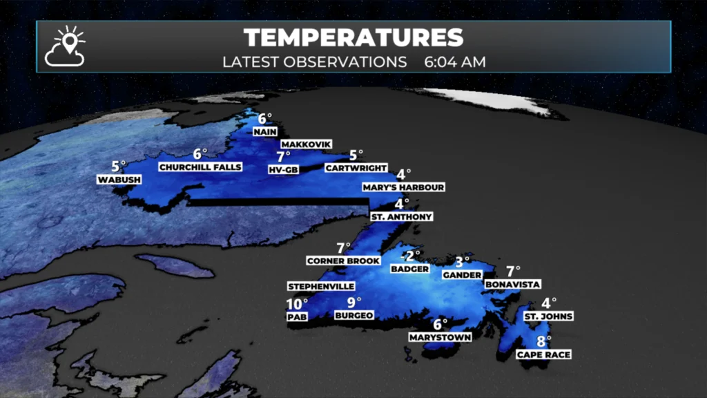
Temperatures at this hour are a bit warmer than the last couple of days, but are cool in some spots. Readings for central and eastern Newfoundland are in the single digits above freezing, except in Badger. Badger, as of just after 6 AM, is reporting -2ºC.
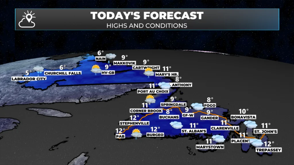
Temperatures today will rise into the middle and upper single digits for much of the Province. The day starts dry almost everywhere, but in Labrador West, rain is expected to begin this morning, if it hasn’t already. Wind speeds will be on the lower end this morning, but it will become noticeably more breezy through the day as an area of low pressure begins to move out of New England and toward Newfoundland and Labrador.
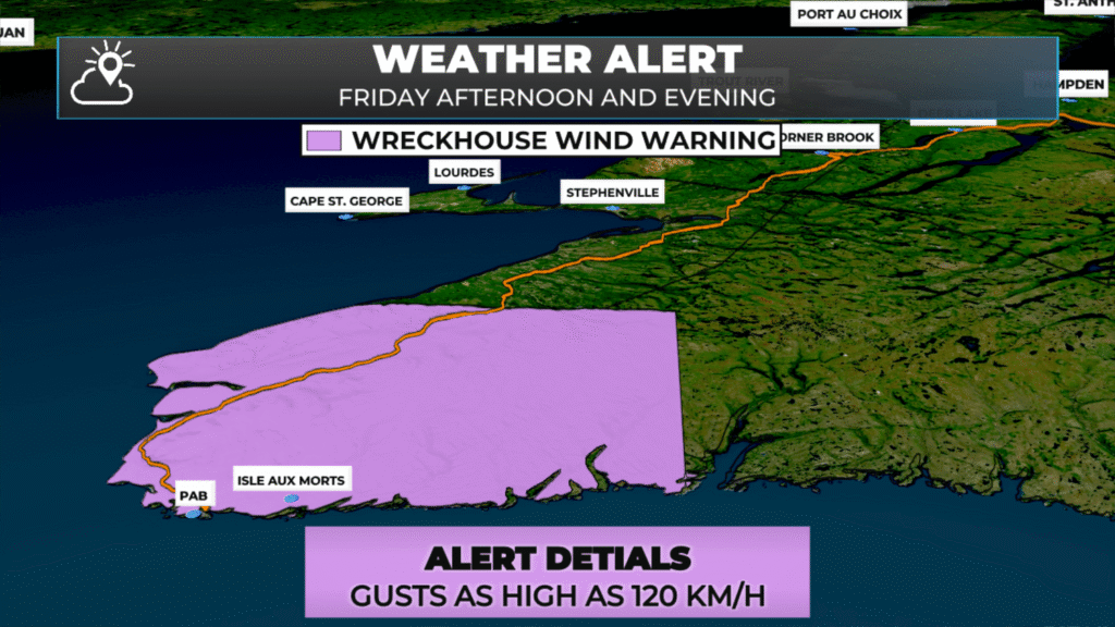
The Channel-Port aux Basques area is under a Wreckhouse Wind Warning, which is in effect for this afternoon and evening. According to the Environment and Climate Change Canada Weather Office in Gander, wind speeds are expected to peak as high as 120 km/h in the area this evening, before gradually diminishing overnight.
The eastern side of the Island, mainly the Avalon Peninsula, will see some gusty winds overnight. They will be highest on the eastern and southeast side of the Avalon, as that is the area that will be closest to Hurricane, or by then, Post-Tropical Storm, Melissa. Gusts over exposed areas may be as high as 100 km/h, but most locations will see gusts between 70 and 90 km/h. The extreme southeast Avalon, like the area near Cape Race, may see gusts nearing hurricane-force, which is 120 km/h.
The rain (and snow) will overspread the Province later today and tonight. Some of the rain will be from the low coming in from the Maritime Provinces, and some will be from Melissa. Radar shows the rain already moving into the region, and at this hour, it’s over the Maritime Provinces.
The rain over eastern Newfoundland will primarily be from Melissa overnight, followed by the low-pressure centre tomorrow. The animation below illustrates how this will unfold.
Labrador will see the first widespread snowfall of the season from tonight into Saturday. While amounts for most areas will be light, up to 5 cm of snow is expected to fall in areas such as Labrador City and Churchill Falls. The higher elevations will see more. Parts of western Newfoundland will also see some snow over the weekend, mainly in the Long Range Mountains.
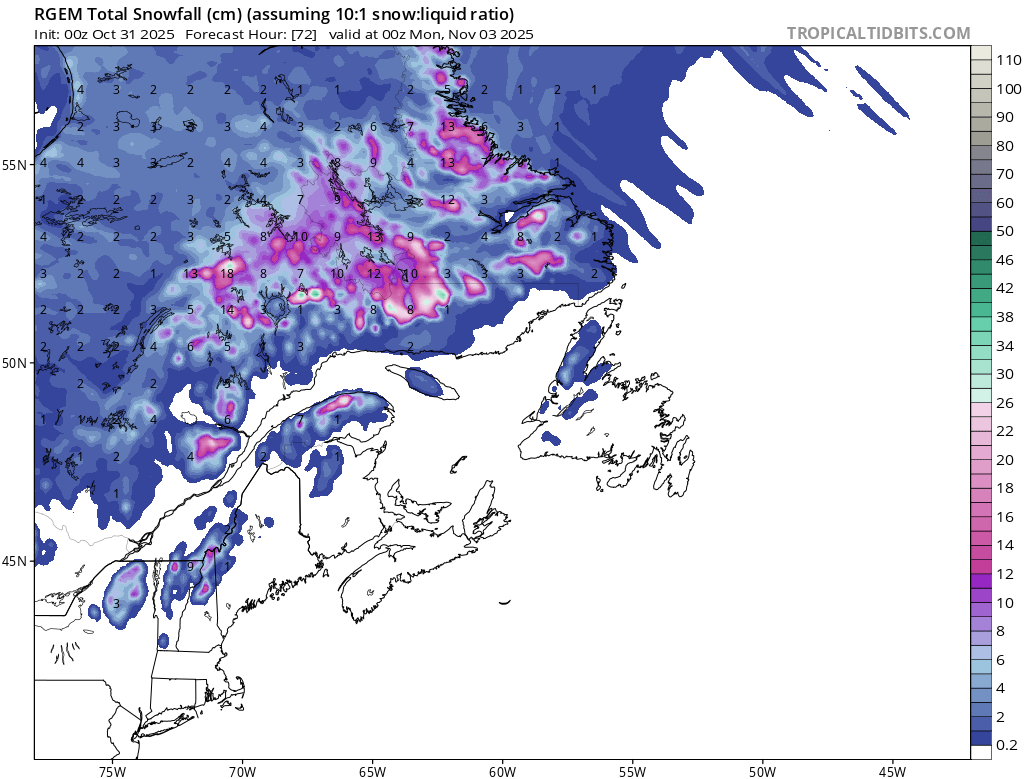
Snowfall forecast from today thru Sunday evening (8:30 PM NDT – November 2, 2025)
I’ll have my next, more detailed forecast, posted this afternoon.
I’ll have my next update posted later today. Including more details on Labrador’s first widespread snowfall!
📱 Get the Sheerr Weather App in the Apple App Store and Google Play Store.
🗺️ Check out the Map Room to see all the latest weather observations for the Province.
🎥 Check out the Provincial Highway Cams to see 👀 what’s going on around our highways and byways!
Happy Halloween!
Thanks for the Spooky 👻 undate! It’s going to a wet night on the Avalon.
Happy Halloween
Thanks Eddie for the update. Happy Halloween.
I was able to silent the notification successfully. Thank you for your assistance.
Thanks Eddie happy Halloween to you and your family !
Thanks for the update! 🎃
Happy Halloween….👻
Hope your girls get out for a treat. Happy Halloween to all.
Thank you