
Friday Morning Weather Brief — October 3, 2025
Good Friday morning!
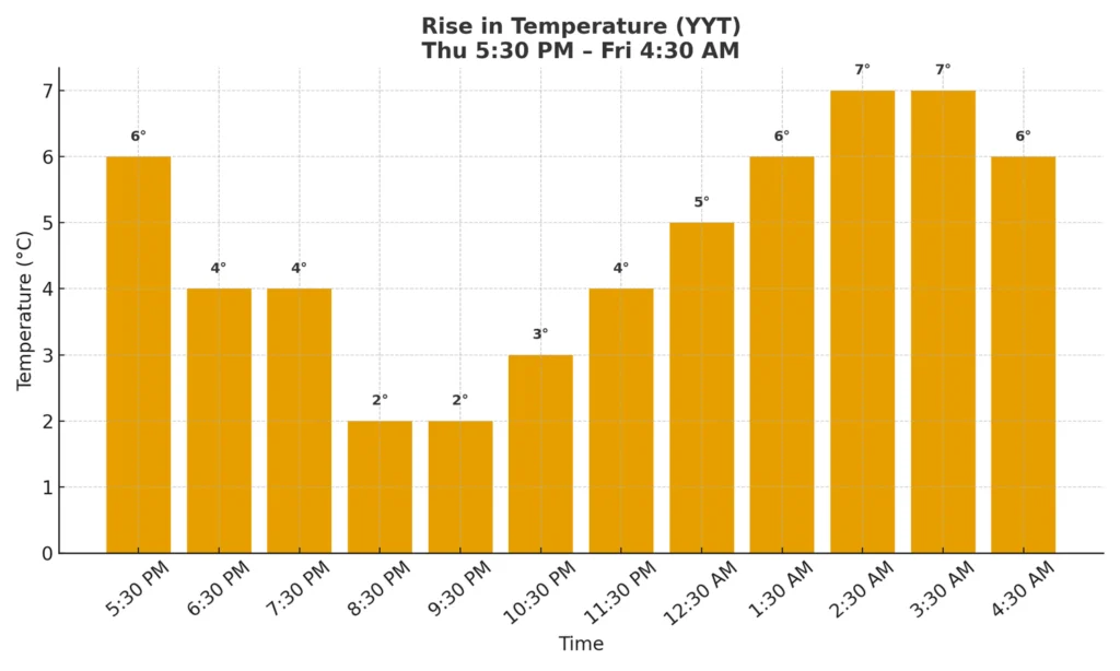
Temperatures last evening fell to nearly the freezing mark over parts of eastern Newfoundland, including in the St. John’s Metro. A quick check of the data shows the low was 1.5º on Thursday, but that occured in the evening. Warmer air moved in overnight and temperatures actually have risen, and as of 5:30 AM are closer to 6º.
This morning’s update is sponsored by Roebothan, McKay, and Marshall.

Visit MakeTheCall.ca to learn more about what the law firm can do for you.
The warmer air that brought milder temperatures to YYT overnight is expected to bring a warmer day to the Province, compared to the last couple of days. In fact, today is expected to be unseasonably warm for many areas. High temperatures will climb into the upper teens and lower 20s this afternoon, accompanied by an abundance of sunshine. That being said, clouds will increase in Labrador West later today ahead of an incoming cold front. Showers are expected to arrive in that area this evening.
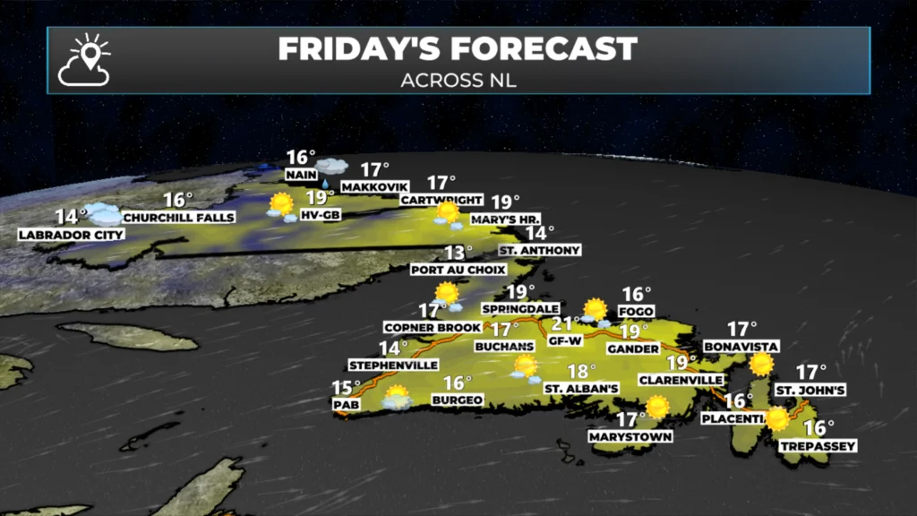
Many areas will likely get close to record highs this afternoon. The locations most likely to break their daily records will be those with highs in the mid-to-upper teens. I think the low 20s are safe… mostly. Here is a list of today’s records across NL:
St. John’s: 22.1º (1988)
Terra Nova National Park: 21.5º (1988)
Gander International Airport: 20.6º (1961)
Badger: 22.1º (2007)’
Deer Lake: 22.2º (1968)
Corner Brook: 22.2º (1968)
Marystown: 20.0º (1988)
St. Lawrence: 19.8º (2011)
Burgeo: 21.8º (2011)
Channel-Port-aux-Basques: 17.7º (2003)
Buchans: 21.5º (2003)
St. Anthony: 19.1º (2003)
Mary’s Harbour: 17.8º (2010)
Cartwright: 17.3º (1996)
Makkovik: 17.5º (2000)
Hopedale: 16.2º (2014)
Nain: 16.4º (2015)
Happy Valley-Goose Bay: 20.6º (2000)
Churchill Falls: 20.5º (2007)
Labrador West area: 20.5º (2005)
The one thing that isn’t easily depicted with the above information is the wind. It will be a breezy day for parts of Labrador and the Great Northern Peninsula. The animation below illustrates how the wind speeds will unfold throughout the day. Gusts will be higher. The wind speeds are expected to drop off tonight.
The National Overview
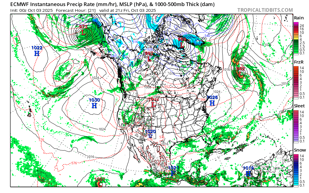
Across the country today, there is not much notable weather to report. There will be some rain along the BC coast and some snow in the mountains. There will be some rain and snow in the Yukon and Northwest Territories due to an area of low pressure, and parts of northern Nunavut will also experience some snowfall today. Showers will move through Quebec along a cold front. That is the same front that will approach Labrador West this afternoon and bring a drop in temperatures for tomorrow. Temperatures will be near freezing in the far north, and closer to the middle teens and even 20 °C in the south and near the US border.
My weekend forecast and next update will get posted later today!
Don’t forget to download my app and be sure to check out the Map Room and Webcam pages!
Wow , sounds like a great day ahead Eddie
Looks like a great Fall day .. nice forecast Eddie!
Good morning Eddie, thanks for weather update.
Morning Eddie it’s a beautiful day, enjoy
Thank you for the update, Eddie. Looks like it’s going to be a beautiful day