
Friday Morning Update — January 9, 2026
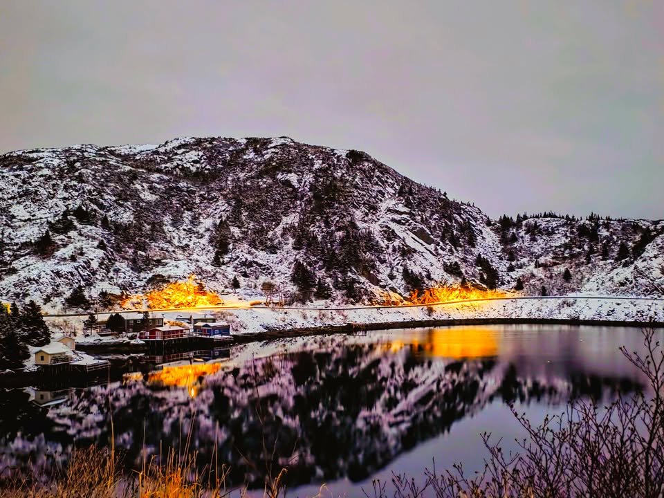
Credit: Johnaton Poulain — Location: The Burin Peninsula
Good Friday Morning!
Here are today’s weather highlights:
The weather is calmer and slightly colder across much of NL this morning.
Beware of black ice as you head out the door this morning!
Quiet day on tap, weather-wise for the Province.
Snow arrives in Labrador West by evening, as our next weather-maker begins to move in. This brings snow to Labrador through Saturday, and a combination of snow and rain to the Island in the same time frame.
Winter storm eyes the region for the late Sunday/Monday time frame with more snow, ice, rain and wind.

This update is sponsored by Roebothan, McKay, Marshall.
Visit MakeTheCall.ca TODAY to learn more about what the law firm can do for you.
Today’s Weather
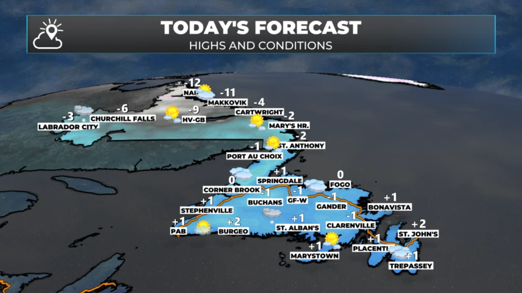
Today’s forecast – January 9, 2026.
Today’s weather across Newfoundland and Labrador is definitely on the quieter side compared to yesterday. The low that gave us a bit of a fuss has moved off into the North Atlantic, and right now we’re kind of in a lull between weather systems. On the island, you’re looking at highs just a few degrees above or below freezing, and up in Labrador, it’s going to stay in the single digits below freezing. Later today, Labrador West will see a bit of light snow as the next system starts to roll in.
The Next One…
Overnight, our next weather maker rolls in, bringing a round of snow through Labrador, so folks up there will wake up to a fresh coating by tomorrow morning. On the island, we’re going to see that snow push in late tonight, especially across the west and south, and it’ll hang around through a good chunk of Saturday. But heads up: along the west coast, south coast, and east coast, and even into central, that snow’s going to flip over to rain pretty quickly. In fact, on the East Coast, we will see the snow start late in the morning and then switch to rain pretty quickly. By tomorrow night, things will start to calm down across the Island as that low-pressure system heads out, and over in Labrador, the snow will wrap up from west to east by Saturday afternoon, clearing offshore early Sunday.
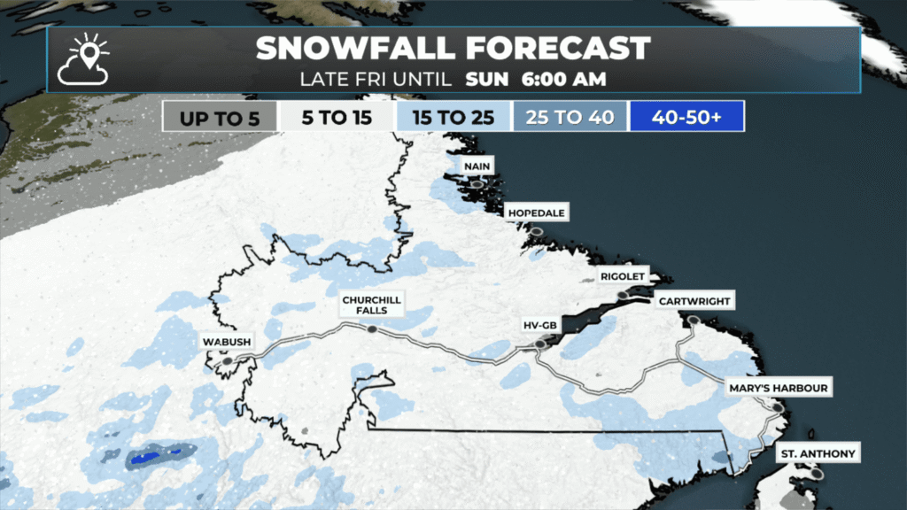
The snowfall forecast from today thru Sunday morning (January 11, 2026).
So in terms of snowfall, by the time Sunday morning comes around, Labrador is generally going to see about 5 to 15 centimetres on the ground. Central and western Newfoundland, along with the Northern Peninsula, will likely pick up around 5 to 10 centimetres. Now, the exception is really those higher terrain areas on Newfoundland’s west coast—think the mountains—where you could see more like 25 or even 30 centimetres piling up in that same timeframe.
So while it’s not going to be a major winter storm, it’s definitely enough to cause some travel headaches on Saturday across parts of the province. Temperatures will be in the single digits below freezing in Labrador and the Northern Peninsula of Newfoundland, while most areas will top out near or above freezing on Saturday. Sunday will be cooler across the board.
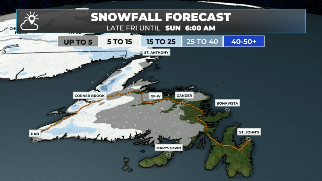
The snowfall forecast from today thru Sunday morning (January 11, 2026).
Early Next Week…
And looking ahead, we’ve got another storm on the way Sunday night. This one’s shaping up to be a pretty potent winter storm, bringing a mix of snow, ice, and rain to Newfoundland, along with heavy snow to Labrador. We’ll also have some strong winds in the mix. As we get through the weekend, I’ll have a clearer picture of how this all unfolds, but you can definitely expect some potentially significant travel disruptions from Monday into possibly Tuesday across much of the province.
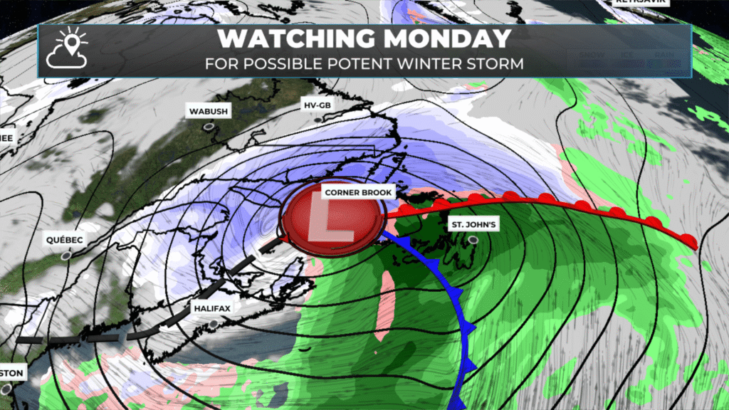
The setup for early next week with the incoming winter storm that should bring snow, ice, rain and wind to NL.
I’ll post my next update later today, which will provide more detail on the above.
📱 Get the Sheerr Weather App in the Apple App Store and Google Play Store.
🗺️ Check out the Map Room to see all the latest weather observations for the Province.
🎥 Check out the Provincial Highway Cams to see 👀 what’s going on around our highways and
Thanks for the update!
Good morning Eddie thanks for updating and enjoy your day
Thank you for the update.
Thank you for keeping us informed. Every second day there is a system moving through. Doesn’t give a Meteorologist much time off
Thanks Eddie for weather update