
Special Weather Statement: First Snow of the Season for Labrador West
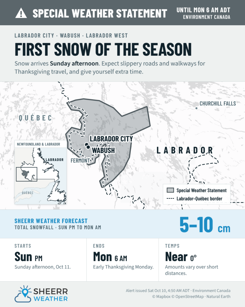
Environment Canada has issued a Special Weather Statement for Labrador City and Wabush, in effect until 6 AM ADT Thanksgiving Monday. It’s the first notable accumulating snowfall of the season for Labrador West and, as is often the case, it’s arriving just in time for a holiday weekend.
What to expect
A few flurries may develop Sunday morning, and the snow becomes steady by early afternoon. The heaviest snow looks to fall Sunday evening, between about 5 PM and midnight. Snow continues overnight before tapering to a few snow showers after 2 AM Monday and ending around daybreak.
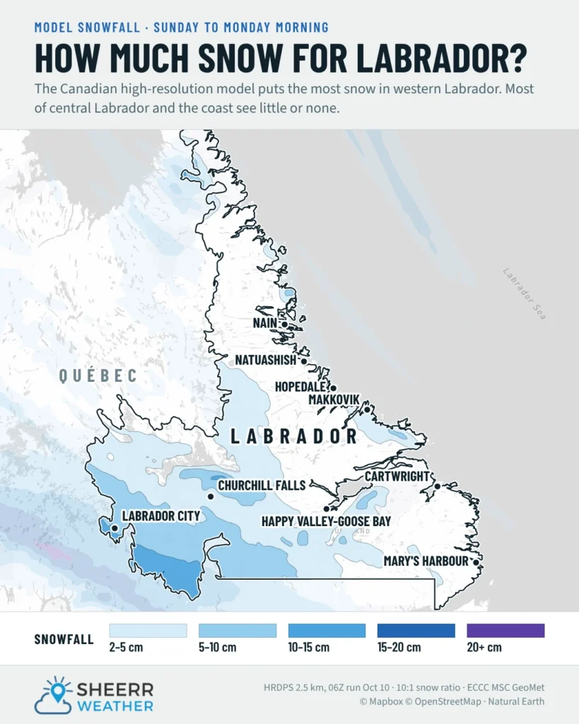
Temperatures are the wildcard. They’ll hover right around 0ºC through the event. That means the snow will be wet and heavy. It will accumulate more easily on grassy surfaces, cars and decks than on roads, at least at first.
As Environment Canada notes, with temperatures this close to freezing, snowfall amounts may vary over short distances. Someone in one part of town could see a slushy 4 cm while a neighbour a few kilometres away measures closer to 10.
Thanksgiving travel
Snow may make Thanksgiving travel slower than usual, with slippery roads and walkways. Be prepared for winter driving conditions and allow extra time to reach your destination. If you’re driving the Trans-Labrador Highway (Route 500) or Route 389 toward Fermont on Sunday or early Monday:
- Take it slow and leave extra space between you and the vehicle ahead.
- Make sure your vehicle has a snow brush and scraper (if they haven’t already been dug out of the shed).
- If you haven’t put the winter tires on yet, this is your sign.
I’ll have an update on the snow timing for you on Sunday morning!