
Halloween Forecast Looking More Tricky Than Treaty
This forecast is sponsored by:

Parts of the Bonavista Peninsula picked up their first accumulating snowfall of the season this morning, and we’re not even out of October yet! Tiffany Wayne sent in a photo of the view from Bonavista, and Michael Plummer shared a video from Bonavista this morning. It looked a lot more like December than the end of October. Pretty wild stuff!
If you caught last night’s forecast, I did mention the chance of a few flurries around Bonavista Bay. Those flurries are long gone now, and behind them we’ve had a pretty nice day across Newfoundland, Labrador and really Atlantic Canada as a whole, at least when it comes to sunshine.
It’s still a little on the cool side, though, and it’s breezy. Winds gusted to 50 km/h in St. John’s, close to 40 km/h in Corner Brook, and close to 60 km/h in St. Anthony and parts of Labrador. That makes it feel much colder out there, with wind chills this afternoon between about 2° and -6° or -7°.
Tonight and Thursday
Tonight will be cool, with lows near the freezing mark across the Province, and it’s going to feel colder than that once you factor in the breeze.
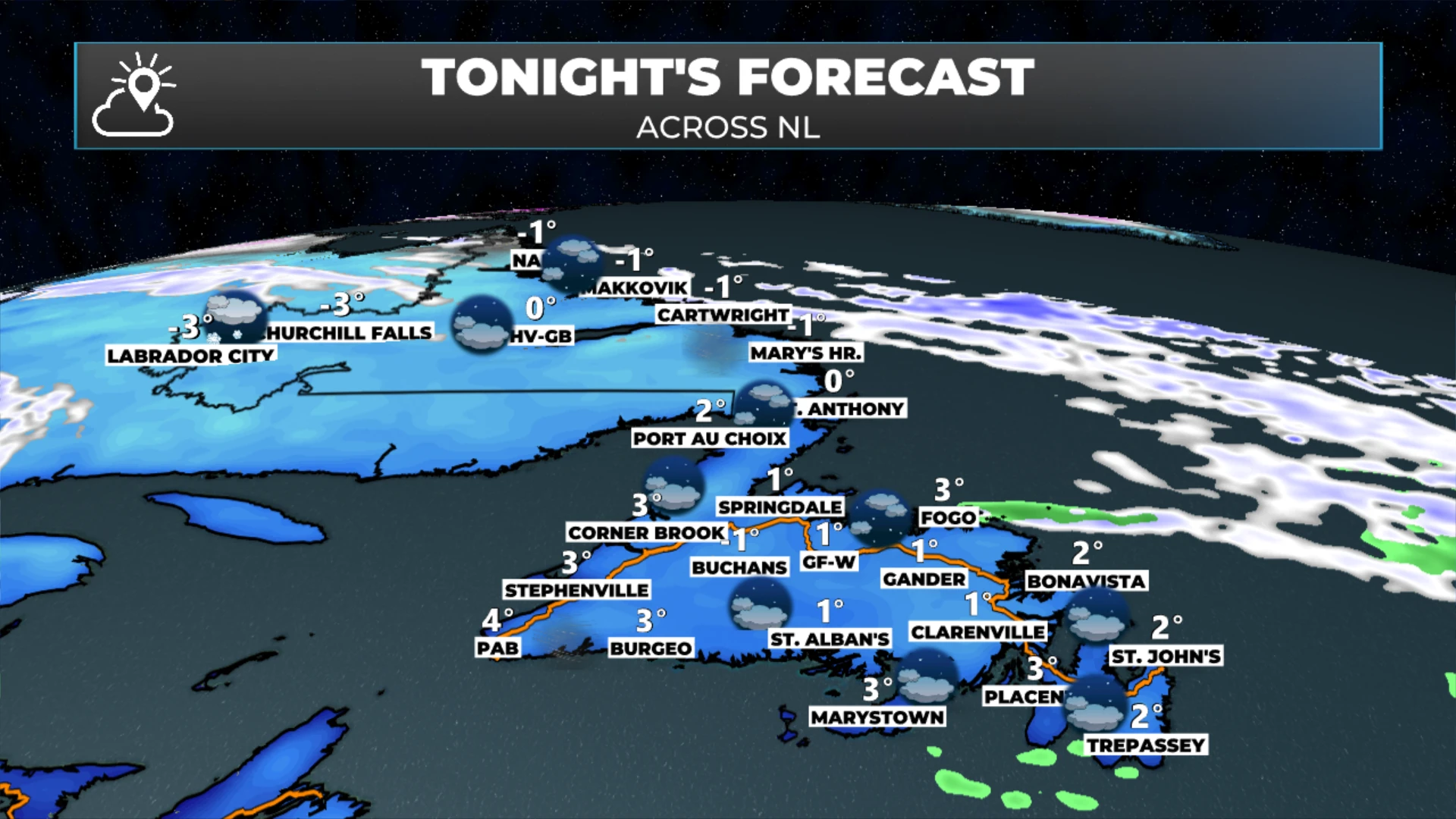
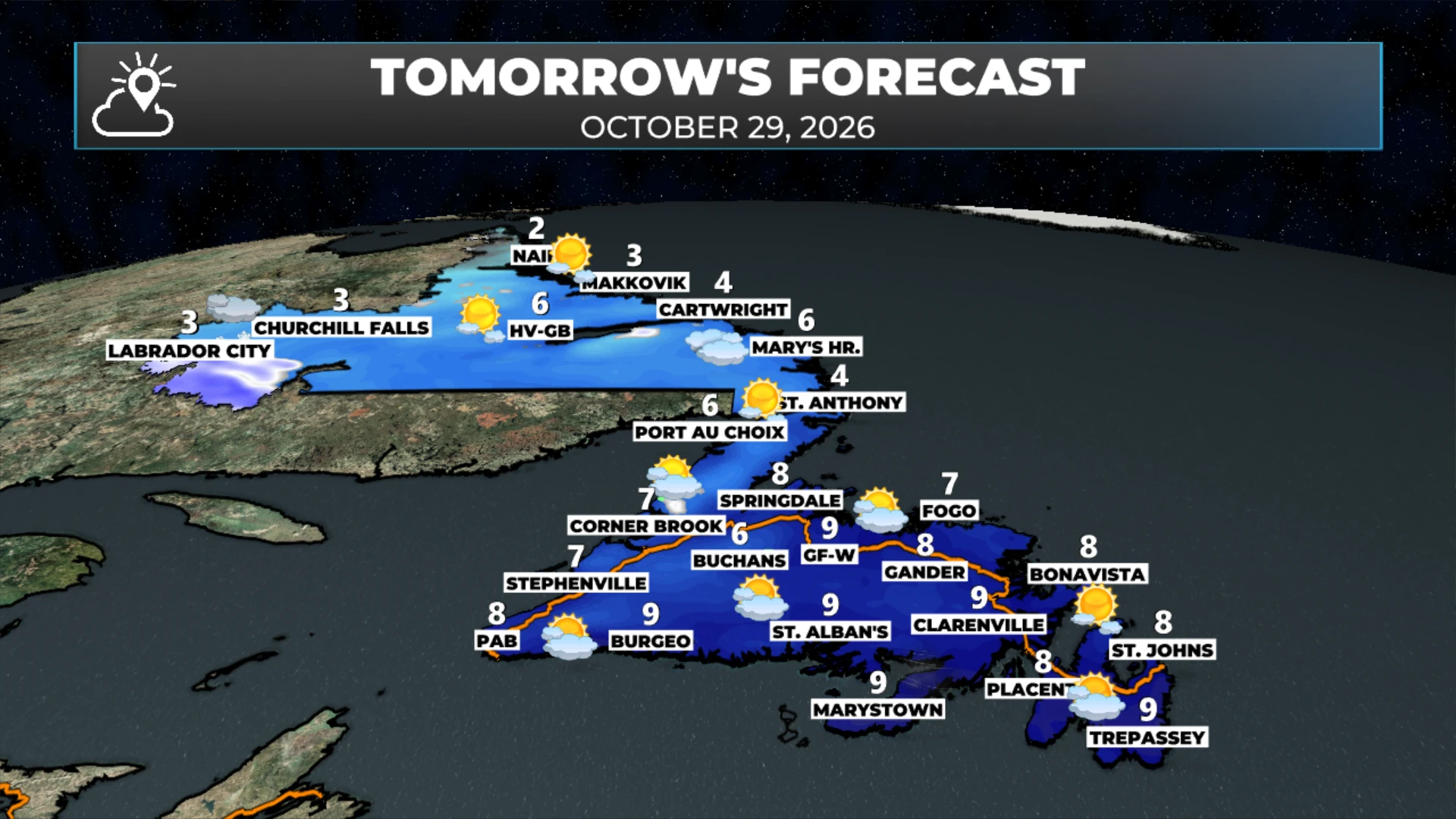
Thursday won’t be quite as breezy, and that’s a good thing. Highs reach 6° to 8° on the Island, and 1° to 3° in Labrador, or 5° to 6° depending on where you are.
In Labrador, an area of low pressure skirts into Labrador West on Thursday, bringing a little snow there during the second half of the day. That snow works toward Churchill Falls and Goose Bay Thursday night.
A warm Friday 🌤️
Rain and rain showers reach the Island by early Friday morning, a little earlier than that on the Northern Peninsula. Because of where that low is sitting, we’ll get southwesterly winds on Friday, and that means a warmer day across Newfoundland, with highs climbing into the low teens.
Every time we see that, especially this late in October, I tell you to savour it, because we don’t get many days like this so late in the season!
In Labrador, Friday looks like highs of 1° to 3°, with a few flurries and some light snow here and there.
By Friday evening, rain showers work toward southeastern Newfoundland ahead of a cold front, and cooler air moves in behind it for Saturday.
A tricky Halloween forecast 🎃
I don’t have the best news for you on this one. The energy from that first low will be sitting up over Labrador, and there’s more energy with a second area of low pressure well offshore Friday night and Saturday. It looks like those two pieces of energy are going to try to phase, or join together, as we head into Saturday. That means the offshore low may play more of a role in our weather than it looked like it would, even as recently as yesterday.
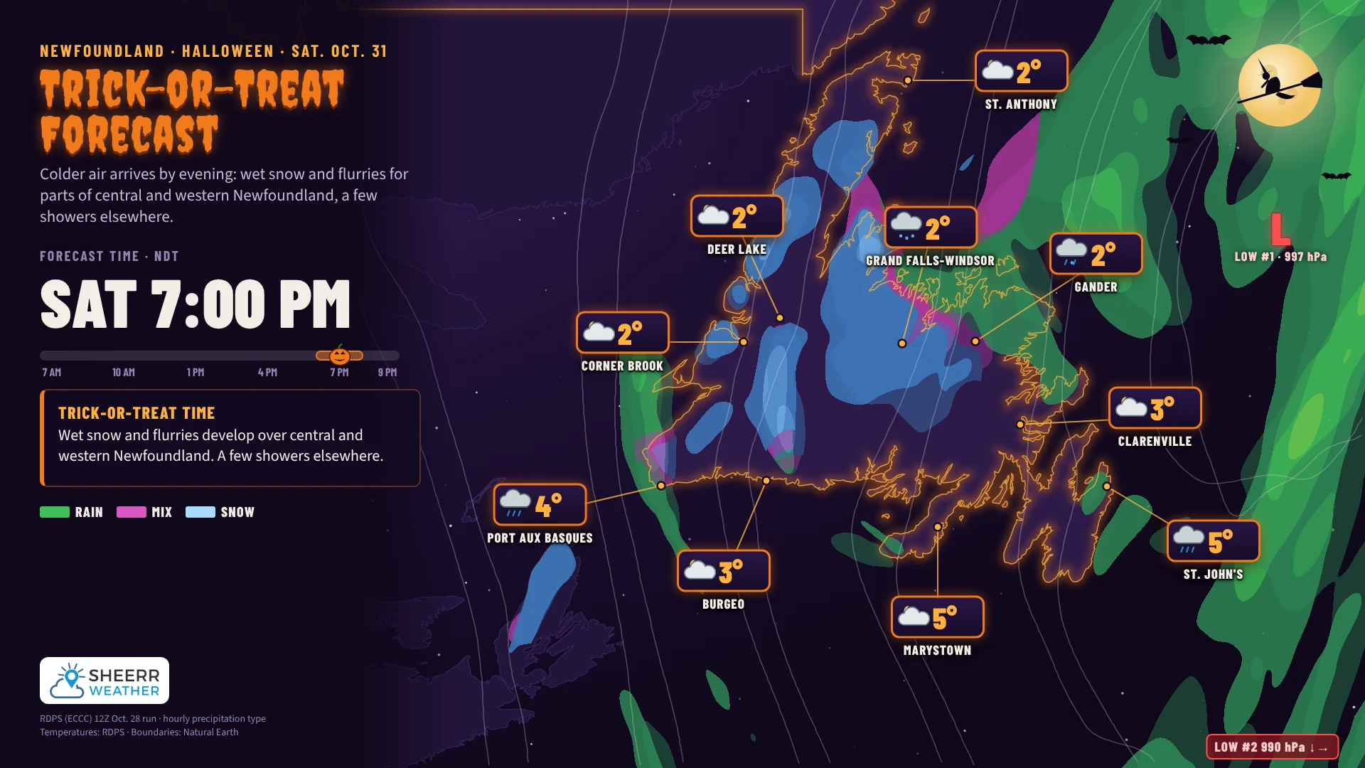
If that happens, we could see more precipitation over Newfoundland on Saturday and Saturday evening, in the form of rain showers and possibly wet snow for parts of central and western Newfoundland. I don’t think we’re looking at accumulating snow, although it’s not out of the realm of possibility.
Right now, it looks like trick-or-treaters in parts of central Newfoundland, and possibly the West Coast, will likely be out in some wet snow, while eastern areas are more likely to see rain showers. So what looked like a decent Halloween forecast on Monday, and even yesterday, isn’t looking quite as great now.
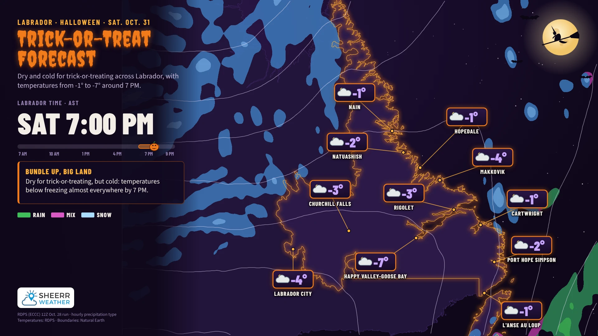
In Labrador, it’s going to be cold for the trick-or-treaters, but not as wet. The temperature in Goose Bay is forecast to be around -7° at trick-or-treat time, so it’ll be a chilly one. I suppose that’s to be expected!
The 7-day outlook
Looking at the 7-day forecast for Newfoundland, we cool down late Saturday into Sunday, with a chance of rain and snow in central and western Newfoundland and on the Northern Peninsula Saturday into Saturday night, which is Halloween.
And don’t forget, the clocks fall back at 2 AM Sunday morning, so we get an extra hour of sleep! Unless you’re a parent like me, and your kids will just be up super early Sunday morning anyway. Then again, maybe not after the Halloween treat hangover!
In Labrador, there’s a 90% chance of snow late in the day Thursday in the west. We’ll call it 100%. Otherwise, the weather is generally cool but not overly busy in the Big Land.
I’ll have an update for you tomorrow morning, likely early, and maybe we’ll do a little Q&A tomorrow too. In the meantime, have a great Wednesday night!
Don’t forget to…
📱 Get the Sheerr Weather App in the Apple App Store and Google Play Store for my latest updates.
📺 Tune into Sheerr Weather 24, my 24-hour weather channel on YouTube.
🗺️ Check out the Map Room to see all the latest weather observations for the Province.
🎥 Check out the Provincial Highway Cams to see 👀 what’s going on around our highways.
Thanks for update Eddie! We have to take the weather as it comes, like it or not.